La Maná facts for kids
Quick facts for kids
La Maná
|
|
|---|---|
|
Town
|
|
 |
|
| Country | Ecuador |
| Province | Cotopaxi Province |
| Canton | La Maná Canton |
| Area | |
| • Town | 8.57 km2 (3.31 sq mi) |
| Population
(2022 census)
|
|
| • Town | 31,740 |
| • Density | 3,703.6/km2 (9,592/sq mi) |
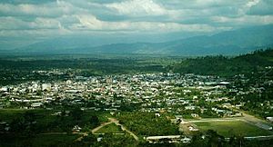
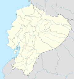
La Maná is a town in the Cotopaxi Province of Ecuador. It is the main town of the La Maná Canton. La Maná is one of seven cantons in the Cotopaxi Province. A canton is like a county or district. The La Maná canton covers about 66,258 acres, making it the sixth largest canton in its province.
The name La Maná has an interesting history. It might come from "LANG MANA ATTI," which means "mine of great king." This name was given because of the rich gold and other minerals found underground. Another idea is that it comes from the "Colorado" word (safiqui) "MANA," meaning "beautiful, big." This could refer to how fertile the land is.
Long ago, the Tsachilas people, also known as "Los Colorados," lived in this area. People have found old clay pieces, animal-shaped statues, and clay pots. These pots might have been used to melt metals like the gold that was common in the mountains.
La Maná became a canton on May 19, 1986. This happened under the government of León Febres Cordero. There is a monument in the canton that honors Carlos Lozada Quintana. He owned a large farm called La Merced Hacienda. He generously gave land for public spaces like plazas, parks, streets, and schools. This helped the community a lot.
Unlike many other towns, La Maná was settled by people from all over Ecuador. They brought their own customs and traditions, making the town a mix of different cultures. The area has huge forests and large farms growing bananas, plantains, yucca, cocoa, tobacco, and coffee. Its location and rich minerals are very important for its growth and play a big part in Ecuador's economy.
Contents
Location and Climate
Where is La Maná?
La Maná Canton is located at the base of the western Andes mountains. It sits on a flat area made of old river deposits, covered with volcanic ash and sand. The main town is on an old river terrace of the San Pablo River. The area has different climates, from subtropical to tropical.
What is the Climate Like?
The average temperature in La Maná is about 23°C (73°F) each year. The hottest months are March and April, with temperatures reaching 28 to 30°C (82-86°F). July is the coolest month, with temperatures around 18°C (64°F).
La Maná has two main seasons:
- Dry Season: This season usually runs from June to November. It's cooler, with temperatures as low as 18°C (64°F), and there is no rain.
- Wet Season: This season typically starts in December and ends in May. It's much hotter and very humid and rainy. Heavy rains can sometimes cause floods in parts of the canton.
| Climate data for La Maná (San Juan La Maná), elevation 223 m (732 ft), (1971–2000) | |||||||||||||
|---|---|---|---|---|---|---|---|---|---|---|---|---|---|
| Month | Jan | Feb | Mar | Apr | May | Jun | Jul | Aug | Sep | Oct | Nov | Dec | Year |
| Mean daily maximum °C (°F) | 28.5 (83.3) |
29.0 (84.2) |
29.5 (85.1) |
29.6 (85.3) |
28.4 (83.1) |
26.9 (80.4) |
26.3 (79.3) |
26.9 (80.4) |
27.5 (81.5) |
27.1 (80.8) |
27.2 (81.0) |
28.1 (82.6) |
27.9 (82.2) |
| Mean daily minimum °C (°F) | 20.5 (68.9) |
20.7 (69.3) |
20.8 (69.4) |
21.0 (69.8) |
20.5 (68.9) |
19.9 (67.8) |
18.9 (66.0) |
18.7 (65.7) |
19.0 (66.2) |
19.2 (66.6) |
19.2 (66.6) |
19.9 (67.8) |
19.9 (67.8) |
| Average precipitation mm (inches) | 445.0 (17.52) |
470.0 (18.50) |
563.0 (22.17) |
481.0 (18.94) |
264.0 (10.39) |
126.0 (4.96) |
19.0 (0.75) |
25.0 (0.98) |
46.0 (1.81) |
48.0 (1.89) |
38.0 (1.50) |
174.0 (6.85) |
2,699 (106.26) |
| Average relative humidity (%) | 87 | 86 | 86 | 86 | 88 | 89 | 87 | 86 | 86 | 86 | 85 | 85 | 86 |
| Source: FAO | |||||||||||||
Fun Places to Visit
Las 7 Cascadas
"Las 7 Cascadas" means "The 7 Waterfalls." It's a beautiful series of natural waterfalls. Even though it's officially in Pangua Canton, it's very close to La Maná, so many people consider it a local attraction. It's a popular spot for tourists.
The Cañaveral
The Cañaveral is a natural gold mine. It's located about 12 kilometers (7.5 miles) from the center of La Maná.
Mirador Pucayacu
"Mirador Pucayacu" is a viewpoint just five minutes from the town center of Pucayacu. From the top, you can see the entire town of Pucayacu below.
Cascada Guadual
Cascada Guadual is a waterfall about 15 kilometers (9 miles) from Pucayacu. You need to follow a path to reach it. The main attraction is a 25-meter (82-foot) tall waterfall and a natural pool where you can swim. It's a good idea to go with a tourist guide to stay safe.
Cascada de Brasil
This waterfall is about 8 kilometers (5 miles) from Pucayacu's center. It's a two-hour walk from the Pucayacu – Sigchos road. The waterfall is about 15 meters (49 feet) high and has a beautiful emerald-colored pool about 5 meters (16 feet) wide. Around the waterfall, you can see many plants like orchids and ferns. You might also spot animals like butterflies and woodpeckers.
Traditional Fair of Pucayacu Parish
Every Thursday, the Pucayacu Parish holds a traditional fair that has been happening for over 50 years! You can buy fresh local products like green plantains, pork, beef, vegetables from the mountains, and local cheeses. There are also places to find food and lodging nearby. One thing to be aware of is that sometimes there can be litter left behind by visitors.
Guasaganda
Guasaganda is another town within the La Maná canton. It's about 60 kilometers (37 miles) from Quevedo. The first settlers came from places like Sucre and Carmela, but the very first people were indigenous groups from areas like Saquisilí and Zumbahua. The name "Guasaganda" might come from Spanish and mean "Big Land." It was once a wild area with many animals, making travel difficult.
Hacienda Malqui
This interesting place is north of Pucayacu, about an hour and a half from La Maná. For a long time, people didn't know that a pile of stones on the property was actually an important archaeological site. Some believe it might be related to the tomb of Atahualpa, an Inca ruler. The word "Malqui" means "body or mummy of the Incas' ancestors." Based on how the plants are arranged and the old buildings, experts think it was a populated center more than 100 years ago. On this farm, which is about 90 acres, people make panela (a type of unrefined sugar) and local drinks.
Machay Archaeological Site
The Machay ruins are an archaeological site located in Peru. This site has old paintings and is on the mountain of Ocpay. The area where the Machay ruins are found is part of the Malqui region. People believe it was a place of worship. Researchers have found stone buildings and other items from the time of the Incas here. Today, it is part of the Malqui Machay cultural project.
See also
 In Spanish: La Maná para niños
 | Percy Lavon Julian |
 | Katherine Johnson |
 | George Washington Carver |
 | Annie Easley |


