La Unión, Olancho facts for kids
Quick facts for kids
La Unión
|
||
|---|---|---|
|
Municipality
|
||

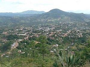
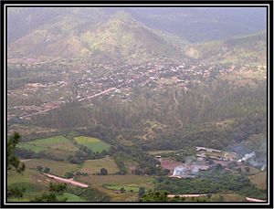
Panoramic view
|
||
|
||
| Country | Honduras | |
| Department | Olancho | |
| Villages | 11 | |
| Founded | 1877 | |
| Area | ||
| • Total | 556 km2 (215 sq mi) | |
| Population
(2015)
|
||
| • Total | 7,861 | |
| • Density | 14.138/km2 (36.62/sq mi) | |
| Time zone | UTC-6 | |
| Climate | Aw | |
La Unión is a town and a municipality located in the northwest part of the Olancho Department in Honduras. A municipality is like a local government area, similar to a county or district.
Contents
History of La Unión
Early Beginnings
La Unión officially became a municipality in 1877. At that time, it was part of the Salamá District.
Before this, around 1852, there was a village called San Francisco de Yocón nearby. This village was unfortunately burned down by a group of fighters led by General José María Medina. He later became the President of Honduras in 1868. General Medina encouraged a civil conflict in the Olancho Department. This was because the people of Olancho wanted to create their own independent republic. They were unhappy with the high taxes the government in Comayagua was asking them to pay.
Rebuilding and Growth
Between 1876 and 1883, La Unión was rebuilt thanks to a special order from President Marco Aurelio Soto. The first homes were built by Mrs. Mary Dilia Vivas, Ms. Paula Almendares, and Lady Camilla Cruz.
The town grew partly because of rules that encouraged people from nearby rural areas to build homes in the town, even if they didn't live there full-time. This brought in families like the Vargas, Funes, and Zaldivar.
Some of the first mayors who led La Unión were Mr. Tomas Herrera and Mr. Macario Vargas.
Modern Developments
The local Catholic Church, named after San Francisco de Asis, was built in 1906. In 1925, the first telegraph line was set up by Mr. Martin Murillo, connecting La Unión to other places. The first school opened in 1930 and was named Francisco Morazan.
In 1983, a group of parents and community members, including Mrs. Alejandro Carcamo, Rigoberto Rivera, and Eleazar Puerto, started a committee. Their goal was to build a high school. It was first called Instituto Privado Nocturno Superacion Franciscana. Later, the government officially recognized it and renamed it Instituto Superacion Franciscana. Professor Victor Almenderez was its first director.
Leaders of La Unión
Here is a list of mayors who have served La Unión in recent times:
- 1982–1984: Helma Zelaya
- 1984–1986: Maria Elena Valle Flores
- 1986–1990: Ramon Alcides Torres Castro
- 1990–1994: Angel Donaldo Tejeda Menocal
- 1994–1998: Carmen Lastenia Padilla Rivera
- 1998–2002: Jose Humberto Rivera
- 2002–2006: Santos Isabel Zelaya Lobo
- 2006–2010: Santos Domingo Munguia Matute
- 2010–2014: Yonis Herrera Tejeda
- 2014–2018: Renan Alcides Torres Argueta
- 2018-2022: Ramón Edgardo Cárcamo Rivera
- 2022-2026: Dolores Olimpia Almendarez Martinez
Geography of La Unión
Where is La Unión?
La Unión is located in a valley near the Camote River. It shares its borders with several other places:
- To the north: Olanchito
- To the south: Salamá and El Rosario
- To the west: Esquipulas del Norte and Jano
- To the east: Yocón and Mangulile
Main Villages
The municipality of La Unión includes five main villages:
- La Unión (the main town)
- El Díctamo
- Los Encuentros
- Palala
- Guanacaste
Each of these villages also has smaller communities or farmhouses around them. For example, El Dictamo includes communities like El Junco and El Empedrado. Palala has areas like Paso Real and Cerro Verde. Los Encuentros includes El Pacon and Los Planes. El Guanacaste has El Naranjo.
Population of La Unión
In 2013, a census counted the population of La Unión municipality as 7,691 people. Most of the people living there, about 99.34%, are Mestizo. This means they have mixed European and Indigenous ancestry. A smaller number of people are Indigenous, White, or Black or Afro-Honduran.
See also
 In Spanish: La Unión (Olancho) para niños


