La Unión, Quintana Roo facts for kids
Quick facts for kids
La Unión
|
|
|---|---|
| Country | Mexico |
| State | Quintana Roo |
| Municipality | Othón P. Blanco |
| Elevation | 13 m (43 ft) |
| Population
(2020)
|
1,104 |
| Time zone | UTC-5 (Eastern Time Zone) |
| Postal code |
77992
|
| Area code(s) | 983 |
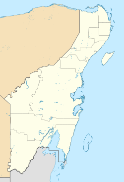
La Unión is a small village, also known as a pueblo, in Mexico. It is located in the state of Quintana Roo. This village is part of the Othón P. Blanco municipality. In 2020, about 1,104 people lived there.
Where is La Unión?
La Unión is found right next to the Hondo River. This river forms a natural border between Mexico and Belize. The village sits about 13 meters (or 43 feet) above sea level.
Connecting Countries
La Unión has a special border crossing point. This allows people to travel easily between Mexico and the nearby village of Blue Creek in Belize. An international bridge connects these two places, making it simple for people to visit each other.
See also
 In Spanish: La Unión (Quintana Roo) para niños

All content from Kiddle encyclopedia articles (including the article images and facts) can be freely used under Attribution-ShareAlike license, unless stated otherwise. Cite this article:
La Unión, Quintana Roo Facts for Kids. Kiddle Encyclopedia.

