Laboulaye, Argentina facts for kids
Quick facts for kids
Laboulaye
|
||
|---|---|---|
|
||
| Country | ||
| Province | ||
| Department | P. Roque Sáenz Peña | |
| Elevation | 131 m (430 ft) | |
| Population
(2010 census)
|
||
| • Total | 20,534 | |
| Time zone | UTC−3 (ART) | |
| CPA base |
X6120
|
|
| Dialing code | +54 3385 | |
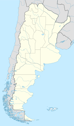
Laboulaye is a city in Argentina. It is located in the southeast part of the Córdoba province. In 2010, about 20,534 people lived there.
The city is found on National Route 7. It is close to the borders of the Santa Fe and Buenos Aires provinces. Laboulaye is about 315 kilometers south of Córdoba City. It is also about 285 kilometers west of Rosario.
Laboulaye's Weather
Laboulaye has a specific climate. The weather box below shows details. It includes temperatures and rainfall. You can see the highest and lowest temperatures. It also shows how much rain falls each month.
| Climate data for Laboulaye, Córdoba (1991–2020, extremes 1950–present) | |||||||||||||
|---|---|---|---|---|---|---|---|---|---|---|---|---|---|
| Month | Jan | Feb | Mar | Apr | May | Jun | Jul | Aug | Sep | Oct | Nov | Dec | Year |
| Record high °C (°F) | 46.3 (115.3) |
42.9 (109.2) |
40.0 (104.0) |
35.7 (96.3) |
32.9 (91.2) |
29.7 (85.5) |
33.0 (91.4) |
36.1 (97.0) |
35.6 (96.1) |
41.7 (107.1) |
40.4 (104.7) |
45.1 (113.2) |
46.3 (115.3) |
| Mean daily maximum °C (°F) | 30.4 (86.7) |
29.1 (84.4) |
27.3 (81.1) |
23.4 (74.1) |
19.4 (66.9) |
16.3 (61.3) |
15.7 (60.3) |
18.7 (65.7) |
21.3 (70.3) |
23.8 (74.8) |
27.3 (81.1) |
29.9 (85.8) |
23.6 (74.5) |
| Daily mean °C (°F) | 23.2 (73.8) |
21.8 (71.2) |
19.9 (67.8) |
16.1 (61.0) |
12.4 (54.3) |
9.1 (48.4) |
8.1 (46.6) |
10.2 (50.4) |
13.2 (55.8) |
16.6 (61.9) |
20.0 (68.0) |
22.4 (72.3) |
16.1 (61.0) |
| Mean daily minimum °C (°F) | 16.9 (62.4) |
15.9 (60.6) |
14.2 (57.6) |
10.8 (51.4) |
7.6 (45.7) |
4.0 (39.2) |
2.8 (37.0) |
3.9 (39.0) |
6.6 (43.9) |
10.5 (50.9) |
13.5 (56.3) |
15.8 (60.4) |
10.2 (50.4) |
| Record low °C (°F) | 5.6 (42.1) |
2.7 (36.9) |
−1.1 (30.0) |
−2.9 (26.8) |
−7.2 (19.0) |
−8.6 (16.5) |
−10.8 (12.6) |
−8.6 (16.5) |
−6.7 (19.9) |
−4.0 (24.8) |
1.6 (34.9) |
1.6 (34.9) |
−10.8 (12.6) |
| Average precipitation mm (inches) | 130.0 (5.12) |
108.4 (4.27) |
128.6 (5.06) |
88.7 (3.49) |
39.0 (1.54) |
13.2 (0.52) |
13.5 (0.53) |
17.5 (0.69) |
48.4 (1.91) |
102.3 (4.03) |
106.0 (4.17) |
137.4 (5.41) |
933.0 (36.73) |
| Average precipitation days (≥ 0.1 mm) | 9.3 | 7.7 | 8.5 | 8.2 | 5.3 | 3.9 | 3.6 | 3.4 | 5.6 | 9.6 | 9.8 | 10.1 | 84.9 |
| Average snowy days | 0.0 | 0.0 | 0.0 | 0.0 | 0.0 | 0.0 | 0.1 | 0.1 | 0.0 | 0.0 | 0.0 | 0.0 | 0.1 |
| Average relative humidity (%) | 69.9 | 74.3 | 76.3 | 76.2 | 78.4 | 76.9 | 72.9 | 67.1 | 64.8 | 68.1 | 64.5 | 64.5 | 71.2 |
| Mean monthly sunshine hours | 294.5 | 248.6 | 238.7 | 189.0 | 164.3 | 147.0 | 164.3 | 195.3 | 210.0 | 229.4 | 273.0 | 288.3 | 2,642.4 |
| Mean daily sunshine hours | 9.5 | 8.8 | 7.7 | 6.3 | 5.3 | 4.9 | 5.3 | 6.3 | 7.0 | 7.4 | 9.1 | 9.3 | 7.2 |
| Percent possible sunshine | 67 | 70 | 63 | 61 | 53 | 49 | 49 | 60 | 60 | 60 | 66 | 62 | 60 |
| Source 1: Servicio Meteorológico Nacional | |||||||||||||
| Source 2: NOAA (percent sun 1961–1990 and December record low only), Meteo Climat (record highs and lows), Oficina de Riesgo Agropecuario (September record high and February record low only) | |||||||||||||
See also
 In Spanish: Laboulaye para niños
Black History Month on Kiddle
Famous African-American Pilots:
 | James B. Knighten |
 | Azellia White |
 | Willa Brown |

All content from Kiddle encyclopedia articles (including the article images and facts) can be freely used under Attribution-ShareAlike license, unless stated otherwise. Cite this article:
Laboulaye, Argentina Facts for Kids. Kiddle Encyclopedia.


