
Lamèque Island facts for kids

Lamèque Island
Location in New Brunswick
|
|
| Coordinates | 47°43′19.82″N 64°39′38.18″W / 47.7221722°N 64.6606056°W |
|---|---|
| Year first constructed | 1872 |
| Construction | wooden tower |
| Tower shape | octagonal frustun tower with balcony and lantern |
| Markings / pattern | white tower, red lantern |
| Height | 16.5 metres (54 ft) |
| Focal height | 16.5 metres (54 ft) |
| Original lens | fourth-order Fresnel lens |
| Current lens | Barbier, Bernard et Turenne lantern |
| Range | 15 nautical miles (28 km; 17 mi) |
| Characteristic | Fl Y 5s. |
| Admiralty number | H1530 |
| CHS number | CCG 1254 |
| NGA number | 7392 |
| ARLHS number | CAN-035 |
Lamèque Island (which in French is Île Lamèque) is a Canadian island. It is located in the Gulf of Saint Lawrence in New Brunswick. This island is at the very northeast tip of Gloucester County, New Brunswick. It used to be known as Shippegan Island.
Lamèque Island is about 150 square kilometers (58 square miles) in size. It is separated from the mainland of North America by a narrow water passage called the Shippagan Gut. This channel helps form Lameque Bay, Shippagan Harbour, and Shippagan Bay to the west of the island. To the north, the island is separated from Miscou Island by the Miscou Channel. These two islands together create Miscou Harbour.
Contents
Connecting the Islands
The Shippagan Bridge
The Shippagan Gut has a special bridge that connects the town of Shippagan, New Brunswick on the mainland to a community called Chiasson-Savoy on Lamèque Island. This bridge is about 1,000 meters (3,280 feet) long. It's a combination of a causeway and a bridge. Part of it is a lift bridge, which can be raised to let small boats pass underneath.
The Miscou Island Bridge
To the north, the Miscou Channel connects Lamèque Island to Miscou Island. A long bridge, about 2,000 meters (6,560 feet) long, crosses this channel. It links the community of Little Shippagan, New Brunswick on Lamèque Island to Miscou Harbour, New Brunswick on Miscou Island.
Lamèque Island and Miscou Island play an important role. They act like a natural barrier, separating Chaleur Bay from the larger Gulf of Saint Lawrence.
Images for kids
-
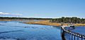
Ecological Park of the Acadian Peninsula in Lamèque

See also
 In Spanish: Isla de Lamèque para niños
