Landfall Peak facts for kids
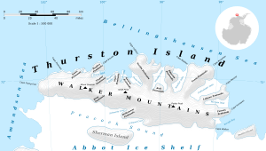
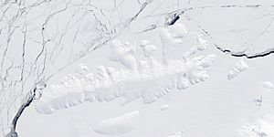
Landfall Peak (72°0′S 102°1′W / 72.000°S 102.017°W) is a prominent mountain peak located on Thurston Island in Antarctica. It stands near the far western end of the island. This peak is an important landmark for ships.
Discovering Landfall Peak
Landfall Peak was first seen by people from the United States Antarctic Service. They spotted it during flights from the ship USS Bear in February 1940. A photographer named E.B. Perce took pictures of the peak at that time.
Later, the U.S. Navy took more air photos during Operation Highjump in December 1946. These photos helped to map the peak's exact location. People from the U.S. Navy Bellingshausen Sea Expedition also observed the peak in February 1960.
Why it's Called Landfall Peak
The Advisory Committee on Antarctic Names gave the peak its name. They chose "Landfall Peak" because its rocky parts are easy to see. This makes it a helpful marker for ships. Ships use it to know they are getting close to Thurston Island when coming from the west. A "landfall" is when sailors first see land after being at sea.
 | Janet Taylor Pickett |
 | Synthia Saint James |
 | Howardena Pindell |
 | Faith Ringgold |


