
Lilydale to Warburton Rail Trail facts for kids
The Lilydale to Warburton Rail Trail (also called the Warburton Trail) is a special path in eastern Victoria, Australia. It's a great place for walking, cycling, and even horse-riding! The trail is about 38 kilometres long. It stretches from Lilydale all the way to Warburton. This path follows the old Warburton railway line that used to be here. A part of the trail, between Corduroy Road in Yarra Junction and Warburton, is also known as the Centenary Trail.
The trail starts in Lilydale. It then goes through many towns. These include Mount Evelyn, Wandin, Seville, Woori Yallock, Launching Place, Yarra Junction, Wesburn, and Millgrove. Finally, it reaches its end in Warburton.
History of the Trail
The Warburton railway line closed down in July 1965. After that, the train tracks were taken away in the 1970s. The land where the railway used to be stayed empty for a long time. In 1984 and again in 1996, the state government thought about selling this land. But people in the community didn't want that to happen. Because of their strong feelings, the government decided not to sell the land.
The trail started to be built in 1996. Since then, it has been worked on and looked after all the time. Many local volunteers have helped, especially a group called the Friends of the Lilydale to Warburton Rail Trail. The Local Council and the State and Federal governments have also helped. For many years, a lot of effort went into clearing the land. They also fixed 13 bridges and put a proper surface on the trail. They even talked with nearby farmers. These farmers had been using parts of the old railway land. Agreements were made to put up fences and gates where they were needed.
By 1998, the trail was mostly finished. You could go all the way from Maroondah Highway in Lilydale to where the old Warburton station used to be. Only a small part, between Lilydale Station and Maroondah Highway, was still not complete.
The last part of the trail was a bridge over the Maroondah Highway. This bridge was finished in early 2011. The next big improvement for the trail was a crossing at York Road in Mount Evelyn. This part was expected to be finished in the middle of 2011.
Where the Trail Changes Path
The Lilydale to Warburton Rail Trail goes all the way from Lilydale to Warburton. However, it doesn't follow the exact path of the old railway line everywhere. About 700 metres from Lilydale station, there's an old bridge. This is where the original Anderson Street used to go over the railway. Just before this bridge, the trail changes direction. It goes around the north, east, and south sides of Mount Lilydale Mercy College.
The school uses the land where the railway used to be. This land connects the older parts of the school (south-west of the line) with a newer part (north-east). The southern end of this changed path goes uphill quite steeply. This steep part means it's not easy for people using wheelchairs to go along this section.

Gallery
-
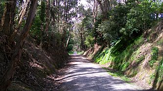
Warburton rail trail, Mount Evelyn
-
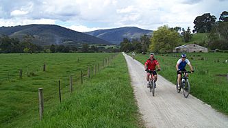
Warburton rail trail, Seville
-
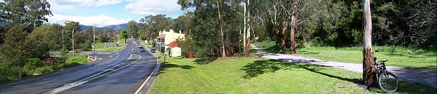
Warburton rail trail, Launching Place
-
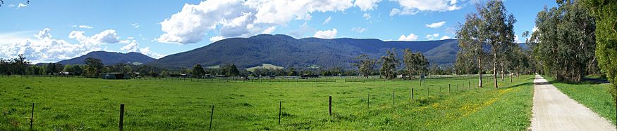
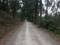
Warburton rail trail, Wesburn


Images for kids
-
Warburton rail trail, Mount Evelyn

