Limestone, Montana facts for kids
Quick facts for kids
Limestone, Montana
|
|
|---|---|
| Country | United States |
| State | Montana |
| County | Stillwater |
| Elevation | 5,535 ft (1,687 m) |
| Population
(2010)
|
|
| • Total | 17 |
| Time zone | UTC-7 (Mountain (MST)) |
| • Summer (DST) | UTC-6 (MDT) |
| ZIP code |
59061
|
| Area code(s) | 406 |
| GNIS feature ID | 777090 |
Limestone is a fascinating place in Stillwater County, Montana. It's known as a ghost town, which means it was once a lively community but is now mostly empty. This historic spot sits at an elevation of 5,535 feet above sea level. You can find Limestone on the Meyer Mountain U.S. Geological Survey Map.
History of Limestone
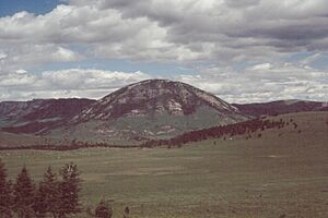
Limestone began as a busy mining community. It was located right next to Lodgepole Creek. The town also sat at the base of Limestone Butte, a large hill that gave the town its name.
Life in the Mining Town
Even though Limestone was a small town, it was very active. People lived and worked there, especially in mining. A post office was an important part of the community. It helped people send and receive letters and packages. The Limestone post office was open for many years, from 1910 until 1953.
What Remains Today
Today, Limestone is a true ghost town. Most of its residents have moved away. However, some buildings from its past are still standing. You can see the old grocery store and the former post office. These buildings offer a glimpse into what life was like in this historic Montana mining town.
 | Janet Taylor Pickett |
 | Synthia Saint James |
 | Howardena Pindell |
 | Faith Ringgold |


