
List of Indiana state historical markers in Martin County facts for kids

Have you ever seen a special sign by the road that tells you about something important that happened a long time ago? These are called historical markers. They are like outdoor history books! In Martin County, Indiana, there is one of these cool markers that tells a story about a place called Hindostan Falls.
These markers are put up by the Indiana Historical Bureau. Their job is to help us remember and learn about important people, places, and events in Indiana's past. Each marker has a story to tell, helping us connect with history right where it happened.
Contents
The Story of Hindostan Falls
The only state historical marker in Martin County is about a place called Hindostan Falls. This marker was put in place in 1966. It helps us remember a town that once stood there.
What Was Hindostan?
Hindostan was a town that started to grow in the early 1800s. It was located near the White River, where there were some beautiful waterfalls. These waterfalls were called Hindostan Falls. The town was a busy place for a while. People used the river to transport goods. It was a hub for trade and travel in the area.
Why Did Hindostan Disappear?
Sadly, the town of Hindostan did not last very long. In the 1820s, a terrible sickness spread through the area. Many people got sick, and some even died. Because of this, many people left Hindostan. The town slowly faded away. Today, there is no town there, just the falls and the historical marker. The marker helps us remember the people who lived there and the town that once thrived.
Finding the Marker
You can find the Hindostan Falls marker near Loogootee, Indiana. It is located where State Road 550 meets County Road 55. It's a great spot to visit if you want to learn more about Indiana's hidden history.
Images for kids
-
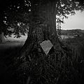
A view of Hindostan Falls today.

See also
- List of Indiana state historical markers
- National Register of Historic Places listings in Martin County, Indiana
