List of National Natural Landmarks in Montana facts for kids
Montana is a state in the western United States known for its beautiful landscapes. It's also home to some very special places called National Natural Landmarks. These are areas that have unique natural features, like amazing rock formations, important fossil sites, or special ecosystems. The United States government recognizes these places to help protect them and teach people about their importance.
There are 10 National Natural Landmarks in Montana. Each one tells a different story about Earth's history, from ancient creatures to powerful glaciers. Let's explore some of these incredible sites!
Contents
Montana's Amazing Natural Landmarks
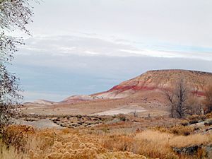
Bridger Fossil Area
The Bridger Fossil Area was named a National Natural Landmark in 1973. It is located in Carbon County, Montana. This area is managed by the federal government, specifically the Bureau of Land Management. The Bridger Fossil Area is famous for its fossils. It contains important remains of a dinosaur called Deinonychus antirrhopus. This dinosaur was a fierce predator that lived millions of years ago.
Bug Creek Fossil Area
The Bug Creek Fossil Area became a landmark in 1966. You can find it in McCone County, Montana. This site is part of the Charles M. Russell National Wildlife Refuge. Scientists have found many fossils of small mammals here. These fossils are from the Cretaceous period, which was a long time ago. Studying them helps us learn about ancient life.
Capitol Rock
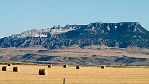
Capitol Rock was recognized as a landmark in 1976. It is located in Carter County, Montana. This natural landmark is managed by the Custer National Forest. Capitol Rock is a tall, impressive rock formation. It is a leftover piece of ancient layers of rock and soil. These layers once covered a large part of the Great Plains. It shows how much the land has changed over millions of years.
Cloverly Formation Site
The Cloverly Formation Site became a landmark in 1973. It is found in Big Horn County, Montana. This land is owned by the Crow Nation, a Native American tribe. The site is important for its very old fossils. It contains fossils of animals with backbones, called vertebrates. These fossils are from the early Cretaceous period.
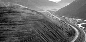
Glacial Lake Missoula
Glacial Lake Missoula was named a landmark in 1966. It is located in Sanders County, Montana, on private land. This area shows amazing evidence of a giant ancient lake. This lake formed during the Ice Age when a huge ice dam blocked a river. When the dam broke, it caused massive floods across North America. You can still see giant ripples in the land from these floods. They are some of the best examples of such ripples on the continent.
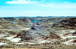
Hell Creek Fossil Area
The Hell Creek Fossil Area was designated a landmark in 1966. It spans several counties in Montana. This land is a mix of state and private ownership. This area is incredibly famous for dinosaur fossils. It is where the first fossils of the mighty Tyrannosaurus rex were found. Fossils of other dinosaurs like Ankylosaurus magniventris have also been discovered here. It's a key place for understanding the end of the dinosaur age.
Medicine Lake Site
The Medicine Lake Site became a landmark in 1980. It is located in Sheridan County, Montana. This site is part of the Medicine Lake National Wildlife Refuge. It is a fantastic example of how glaciers shaped the land. You can see many features left behind by glaciers here. These include hills of rock and dirt called till and kames. There are also long ridges called eskers. These features help scientists understand past ice ages.
Middle Fork Canyon
Middle Fork Canyon was recognized as a landmark in 1977. It is in Gallatin County, Montana. The Bureau of Land Management oversees this federal land. This canyon is a great example of a "superposed stream." This means a river cut through existing rock layers. It carved a deep canyon across the natural folds of the land. It shows the power of water over long periods of time.
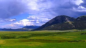
Red Rock Lakes National Wildlife Refuge
The Red Rock Lakes National Wildlife Refuge was named a landmark in 1966. It is located in Beaverhead County, Montana, on federal land. This refuge is a special place with high-altitude ecosystems. It shows what the land was like before European settlers arrived. It is home to many different plants and animals. It is also a critical habitat for the rare Trumpeter Swan.
Square Butte
Square Butte became a landmark in 1980. It is located in Chouteau County, Montana. This federal land is managed by the Bureau of Land Management. Square Butte is a very unique mountain. It is one of the best examples in the United States of "banded magmatic rock." This means the rock formed from molten material deep underground. It cooled in layers, creating distinct bands. It's a cool place to see how volcanoes and geology work!
 | Victor J. Glover |
 | Yvonne Cagle |
 | Jeanette Epps |
 | Bernard A. Harris Jr. |


