List of National Natural Landmarks in New Hampshire facts for kids
New Hampshire is home to some truly special natural places! These spots are called National Natural Landmarks. They are chosen because they show off the best examples of America's natural history. Think of them as outdoor museums, but with real plants, animals, and amazing landforms. New Hampshire has 11 of these incredible landmarks.
Contents
New Hampshire's Amazing Natural Landmarks
East Inlet Natural Area
This natural area was named a landmark in 1972. It's a unique place with a special kind of swamp called a "black spruce-tamarack bog." It also has a very old forest with balsam fir and red spruce trees that have never been cut down. It's like stepping back in time to see nature as it once was.
Floating Island
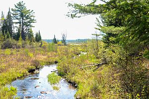
Also named in 1972, Floating Island is a really cool place. It's a "heath bog" that actually floats on water! You can find it in the Umbagog National Wildlife Refuge. Imagine a piece of land, covered in plants, just drifting around on a lake.
Franconia Notch
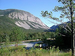
Franconia Notch became a landmark in 1971. This area is a valley that was carved out by huge glaciers long, long ago. The glaciers moved slowly, grinding the land into a special "U-shape" valley. It's a great example of how ice can change the landscape.
Heath Pond Bog
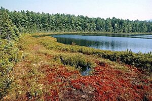
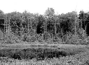
Designated in 1972, Heath Pond Bog is a perfect example of how a bog grows over time. It shows the process of "bog succession," which means how a pond slowly turns into a bog with special plants like sphagnum moss, heath plants, and black spruce trees.
Madison Boulder
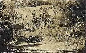
The Madison Boulder was recognized in 1970. This giant rock is truly impressive! It's the biggest known "glacial erratic" in North America. A glacial erratic is a boulder that was carried by a glacier and then left behind when the ice melted. This one is enormous!
Mount Monadnock
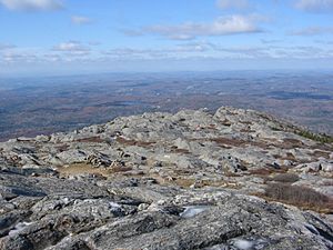
Mount Monadnock became a landmark in 1987. This mountain stands out because it's quite isolated and rises high above the land around it. It's so famous for this shape that the word "monadnock" is now used to describe any isolated mountain that stands alone.
Nancy Brook Virgin Spruce Forest and Scenic Area
Named in 1987, this forest is very special. It might be the largest "virgin forest" in the northeastern United States. A virgin forest means the trees have never been cut down by humans. It's part of the White Mountain National Forest, offering a glimpse of ancient woodlands.
Pondicherry Wildlife Refuge
Pondicherry Wildlife Refuge was designated in 1972. This refuge has two shallow ponds with warm water. These ponds are surrounded by marshes, bogs, and forests. This mix of habitats makes it a perfect home for many different kinds of birds. It's a birdwatcher's paradise!
Rhododendron Natural Area
This natural area became a landmark in 1982. It's famous for having the largest group of "rhododendron" plants that are still growing strong in central and southern New England. When they bloom, it's a beautiful sight!
Spruce Hole Bog
Spruce Hole Bog was named a landmark in 1972. This bog is the last known "kettle hole bog" in southern New Hampshire. A kettle hole is a depression in the ground left by a melting block of glacial ice. Over time, these can fill with water and become bogs.
White Lake Pitch Pine
Designated in 1980, this area is home to a mature and undisturbed forest. It's filled with "pitch pine" trees and "bear-oak" trees. This forest shows what the natural woodlands of the region looked like before human development.
 | John T. Biggers |
 | Thomas Blackshear |
 | Mark Bradford |
 | Beverly Buchanan |


