
List of Pennsylvania state historical markers in Tioga County facts for kids

Have you ever seen a special sign by the road that tells you about something important that happened long ago? These are called Pennsylvania state historical markers. They are like outdoor history books!
This article is about the official historical markers placed in Tioga County, Pennsylvania. These markers are put up by the Pennsylvania Historical and Museum Commission (PHMC). They help us learn about the people, places, and events that shaped this area. There are 15 historical markers in Tioga County, each telling a unique story.
Exploring Tioga County's History
What Are Historical Markers?
Historical markers are special signs that tell us about important events, people, or places. They are usually found along roadsides or in towns. Each marker has a short story about something significant that happened right there. They help us remember history and understand how our communities grew.
In Tioga County, these markers share stories about its rich past. They cover everything from early industries to important people and natural landmarks. Reading them is like going on a treasure hunt for history!
Important Stories from Tioga County
Tioga County has a fascinating history, and its markers highlight many key moments. Let's explore some of these stories.
Coal and Industry
Tioga County was once a big center for mining coal. This black rock was very important for fuel and industry.
- Blossburg Coal

This marker tells about the coal mining industry in Blossburg. Coal was discovered here in the early 1800s. It became a huge business, bringing many people to the area. The coal from Blossburg was known for its good quality. This industry helped the region grow a lot. The marker was placed on July 25, 1987, north of Morris.
- William B. Wilson

William B. Wilson was a very important person from Blossburg. He started working in the coal mines when he was young. Later, he became a leader for workers' rights. He even became the first U.S. Secretary of Labor! This means he was in charge of a big government department that helped workers. His marker was dedicated on October 29, 1948, near Blossburg.
Nature and Conservation
Tioga County is also known for its beautiful natural areas, including the Pennsylvania Grand Canyon.
- Civilian Conservation Corps

During the Great Depression, a program called the Civilian Conservation Corps (CCC) helped many young men find work. They built parks, planted trees, and helped protect nature. In Tioga County, the CCC worked in places like Leonard Harrison State Park. They built trails and facilities that we still use today. This marker was placed on June 3, 1995, in Wellsboro.
- Nessmuk

George W. Sears, also known as "Nessmuk," was a famous writer and outdoorsman. He loved nature and wrote about his adventures in the wilderness. He encouraged people to enjoy and protect nature. He was one of the first people to write about lightweight camping. His markers are in Wellsboro and Leonard Harrison State Park. They were dedicated on October 10, 1972.
- Pine Creek Path

Long before roads, Native Americans used paths to travel. The Pine Creek Path was one of these important routes. It followed Pine Creek, which is now a popular rail trail. This path was used for trade and travel by different tribes. The marker was placed on November 2, 1951, near Ansonia.
People and Progress
Historical markers also celebrate important people and how communities developed.
- Rural Electrification

Imagine life without electricity! For a long time, many farms and rural homes didn't have power. The Rural Electrification Administration (REA) was a government program that helped bring electricity to these areas. This changed life for many families, making farming and daily chores much easier. This marker was dedicated on October 24, 1986, in Mansfield.
- Tioga County

This marker celebrates the founding of Tioga County itself. The county was created in 1804. It was named after the Tioga River, which means "at the forks" in a Native American language. The marker highlights the county's history and its growth over the years. It was placed on March 26, 1982, at the Courthouse Square in Wellsboro.
- William A. Stone

William A. Stone was another important person from Tioga County. He served as the Governor of Pennsylvania from 1899 to 1903. Governors are the leaders of a state's government. Stone's markers tell about his life and his contributions to the state. They were dedicated on September 1, 1948, in Wellsboro.
Images for kids
-

Placeholder image for Coal Discovery marker.
-
Placeholder image for Corning & Blossburg Railroad marker.
-
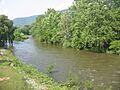
Lycoming Creek, near the Sheshequin Path.
-
Placeholder image for Williamson Road marker near Canoe Camp.
-
Placeholder image for Williamson Road marker near Liberty.

See also
- List of Pennsylvania state historical markers
- National Register of Historic Places listings in Tioga County, Pennsylvania
