List of Pennsylvania state historical markers in Warren County facts for kids
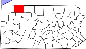
This is a list of the Pennsylvania state historical markers in Warren County.
This is intended to be a complete list of the official state historical markers placed in Warren County, Pennsylvania by the Pennsylvania Historical and Museum Commission (PHMC). The locations of the historical markers, as well as the latitude and longitude coordinates as provided by the PHMC's database, are included below when available. There are 12 historical markers located in Warren County.
Historical markers
| Marker title | Image | Date dedicated | Location | Marker type | Topics |
|---|---|---|---|---|---|
| Buckaloons |  |
October 23, 1947 | Buckaloons Park, near US 62, east of Irvine 41°50′08″N 79°15′26″W / 41.835550°N 79.257267°W |
Roadside | Native American |
| Celoron's Expedition |  |
October 23, 1947 | Pennsylvania Avenue (Business US 6) at Hickory Street, Warren 41°50′41″N 79°08′57″W / 41.84482°N 79.14923°W |
Roadside | Exploration, Government & Politics, Government & Politics 18th Century |
| Conewango |  |
October 23, 1947 | Pennsylvania Avenue (Business US 6), Conewango Creek Bridge (west side), Warren 41°50′37″N 79°08′25″W / 41.8437°N 79.14027°W |
Roadside | Early Settlement, Native American |
| Gen. William Irvine |  |
October 23, 1947 | National Forge Road near Bosko Street, Irvine 41°50′24″N 79°15′42″W / 41.83987°N 79.26173°W |
Roadside | Professions & Vocations |
| Grandin Well, The |  |
July 15, 1959 | US 62, .4 mile south of Allegheny River Bridge (Buckingham Street) near Tidioute 41°40′37″N 79°25′01″W / 41.67693°N 79.41688°W |
Roadside | Business & Industry, Oil & Gas |
| Handsome Lake |  |
October 2, 1946 | PA 59 at Cornplanter (Missing) |
Roadside | Native American |
| Indian Paint Hill |  |
October 23, 1947 | US 62, 3 miles northeast of Tidioute 41°42′30″N 79°20′57″W / 41.7084°N 79.34907°W |
Roadside | Native American |
| Robert Houghwout Jackson (1892-1954) |  |
August 23, 1997 | Garland-Spring Creek (PA 426) & Eldred Hill Roads, Spring Creek 41°52′01″N 79°31′04″W / 41.86705°N 79.51777°W |
Roadside | Government & Politics, Government & Politics 20th Century |
| Seneca Crossing |  |
November 3, 2007 | Intersection of Scandia & Wigwam Roads, Glade Township 41°53′17″N 79°03′31″W / 41.888033°N 79.058667°W |
Roadside | American Revolution, Exploration, Native American, Paths & Trails, Transportation |
| Sugar Run Mounds |  |
October 2, 1946 | PA 59 at Cornplanter (Missing) |
Roadside | Native American |
| Thompson's Island |  |
October 23, 1947 | US 62, ~4 miles S of Irvine 41°47′03″N 79°16′55″W / 41.784067°N 79.282033°W |
Roadside | American Revolution, Military, Native American |
| Warren County |  |
March 12, 1981 | County Courthouse, 4th Avenue at Market Street, Warren 41°50′53″N 79°08′49″W / 41.848117°N 79.147°W |
City | Government & Politics, Government & Politics 19th Century |
See also
- List of Pennsylvania state historical markers
- National Register of Historic Places listings in Warren County, Pennsylvania

All content from Kiddle encyclopedia articles (including the article images and facts) can be freely used under Attribution-ShareAlike license, unless stated otherwise. Cite this article:
List of Pennsylvania state historical markers in Warren County Facts for Kids. Kiddle Encyclopedia.

