List of places on the Victorian Heritage Register in the Borough of Queenscliffe facts for kids
The Borough of Queenscliffe in Victoria, Australia, is home to many special buildings and places. These important spots are listed on the Victorian Heritage Register. This register is like a special list kept by the Heritage Council of Victoria, which helps protect places that are important to Victoria's history and culture.
As of 2020, there are 16 places in Queenscliffe that are on this state-wide heritage list. These places tell stories about how people lived, worked, and built things in the past.
Contents
- Historic Places in Queenscliffe
- Arilpa
- Ballara
- Fisherman's Shed
- Lathamstowe
- Ozone Hotel
- Pilots' Cottages
- Point Lonsdale Maritime and Defence Precinct
- Queenscliff Hotel
- Queenscliff Pier and Lifeboat Complex
- Queenscliff Railway Station
- Rosenfeld
- Roseville Cottage
- Shortlands Bluff
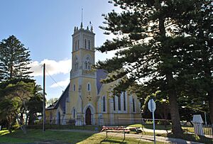
- St George the Martyr Church and Parish Hall
- Warringah
- Wreck Bell
Historic Places in Queenscliffe
Queenscliffe has many places that are important because of their history. Here are some of them:
Arilpa
Arilpa is a historic building located at 77 Glaneuse Road in Point Lonsdale. It was built in 1913 and was added to the heritage register in 1996.
Ballara
Another interesting place in Point Lonsdale is Ballara, found at 57-73 Glaneuse Road. This building was constructed between 1907 and 1908 and became a heritage site in 1995.
Fisherman's Shed
In Queenscliff, you can find the Fisherman's Shed at 1 Weeroona Parade and 2 Wharf Street. Its exact building date is unknown, but it was recognized for its heritage value in 2005.
Lathamstowe
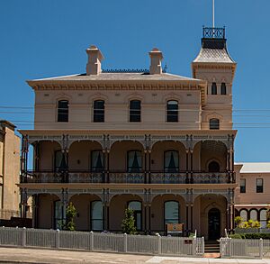
Lathamstowe is a significant building at 44 Gellibrand Street in Queenscliff. It was built in 1882-83 and was added to the register in 1994.
Ozone Hotel
The former Ozone Hotel, located at 42 Gellibrand Street in Queenscliff, is a grand building from 1881. It was listed on the heritage register in 1995.
Pilots' Cottages
The Pilots' Cottages at 60-62 Gellibrand Street in Queenscliff are very old, built in 1853-54. They were recognized as heritage places way back in 1982. These cottages were likely home to the pilots who guided ships through the tricky waters.
Point Lonsdale Maritime and Defence Precinct
The Point Lonsdale Maritime and Defence Precinct at 2 Point Lonsdale Road in Point Lonsdale is a whole area with historical importance. It includes structures from the 1850s and was listed in 1982. This precinct tells the story of how the area was defended and how ships were guided safely.
Queenscliff Hotel
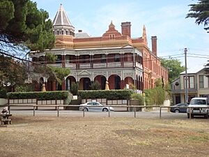
The Queenscliff Hotel, found at 16 Gellibrand Street in Queenscliff, was built in 1887. This beautiful hotel was added to the heritage list in 1995.
Queenscliff Pier and Lifeboat Complex
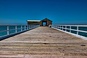
The Queenscliff Pier and Lifeboat Complex on Symonds Street in Queenscliff is a key part of the town's history. Built between 1884 and 1889, it became a heritage site in 1982. The pier was important for transport and fishing, and the lifeboat complex reminds us of the brave people who rescued sailors.
Queenscliff Railway Station
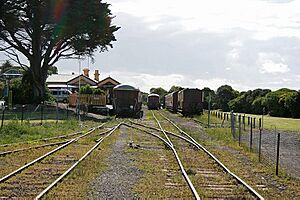
The Queenscliff railway station at 20 Symonds Street in Queenscliff was built in 1881. It was listed on the heritage register in 1982. This station was once a busy hub for trains bringing people to and from Queenscliff.
Rosenfeld
Rosenfeld is a building located at 26 King Street in Queenscliff. It was built in 1859 and was added to the heritage list in 1995.
Roseville Cottage
Roseville Cottage, at 42 Mercer Street in Queenscliff, dates back to 1863-64. It was recognized as a heritage place in 1996.
Shortlands Bluff
Shortlands Bluff, found at 133-135 Hesse Street in Queenscliff, has historical elements from the 1840s. It was added to the register more recently, in 2019. This area likely played a role in coastal observation or defense.
St George the Martyr Church and Parish Hall
The St George the Martyr Church and Parish Hall at 16-26 Hobson Street in Queenscliff were built between 1863 and 1864. This church complex became a heritage site in 1995.
Warringah
Warringah is a building at 80 Mercer Street in Queenscliff, built around 1860. It was added to the heritage register in 1996.
Wreck Bell
The Wreck Bell is a unique heritage item located in Princes Park, at the corner of Wharf Street and Gellibrand Street in Queenscliff. This bell, from 1891, was listed in 2004. It likely served as a warning or memorial for shipwrecks.


