List of places on the Victorian Heritage Register in the City of Wyndham facts for kids
This is a list of places on the Victorian Heritage Register in the City of Wyndham in Victoria, Australia. The Victorian Heritage Register is maintained by the Heritage Council of Victoria.
The Victorian Heritage Register, as of 2020, lists the following 13 state-registered places within the City of Wyndham:
| Place name | Place # | Location | Suburb or Town | Co-ordinates | Built | State registered |
Photo |
|---|---|---|---|---|---|---|---|
| Callanan's Chemist | H1956 | 47 Watton St | Werribee | 37°54′03″S 144°39′45″E / 37.900920°S 144.662530°E | 1939 | 6 December 2001 | |
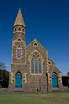
| Crossroads Uniting Church | H0628 | 19-21 Duncans Rd | Werribee | 37°54′09″S 144°39′46″E / 37.902630°S 144.662900°E | 1884 | 1 October 1986 |  |
| Eynesbury | H0362 | Eynesbury Rd and Springhill Rd | Eynesbury | 37°47′24″S 144°33′55″E / 37.790040°S 144.565230°E | 1872-75 | 9 October 1974 |  |
| Geodetic Survey Baseline | H1957 | Rear 301 Princes Hwy (Hoppers Crossing); 1245 Sayers Rd (Tarneit); off Springhill Rd (Eynesbury) |
Hoppers Crossing Tarneit Eynesbury |
37°53′06″S 144°41′51″E / 37.885100°S 144.697520°E | 1860s | 15 October 2001 | |
| Little River railway station | H1572 | 19-27 River St | Little River | 37°57′46″S 144°29′56″E / 37.962860°S 144.498980°E | 1864 | 20 August 1982 |  |
| Main Outfall Sewer | H1932 | from Laverton North to Werribee |
37°49′18″S 144°50′33″E / 37.821620°S 144.842470°E | 1892-94 | 13 September 2001 | ||
| Point Cook Homestead and Stables | H1509 | Point Cook Homestead Rd | Point Cook | 37°55′30″S 144°47′32″E / 37.925120°S 144.792180°E | c. 1857 | 9 October 1974 |  |
| Rothwell Bridge | H1454 | Old Melbourne Rd over Little River |
Little River | 37°58′37″S 144°30′31″E / 37.976880°S 144.508530°E | 1866-67 | 20 August 1982 | |
| State Research Farm | H1961 | 600 Sneydes Rd | Werribee | 37°53′46″S 144°41′00″E / 37.896200°S 144.683400°E | 1912 | 14 February 2002 | |
| Water Tank | H1416 | Cocoroc Rd | Cocoroc | 37°57′03″S 144°38′02″E / 37.950710°S 144.633880°E | 1854 | 20 August 1982 | |
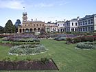
| Werribee Park | H1613 | 320 K Rd | Werribee South | 37°53′46″S 144°41′00″E / 37.896200°S 144.683400°E | 1865 | 1 April 1987 |  |
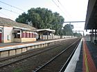
| Werribee railway station | H1309 | Comben St | Werribee | 37°53′59″S 144°39′39″E / 37.899700°S 144.660910°E | 1857 | 17 April 1987 |  |
| Werribee Satellite Aerodrome | H1884 | Princes Hwy | Werribee | 37°54′36″S 144°38′40″E / 37.910000°S 144.644350°E | 1942 | 9 November 2000 |  |

All content from Kiddle encyclopedia articles (including the article images and facts) can be freely used under Attribution-ShareAlike license, unless stated otherwise. Cite this article:
List of places on the Victorian Heritage Register in the City of Wyndham Facts for Kids. Kiddle Encyclopedia.
