
Little Black, Wisconsin facts for kids
Quick facts for kids
Little Black, Wisconsin
|
|
|---|---|
 |
|

Location of Little Black, Wisconsin
|
|
| Country | |
| State | |
| County | Taylor |
| Area | |
| • Total | 35.0 sq mi (90.7 km2) |
| • Land | 35.0 sq mi (90.7 km2) |
| • Water | 0 sq mi (0.0 km2) |
| Elevation | 1,417 ft (432 m) |
| Population
(2000)
|
|
| • Total | 1,148 |
| • Density | 32.8/sq mi (12.7/km2) |
| Time zone | UTC-6 (Central (CST)) |
| • Summer (DST) | UTC-5 (CDT) |
| Area code(s) | 715 & 534 |
| FIPS code | 55-44900 |
| GNIS feature ID | 1583580 |
| PLSS township | T30N R1E |
Little Black is a town in Taylor County, Wisconsin. It's a quiet place, about six miles square. Part of the village of Stetsonville is also in Little Black, along with a smaller community also called Little Black. In the year 2000, about 1,148 people lived here.
Contents
Exploring Little Black's Geography
Little Black covers about 35 square miles (90.7 square kilometers) of land. It has almost no water within its borders, except for small streams and the Little Black River. The land here is mostly flat. It was shaped by ancient glaciers long ago.
The soil in the northwest part of Little Black is called Merrill till. The southeast part has Edgar till. These are types of soil left behind by glaciers.
A Look Back at Little Black's History
Early Surveys and Land Description
The first surveys of the land that would become Little Black happened in 1847. Surveyors marked the western edge of the town. This line was important for measuring all the land in Wisconsin.
In 1854, another group of surveyors mapped out the entire area. They walked through forests and swamps. After their work, the head surveyor wrote a description. He noted that some swamps were not good for farming. He also said the land was generally poor. He mentioned that hemlock trees were common. There was not much pine. However, he noted many small streams. A larger stream in the north was good for mills. At that time, there were no buildings or farms in the area.
Railroads and Early Industries
Around 1873, the Wisconsin Central Railroad Company built its tracks through the eastern part of Little Black. This line was heading north towards Medford and Ashland. To help pay for the railroad, the company was given half of the land for eighteen miles on each side of the tracks. This usually included the odd-numbered sections of land.
The railroad built a station in what would become Stetsonville. In 1873, the first sawmill in Taylor County was built in the hamlet of Little Black. Another sawmill was built in Stetsonville in 1875. These mills used lumber cut from the surrounding forests.
How Little Black Got Its Name
When Taylor County was created in 1875, Little Black was formed. It was named after the Little Black River. At first, it was much larger than it is today. It included all the modern towns from Taft to Deer Creek. Over the years, other towns were separated from Little Black. Deer Creek was split off in 1880.
Growth of the Hamlet of Little Black
A small village area was planned for Little Black. It had a post office and a church. The first sawmill there opened in 1873. A shingle mill, which made roof shingles, was added in 1880. Another mill opened in 1883 where the railroad crossed the Little Black River.
This mill changed owners several times. In 1889, it burned down. However, it was rebuilt with new technology. It became one of the largest mills in Wisconsin. It ran day and night and employed over 200 people. But in 1893, it closed down.
Settlers and Community Development
A map from 1900 shows that many settlers had moved into the town. Most of the land was settled, except for the southwest corner. The map also shows that land near the railroad was very popular. East-west roads were built every mile. North-south roads, like today's Swallow Drive and Gibson Drive, also existed.
Settlers built their homes along these roads. Most farms were 40 or 80 acres. The map shows sawmills in Little Black and Stetsonville. There were also several rural schoolhouses and churches in both communities.
By 1911, a new map showed even more settlers. The last southwest corner of the town was now filled in. Almost all the east-west roads were complete. More schools and another sawmill were added.
People of Little Black: Demographics
In the year 2000, Little Black had 1,148 people living there. These people lived in 403 households, with 321 of them being families. The town had about 33 people per square mile.
Most people in Little Black were White (99.04%). A small number were African American, Native American, or Asian. About 0.52% of the population was Hispanic or Latino.
Many households (38.7%) had children under 18 living with them. Most households (65.0%) were married couples. The average household had about 2.85 people. The average family had about 3.16 people.
The population was spread out by age. About 30.4% were under 18 years old. About 10.6% were 65 years or older. The average age in the town was 36 years.
The median income for a household was $45,000. For families, it was $48,167. This means half of the households earned more than this amount, and half earned less. About 8.1% of the population lived below the poverty line. This included 9.1% of those under 18 and 8.8% of those 65 and older.
Images for kids
-
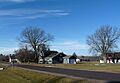
A bit of the hamlet of Little Black in 2023

See also
 In Spanish: Little Black (Wisconsin) para niños
