
Little Woods, Louisiana facts for kids
Quick facts for kids
Little Woods, Louisiana
|
|
|---|---|
| Nickname(s):
Lake Pontchartrain Camps
|
|

1935 map of portion of eastern New Orleans lakefront around Little Woods.
|
|
| Country | United States |
| State | Louisiana |
| Parish | Orleans |
| Elevation | -3 ft (−0.9 m) |
| Time zone | UTC-6 (Central (CST)) |
| • Summer (DST) | UTC-5 (CDT) |
| Area code(s) | 504 |
| GNIS, 1980 feature ID | 543401 |
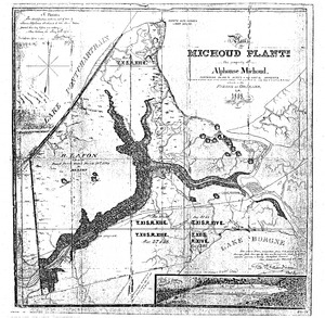
Little Woods (which means "La Petite Bois" in French) was once a small community right by the shore of Lake Pontchartrain in Louisiana. The name "Little Woods" is still used today. It came from the small groups of trees that grew on higher ground, surrounded by water and wetlands. You can even see the French name on old maps from the 1800s.
Contents
How the Land Was Formed
Long, long ago, after the Ice Age, the land around Lake Pontchartrain was formed. This happened because rivers dropped off dirt and sand, creating the beaches we see today. About 4,600 years ago, a line of old sandbars, called the Pine Island trend, helped create barrier islands in the area. Scientists have studied these old beaches and found many different kinds of mollusks (like snails and clams) here.
Ancient Discoveries
Scientists have explored the Little Woods area and found amazing things from the past. They discovered pieces of old pottery and pumice (a light rock from volcanoes). They also found burial sites with quartz crystals and bones.
These discoveries show that people lived here a very long time ago, from about 500 BCE to 1 CE. These early people were part of the Tchefuncte Culture, who were among the first to make pottery from local clay. Big digs to find these ancient shell deposits happened in the 1930s. Today, only a few of these important historical sites remain.
Early Explorers and Plans
In the late 1600s, explorers like Robert de La Salle and Pierre Le Moyne d'Iberville visited the area. They noticed that the native people in Louisiana lived in homes built on pier-like structures over the water. France, led by King Louis XIV, even had trading agreements with the local native groups.
Later, in the early 1800s, a man named Pierre Denis de la Ronde had a big idea. He planned a road from Little Woods to a town called Versailles, Louisiana. He also imagined a canal that would connect Lake Pontchartrain to the Mississippi River. However, in 1803, France sold the Louisiana territories to Spain, changing many plans.
The Railroad Arrives
By 1882, Little Woods was part of a large plantation. A railroad was being built to connect New Orleans to other places. This included building the longest train trestle bridge in the world!
Railroad workers built small houses along the tracks. Little Woods became a "whistle stop," a place where trains would wait to cross the long bridge. People living in the camps there would fish and sell their seafood in the city.
Sadly, in 1908, a train accident happened at the Little Woods Station. Two trains crashed in the fog, and several important people from the community were injured or died.
The Roaring Twenties
The 1920s were a lively time, and Little Woods became a popular vacation spot! Famous jazz musician Louis Armstrong even wrote in his autobiography that he played music in Little Woods when he was just 13 years old.
Hundreds of camps were set up along the lakefront, from West End to Little Woods. People came to relax, fish, and enjoy the music. Ragtime and early Jazz, sometimes called "Ragajazz," were very popular. Bands like Kid Stevenson Jazz Hounds and Alcide "Yellow" Nunez played their tunes in the area. Some camps from other parts of the lake were even moved to Little Woods during this time.

