Loch Beanie facts for kids
Quick facts for kids Loch Beanie |
|
|---|---|

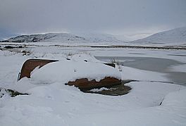
View of the small fishing boat next to Loch Beanie.
|
|
| Coordinates | 56°48′07″N 3°22′37″W / 56.80199814°N 3.37682275°W |
| Type | freshwater loch |
| Primary outflows | Allt Mòr into Shee Water |
| Max. length | 0.804672 km (0.500000 mi) |
| Max. width | 0.321869 km (0.200000 mi) |
| Surface area | 17 ha (42 acres) |
| Average depth | 17.71 ft (5.40 m) |
| Max. depth | 17.71 ft (5.40 m) |
| Water volume | 32,079,387 cu ft (908,387.1 m3) |
| Shore length1 | 2 km (1.2 mi) |
| Surface elevation | 406 m (1,332 ft) |
| Max. temperature | 59.2 °F (15.1 °C) |
| Min. temperature | 59.2 °F (15.1 °C) |
| Islands | 1 |
| 1 Shore length is not a well-defined measure. | |
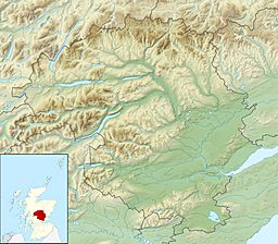
Loch Beanie, also called Loch Schchernich, is a small, shallow freshwater loch. It is found in a beautiful area called Glen Shee in Perth and Kinross, Scotland. This loch is about 0.8 kilometers (0.5 miles) long and 0.3 kilometers (0.2 miles) wide. It's a peaceful spot, perfect for enjoying nature.
The Mysterious Island of Loch Beanie
Loch Beanie has a small island right in its middle. This island is quite special because it holds a secret from the past.
What is a Crannog?
On the island, about 100 meters (330 feet) from the southern shore, there is an ancient structure. It is called a Crannog. A crannog is an old, artificial island. People built these islands in lakes or lochs a very long time ago. They used boulders and small stones to make them. Less than a third of this crannog's surface is visible above the water today.
A Home on the Water?
It seems that a building might have once stood on this crannog. Old maps give us clues about its history.
- Timothy Pont's Map (around 1600): A map made by Timothy Pont shows a large house, or "mansion," on the island. He wrote that it was "Loch Sesatut, sumtyms ye dwelling of ye chief man of Glenshy and Strathardle." This means it was once the home of an important leader in the area.
- Robert Gordon's Map (1636–1648): Another map by Robert Gordon of Straloch also mentions the building. He called it "L. Sesatur old chief dwelling of Glens(hie)." This confirms that it was a significant place.
However, by the year 1747, people had forgotten all about this island and its history. It's amazing how a place once so important could become lost to memory!


