Loch a' Ghobhainn facts for kids
Quick facts for kids Loch a' Ghobhainn |
|
|---|---|
 |
|
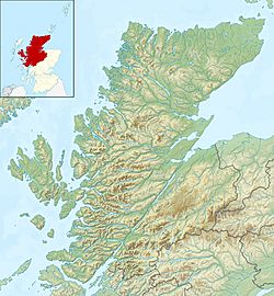
| Location | Wester Ross, Highlands Scotland |
| Coordinates | 57°37′50″N 5°35′50″W / 57.6305°N 5.5971°W |
| Type | freshwater loch |
| Basin countries | Scotland |
| Max. length | 0.75 mi (1.21 km) |
| Max. width | 0.3 mi (0.48 km) |
| Surface area | 108.7 ha (269 acres) |
| Average depth | 12.5 ft (3.8 m) |
| Max. depth | 28 ft (8.5 m) |
| Water volume | 54,000,000 cu ft (1,500,000 m3) |
| Shore length1 | 3.1 km (1.9 mi) |
| Surface elevation | 308 m (1,010 ft) |
| Islands | 2 |
| 1 Shore length is not a well-defined measure. | |
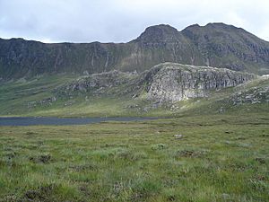
Loch a' Ghobhainn is a beautiful freshwater loch (which is the Scottish word for a lake) located in the amazing Scottish Highlands. It's found inland, a bit to the southwest of a village called Shieldaig. This loch is a natural wonder, sitting high up in the hills.
Discovering Loch a' Ghobhainn
Loch a' Ghobhainn has a unique, slightly oval shape. Imagine a squashed circle! Its edge, or perimeter, stretches for about 3.1 km (1.9 mi). That's like walking around a good-sized park!
Size and Depth
The loch is about 0.75 mi (1.21 km) long. That's roughly the length of 13 football fields! Its average depth is 12.5 ft (3.8 m), which is taller than a basketball hoop. At its very deepest point, the loch goes down 28 ft (8.5 m). That's as deep as a two-story building!
Mapping the Waters
Did you know that people have been studying lochs for a long time? Loch a' Ghobhainn was carefully measured and mapped on August 8, 1902. Two people named T.N. Johnston and John Hewitt did this important work.
Their measurements were part of a much bigger project. It was called Sir John Murray's Bathymetrical Survey of Fresh-Water Lochs of Scotland. This survey happened between 1897 and 1909. It was a huge effort to map all the freshwater lochs in Scotland. Scientists wanted to understand how deep they were and what their shapes looked like underwater. This helps us learn more about these amazing natural places.
 | Selma Burke |
 | Pauline Powell Burns |
 | Frederick J. Brown |
 | Robert Blackburn |


