Lost Dutchman State Park facts for kids
Quick facts for kids Lost Dutchman State Park |
|
|---|---|

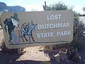
Entrance to the Lost Dutchman State Park
|
|
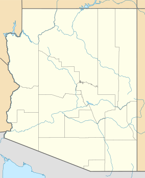
| Location | Pinal, Arizona, United States |
| Area | 320 acres (130 ha) |
| Elevation | 2,060 ft (630 m) |
| Established | 1977 |
| Named for | Lost Dutchman's Gold Mine |
| Governing body | Arizona State Parks |

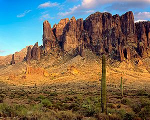
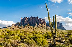
Lost Dutchman State Park is a cool place to visit in central Arizona, USA. It's about 320 acres big and sits right next to the amazing Superstition Mountains. The park gets its name from a famous story about a hidden gold mine called the Lost Dutchman's Gold Mine, a legend from the Old West! You can find the park about 40 miles (64 km) east of Phoenix, right off U.S. Highway 60.
Contents
Park History and Growth
The area where the park is now started as a place for people to visit during the day. This was set up by the Bureau of Land Management in 1972.
In 1977, a big part of the land, about 292 acres (118 ha), was given to the state of Arizona. This created the Lost Dutchman State Park. The park grew even bigger in 1983, reaching its current size of 320 acres (130 ha).
What to Do at the Park
Lost Dutchman State Park is a great spot for outdoor fun. It has places where you can set up camp and areas for day visitors to park. It's also a starting point for many trails that lead into the Tonto National Forest. The Superstition Mountains are located within this forest.
Popular Hiking Trails
Some of the most popular walks start from the park and go onto trails managed by the National Forest Service. These trails include the Jacob's Crosscut trail, which goes along the western side of the Superstitions. Another popular trail is the Siphon Draw trail, which climbs up the mountain face. Many people think these trails are part of the state park, but they are actually in the National Forest.
Siphon Draw and Superstition Ridgeline Trails
Hiking to the Flatiron
Siphon Draw is a very popular trail that leads to a famous rock formation called the "Flatiron." It looks like the front of a ship sticking out of the mountain. The last mile (1.6 km) of the hike to the Flatiron is a steep climb over large rocks. This area is a wilderness, so there are no trail signs or markers. The very last 10 yards (9.1 m) to the Flatiron is a difficult climb called 'The Wall.' Park Rangers suggest wearing gloves for this part. This last mile is also not safe for hiking with dogs.
Continuing Along the Superstition Ridgeline
The trail continues along the mountain ridge from the Flatiron to the Peralta Trailhead, which is about 8 miles (13 km) away. The first part of the trail from Lost Dutchman State Park to the Basin (about halfway) is easy to follow and very popular. However, the last mile up to the Flatiron is an unmarked wilderness area.
From the Flatiron along the top of the ridge to Peralta Trailhead, the trail is much harder to see. It doesn't get many hikers, so it's only marked by small piles of rocks called cairns. This part of the trail is very remote. You can only get to it from the trailheads at each end. There are a few possible escape routes like Hog Canyon or Hieroglyphics Canyon if there's an emergency. But these trails are even tougher and harder to find your way through. Because these canyons are so remote and difficult, hikers should plan to finish the entire hike and bring emergency gear.
Important Safety Tips for Ridgeline Hiking
You should never try this hike in the summer. There is no water along the entire route, and very little shade. You would need to carry so much water that it would be too heavy for even the strongest hikers. Even in winter or cooler seasons, each hiker should carry at least one to two gallons (3.8 to 7.6 liters) of pure water.
The ridgeline climbs about 2,800 feet (853 m) from the lowest point at Siphon Draw Trailhead (2,000 feet or 610 m) to the highest point near Superstition Peak (about 4,800 feet or 1,463 m). The total amount of climbing on this trail is about 4,400 feet (1,341 m). This is much more climbing than on the Bright Angel Trail in the Grand Canyon. Also, the Bright Angel Trail has water stations and is near a creek and river, but the Superstition Ridgeline has no water at all.
Park Saved from Closure
Lost Dutchman State Park was supposed to close down on June 3, 2010. But a kind person from Katy, Texas, donated $8,000. This generous gift helped the park stay open for everyone to enjoy!
 | Georgia Louise Harris Brown |
 | Julian Abele |
 | Norma Merrick Sklarek |
 | William Sidney Pittman |


