Lunenburg, Virginia facts for kids
Quick facts for kids
Lunenburg, Virginia
|
|
|---|---|

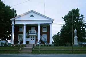
Lunenburg Courthouse
|
|
| Country | United States |
| State | Virginia |
| County | Lunenburg |
| Area | |
| • Total | 2.14 sq mi (5.54 km2) |
| • Land | 2.14 sq mi (5.54 km2) |
| • Water | 0 sq mi (0.0 km2) |
| Elevation | 512 ft (156 m) |
| Population
(2010)
|
|
| • Total | 165 |
| • Density | 77/sq mi (29.8/km2) |
| Time zone | UTC−5 (Eastern (EST)) |
| • Summer (DST) | UTC−4 (EDT) |
| ZIP code |
23952
|
| Area code(s) | 434 |
| FIPS code | 51-47496 |
| GNIS feature ID | 1498509 |
Lunenburg is a small community in Virginia, United States. It is known as a census-designated place (CDP). This means it is a special area defined by the government for counting people.
Lunenburg is also the county seat of Lunenburg County. A county seat is like the main town where the county government offices are located. In 2010, about 165 people lived here. You might also hear it called Lunenburg Courthouse or Lunenburg Court House.
Geography of Lunenburg
Lunenburg is located in the middle of Lunenburg County. This area is in the southeastern part of Virginia. It is about 3 miles (4.8 km) southwest of Victoria. Victoria is the biggest town in the county.
Roads and Travel
Two main roads, Route 40 and Route 49, go through Lunenburg. Route 40 heads northwest for about 14 miles (23 km) to Keysville. Route 49 goes southwest for about 16 miles (26 km) to Chase City. These two roads meet in Lunenburg. From there, they travel northeast together towards Victoria.
Land and Water
The Lunenburg area covers about 5.5 square kilometers (2.1 square miles). All of this area is land. The community is on a raised area, like a small hill. Water from this area flows in different directions.
Some water goes northwest into Couches Creek. Other water flows south into Reedy Creek. Both of these creeks eventually join the Meherrin River. The Meherrin River then flows southeast. It finally reaches the Chowan River and Albemarle Sound in North Carolina.
See also
 For information about Lunenburg (Virginia) in Spanish, check out Lunenburg (Virginia) para niños.
 | Mary Eliza Mahoney |
 | Susie King Taylor |
 | Ida Gray |
 | Eliza Ann Grier |


