Malus Island facts for kids

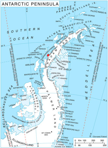
Location of Stresher Peninsula on Graham Land, Antarctic Peninsula
|
|
|
Location in Antarctica
|
|
| Geography | |
|---|---|
| Location | Antarctica |
| Coordinates | 66°14′S 65°45′W / 66.233°S 65.750°W |
| Administration | |
| Administered under the Antarctic Treaty System | |
| Demographics | |
| Population | Uninhabited |
Malus Island is a small, remote island located in the icy continent of Antarctica. It's a place where no one lives, surrounded by the vast, frozen landscape of the Antarctic Peninsula. This island is a part of the many landforms that make up this incredible polar region.
Where is Malus Island?
Malus Island is found in a specific spot off the coast of Antarctica. It lies about 8.3 kilometers (which is 4.5 nautical miles) south of a point called Cape Evensen. The island is located within a body of water known as Auvert Bay. This bay is situated off the northwest coast of the Stresher Peninsula, which is part of Graham Land in Antarctica.
How Malus Island Got Its Name
Malus Island was first mapped and explored by a group of adventurers. The British Graham Land Expedition charted the island between 1934 and 1937. This expedition was led by a brave explorer named John Rymill.
The island received its name in 1960 from the UK Antarctic Place-Names Committee. They decided to name it after a famous French scientist, Étienne-Louis Malus. He was a physicist who made an important discovery about light. Malus found out that light can be "polarized" when it reflects off surfaces. This means light waves can be made to vibrate in a specific direction. This discovery was later used to design special "snow goggles." These goggles help protect eyes from the bright glare of the sun reflecting off snow and ice.


