Matías Romero, Oaxaca facts for kids
Quick facts for kids
Matías Romero
|
|
|---|---|
|
Municipality and town
|
|
| Country | |
| State | Oaxaca |
| Area | |
| • Total | 1,459.54 km2 (563.53 sq mi) |
| Population
(2005)
|
|
| • Total | 38,421 |
| Time zone | UTC-6 (Central Standard Time) |
| • Summer (DST) | UTC-5 (Central Daylight Time) |
| Area code(s) | 972 |
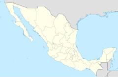
Matías Romero is a town and a municipality in the state of Oaxaca, located in south-western Mexico. A municipality is like a local government area. The town and municipality are named after Matías Romero Avendaño, who was an important Mexican politician and diplomat. A diplomat works to keep good relationships between countries.
The municipality covers a large area of about 1,459.54 square kilometers. It is part of the Juchitán District, which is in the western part of the Istmo de Tehuantepec region.
One popular place to visit is El Rio Corte in Colonia Cuauhtemoc. It's a wide river with great beaches, perfect for relaxing. In 2005, the total population of the municipality was 38,421 people.
History of Matías Romero
Earthquakes in 2017
In 2017, the area around Matías Romero experienced some strong earthquakes. On September 23, a magnitude 6.1 earthquake hit close to the town. This earthquake happened between the locations of two even bigger quakes that had struck earlier that month.
- On September 8, a very powerful 8.1 magnitude earthquake occurred off the southern Pacific coast, near the state of Chiapas.
- Then, on September 19, Mexico City was hit by a 7.1 magnitude earthquake. This date was also the 32nd anniversary of a terrible earthquake in 1985 that caused a lot of damage and sadly, many lives were lost.
Recent Events (2020-Present)
In 2020, the Municipal President, Alfredo Juárez, passed away. This happened during the COVID-19 pandemic in Mexico, a time when many people around the world were affected by the virus.
See also
 In Spanish: Matías Romero (Oaxaca) para niños
 | Kyle Baker |
 | Joseph Yoakum |
 | Laura Wheeler Waring |
 | Henry Ossawa Tanner |


