McNeil, Travis County, Texas facts for kids
Quick facts for kids
McNeil
|
|
|---|---|

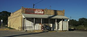
Post Office and Austin White Lime Company Store
|
|
| Country | United States |
| State | Texas |
| County | Travis |
| Elevation | 830 ft (250 m) |
| Time zone | UTC-6 (Central (CST)) |
| • Summer (DST) | UTC-5 (CDT) |
| ZIP codes |
78651
|
McNeil is a small, unincorporated community in Travis County, Texas. An "unincorporated community" means it's not an official city or town with its own local government. In 2000, about 70 people lived here. McNeil is located within the larger Greater Austin area. It sits at an elevation of 830 feet (253 meters) above sea level.
Contents
History of McNeil
McNeil started because two important railroad lines met there. One line, built by the International & Great Northern Railroad, connected Rockdale to Austin in 1876. The other line, from the Austin and Northwestern Railroad, went from Austin to Burnet in 1892.
Early Days and Railroads
The community was named after George McNeil. He was a regional manager for the Austin and Northwestern Railroad. McNeil got its own post office in December 1888. Adison A. Sheppard was the first postmaster.
Today, the name "McNeil" is mostly used for a large company facility and the railroad crossing. Many nearby homes use Austin mailing addresses.
Lime Company and Post Office
From 1888 until March 31, 2024, the Austin White Lime Company operated in McNeil. They dug up limestone and made lime products from it. This company was a big part of the community for a very long time.
Even though McNeil is not an official city, it still has its own post office. This post office has the ZIP code 78651. However, this ZIP code only covers the post office and the Austin White Lime company store, not the surrounding areas.
Modern Rail Lines
The railroad tracks in McNeil are now owned by two companies. These are the Capital Metropolitan Transportation Authority (Cap Metro) and the Union Pacific Railroad (UP). The Cap Metro lines were once the Austin and Northwestern tracks.
Cap Metro uses its lines for both commuter rail and freight trains. The Capital MetroRail commuter train even has a stop nearby called Howard station. Freight trains on Cap Metro's lines are run by the Austin Western Railroad.
There's a special overpass built in 2007 that allows commuter trains to go over the UP tracks. Freight trains, however, use a "diamond crossing" where the tracks cross at the same level. Freight is also moved between Union Pacific and Austin Western trains here. Another railroad, BNSF, also uses these tracks to reach Austin Western.
In the past, McNeil also had a hotel and a general store. At one point, about 200 people lived there. By the 1930s, the population dropped to 125. From the 1940s until 2000, about 70 people lived in McNeil.
Where is McNeil?
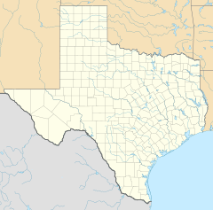
McNeil is located about 15 miles (24 kilometers) north of Austin. It is in the northern part of Travis County.
Learning in McNeil
McNeil High School was built in 1991. It opened its doors for classes in 1992, and its first senior class graduated in 1994. The school is part of the Round Rock Independent School District.


