
Burnet, Texas facts for kids
Quick facts for kids
Burnet, Texas
|
|
|---|---|

City Hall in Burnet
|
|
| Nickname(s):
Bluebonnet Capital of Texas
|
|
| Motto(s):
"Lakes, Hills, History"
|
|
| Country | United States |
| State | Texas |
| County | Burnet |
| Area | |
| • Total | 10.40 sq mi (26.94 km2) |
| • Land | 10.37 sq mi (26.85 km2) |
| • Water | 0.03 sq mi (0.09 km2) |
| Elevation | 1,339 ft (408 m) |
| Population
(2020)
|
|
| • Total | 6,436 |
| • Density | 618.8/sq mi (238.90/km2) |
| Time zone | UTC−6 (CST) |
| • Summer (DST) | UTC−5 (CDT) |
| ZIP Code |
78611
|
| Area codes | 512 and 737 |
| FIPS code | 48-11464 |
| GNIS feature ID | 2409948 |
Burnet (pronounced BUR-nit) is a city in Texas, United States. It is the main city, or county seat, of Burnet County. In 2020, about 6,436 people lived there.
Both the city and the county are named after David Gouverneur Burnet. He was the first temporary president of the Republic of Texas. He also served as vice president later on.
Contents
Where is Burnet Located?
Burnet is in the middle of Burnet County. It is about 54 miles (87 km) northwest of Austin, the state capital. You can drive there in about 60 to 90 minutes.
The city is also 36 miles (58 km) west of Georgetown. It is 100 miles (160 km) north of San Antonio.
How Big is Burnet?
Burnet covers a total area of about 10.40 square miles (26.94 square km). Most of this area is land. Only a tiny part, about 0.03 square miles (0.09 square km), is covered by water.
What is the Weather Like?
Burnet has a humid subtropical climate. This means it has hot and humid summers. The winters are usually mild to cool. Temperatures can reach 90°F (32°C) or higher in any month of the year.
| Climate data for Burnet, Texas (1991–2020 normals, extremes 1896–present) | |||||||||||||
|---|---|---|---|---|---|---|---|---|---|---|---|---|---|
| Month | Jan | Feb | Mar | Apr | May | Jun | Jul | Aug | Sep | Oct | Nov | Dec | Year |
| Record high °F (°C) | 95 (35) |
100 (38) |
100 (38) |
102 (39) |
104 (40) |
110 (43) |
114 (46) |
114 (46) |
108 (42) |
105 (41) |
92 (33) |
92 (33) |
114 (46) |
| Mean daily maximum °F (°C) | 58.6 (14.8) |
62.6 (17.0) |
69.9 (21.1) |
77.2 (25.1) |
83.8 (28.8) |
90.4 (32.4) |
93.9 (34.4) |
94.5 (34.7) |
87.6 (30.9) |
78.5 (25.8) |
67.5 (19.7) |
59.8 (15.4) |
77.0 (25.0) |
| Daily mean °F (°C) | 46.5 (8.1) |
50.5 (10.3) |
57.7 (14.3) |
65.0 (18.3) |
73.0 (22.8) |
79.5 (26.4) |
82.6 (28.1) |
82.7 (28.2) |
76.1 (24.5) |
66.3 (19.1) |
55.8 (13.2) |
48.0 (8.9) |
65.3 (18.5) |
| Mean daily minimum °F (°C) | 34.4 (1.3) |
38.4 (3.6) |
45.5 (7.5) |
52.8 (11.6) |
62.2 (16.8) |
68.7 (20.4) |
71.4 (21.9) |
70.8 (21.6) |
64.6 (18.1) |
54.1 (12.3) |
44.2 (6.8) |
36.1 (2.3) |
53.6 (12.0) |
| Record low °F (°C) | −4 (−20) |
−1 (−18) |
12 (−11) |
27 (−3) |
34 (1) |
46 (8) |
54 (12) |
50 (10) |
38 (3) |
22 (−6) |
15 (−9) |
−4 (−20) |
−4 (−20) |
| Average precipitation inches (mm) | 1.94 (49) |
1.95 (50) |
2.86 (73) |
2.32 (59) |
4.07 (103) |
3.17 (81) |
2.09 (53) |
2.42 (61) |
3.39 (86) |
3.57 (91) |
2.64 (67) |
1.92 (49) |
32.34 (821) |
| Average snowfall inches (cm) | 0.0 (0.0) |
0.1 (0.25) |
0.0 (0.0) |
0.0 (0.0) |
0.0 (0.0) |
0.0 (0.0) |
0.0 (0.0) |
0.0 (0.0) |
0.0 (0.0) |
0.0 (0.0) |
0.0 (0.0) |
0.0 (0.0) |
0.1 (0.25) |
| Average precipitation days (≥ 0.01 in) | 5.9 | 6.4 | 7.1 | 5.4 | 7.6 | 6.0 | 4.1 | 4.5 | 5.7 | 5.7 | 5.9 | 5.9 | 70.2 |
| Average snowy days (≥ 0.1 in) | 0.0 | 0.2 | 0.0 | 0.0 | 0.0 | 0.0 | 0.0 | 0.0 | 0.0 | 0.0 | 0.0 | 0.0 | 0.2 |
| Source: NOAA | |||||||||||||
Burnet's History
In December 1847, a group of Texas Rangers set up a station here. This station helped protect early settlers from Native American raids. In 1849, it became a federal fort called Fort Croghan.
A town was started next to Fort Croghan in 1852. This was when Burnet County was also created. The town was first called Hamilton. It was named after John Hamilton, who owned land nearby.
In 1857, people in the town asked to change the name to Burnet. This was because another town in Texas was already named Hamilton. The name was officially changed in 1858.
The town grew a lot when the Austin and Northwestern Railroad arrived in 1882. Burnet became a major stop for goods traveling west. After the railroad went further to Llano in 1892, Burnet became more of a farming and livestock center. The city of Burnet officially became a city in 1933.
The local newspaper, the Burnet Bulletin, has been serving the community since 1873.
People in Burnet
| Historical population | |||
|---|---|---|---|
| Census | Pop. | %± | |
| 1870 | 280 | — | |
| 1880 | 490 | 75.0% | |
| 1890 | 1,454 | 196.7% | |
| 1900 | 1,003 | −31.0% | |
| 1910 | 981 | −2.2% | |
| 1920 | 966 | −1.5% | |
| 1930 | 1,055 | 9.2% | |
| 1940 | 1,945 | 84.4% | |
| 1950 | 2,394 | 23.1% | |
| 1960 | 2,214 | −7.5% | |
| 1970 | 2,864 | 29.4% | |
| 1980 | 3,410 | 19.1% | |
| 1990 | 3,423 | 0.4% | |
| 2000 | 4,735 | 38.3% | |
| 2010 | 5,987 | 26.4% | |
| 2020 | 6,436 | 7.5% | |
| U.S. Decennial Census | |||
Burnet's population has grown over the years. In 1870, there were 280 people. By 2020, the population had grown to 6,436 people.
2020 Census Information
| Race | Number | Percentage |
|---|---|---|
| White (NH) | 4,415 | 68.6% |
| Black or African American (NH) | 152 | 2.36% |
| Native American or Alaska Native (NH) | 21 | 0.33% |
| Asian (NH) | 82 | 1.27% |
| Pacific Islander (NH) | 2 | 0.03% |
| Some other race (NH) | 27 | 0.42% |
| Mixed/multiracial (NH) | 229 | 3.56% |
| Hispanic or Latino | 1,508 | 23.43% |
| Total | 6,436 |
In 2020, there were 6,436 people living in Burnet. There were 2,142 households. About 31.7% of these households had children under 18 living with them. The average household had 2.46 people.
What is the Economy Like?
Some of the biggest employers in Burnet include the Burnet Consolidated Independent School District. This school district employs 285 people. Other major employers are Entegris, the Burnet County government, and Seton Highland Lakes Hospital.
Education in Burnet
Burnet is served by the Burnet Consolidated Independent School District. The city is home to the Burnet High School Bulldogs.
Outside of Burnet, there is a summer camp called Camp Longhorn. It has three different locations: Inks Lake, Indian Springs, and C3.
Getting Around Burnet
Burnet has two main highways:
 U.S. Highway 281 goes north and south. It connects Burnet to Lampasas (22 miles north) and Marble Falls (13 miles south).
 State Highway 29 goes east and west. It connects Burnet to Llano (30 miles west) and Georgetown (36 miles east).
You can also take a fun steam train ride called the Hill Country Flyer. It runs from Cedar Park to Burnet on certain days of the year.
The Burnet Municipal Airport is also known as Kate Craddock Field. It is a general-aviation airport for smaller planes. It has a 5000-foot (1524 m) lighted runway. The airport is home to the Highland Lakes Squadron of the Commemorative Air Force.
Fun Things to Do in Burnet
There are many attractions in and around Burnet:
- The Highland Lakes
- Longhorn Cavern
- Inks Lake State Park
- The Historic Burnet Square, with old buildings and unique shops
- The Highland Lakes Air Museum
- The Hill Country Motorheads Vintage Motorcycle Museum
- Fort Croghan Museum and Grounds
- The Vanishing Texas River Cruise
- Hamilton Creek Park
- Spider Mountain Bike Park
- Galloway Hammond Recreation Center
- Delaware Springs Golf Course
- The Austin Steam Train Association's Hill Country Flyer
The Historic Square has buildings from the 1880s. You can find many unique shops and places to eat there.
Famous People From Burnet
- Doak Field, a professional American football player
- Stephen McGee, a football player for Texas A&M University and the Dallas Cowboys
- Andrew Moses, a career officer in the United States Army
- Jordan Shipley, a wide receiver for The University of Texas at Austin and the Cincinnati Bengals
- Logan Vandeveer, a Texas soldier, ranger, and civic leader
Gallery
-
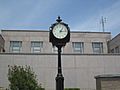
Clock at Burnet County Courthouse
-
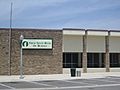
First State Bank of Burnet
-
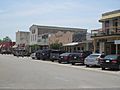
Businesses in downtown Burnet.
-
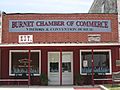
The Burnet Chamber of Commerce office is located downtown across from the courthouse.
-
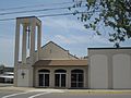
First Baptist Church in Burnet
-
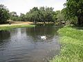
Hamilton Creek Park off U.S. Route 281 in Burnet


See also
 In Spanish: Burnet (Texas) para niños
