Burnet County, Texas facts for kids
Quick facts for kids
Burnet County
|
|
|---|---|

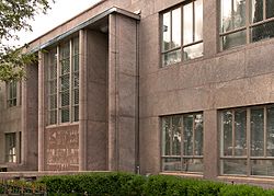
The Burnet County Courthouse in Burnet
|
|

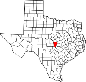
Location within the U.S. state of Texas
|
|
 Texas's location within the U.S. |
|
| Country | |
| State | |
| Founded | 1854 |
| Named for | David Gouverneur Burnet |
| Seat | Burnet |
| Largest city | Marble Falls |
| Area | |
| • Total | 1,021 sq mi (2,640 km2) |
| • Land | 994 sq mi (2,570 km2) |
| • Water | 27 sq mi (70 km2) 2.6% |
| Population
(2020)
|
|
| • Total | 49,130 |
| • Density | 48.119/sq mi (18.579/km2) |
| Time zone | UTC−6 (Central) |
| • Summer (DST) | UTC−5 (CDT) |
| Congressional district | 31st |

Burnet County (pronounced BUR-nit) is a county in the state of Texas, USA. It is located on the Edwards Plateau. In 2020, about 49,130 people lived here.
The main town, or county seat, is Burnet. The county was started in 1852 and officially organized in 1854. It is named after David Gouverneur Burnet. He was the first president of the Republic of Texas.
Contents
History of Burnet County
Early People and Settlers
Long ago, Native American groups lived in this area. They were here as early as 4500 BC. Later, tribes like the Tonkawa, Lipan Apache, and Comanche lived here.
In the 1820s and 1830s, explorers like Stephen F. Austin came to survey the land. The first settlers arrived in 1848. In 1849, the United States built Fort Croghan to help protect the settlers.
In 1851, about 20 Mormon families started a colony. They settled at Hamilton Creek. This place later became known as Morman Mill.
Forming the County
In 1852, the Texas government created Burnet County. It was formed from parts of Bell, Travis, and Williamson Counties. The first post office opened in Hamilton in 1853.
Changes Over Time
By 1860, some people in Burnet County were enslaved. After the Civil War, many former slaves stayed in the county. They found work on farms and ranches. Some moved to the Marble Falls area for jobs in town.
Between 1882 and 1903, railroad tracks were built. They connected Burnet, Granite Mountain, Marble Falls, and Lampasas. This helped towns like Lake Victor and Bertram grow as shipping centers.
During the Great Depression, many farmers faced hard times. But government projects helped create jobs. The Lower Colorado River Authority hired many people. They worked on building the Hamilton (Buchanan) Dam and Roy B. Inks Dam.
Geography of Burnet County
Land and Water
Burnet County covers about 1,021 square miles. About 27 square miles of this area is covered by water. This means about 2.6% of the county is water.
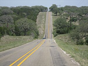
Main Roads
Neighboring Counties
Burnet County shares borders with several other counties:
- Lampasas County (north)
- Bell County (northeast)
- Williamson County (east)
- Travis County (southeast)
- Blanco County (south)
- Llano County (west)
- San Saba County (northwest)
Protected Areas
Part of the Balcones Canyonlands National Wildlife Refuge is located in Burnet County. This area helps protect wildlife.
Population and People
| Historical population | |||
|---|---|---|---|
| Census | Pop. | %± | |
| 1860 | 2,487 | — | |
| 1870 | 3,688 | 48.3% | |
| 1880 | 6,855 | 85.9% | |
| 1890 | 10,747 | 56.8% | |
| 1900 | 10,528 | −2.0% | |
| 1910 | 10,755 | 2.2% | |
| 1920 | 9,499 | −11.7% | |
| 1930 | 10,355 | 9.0% | |
| 1940 | 10,771 | 4.0% | |
| 1950 | 10,356 | −3.9% | |
| 1960 | 9,265 | −10.5% | |
| 1970 | 11,420 | 23.3% | |
| 1980 | 17,803 | 55.9% | |
| 1990 | 22,677 | 27.4% | |
| 2000 | 34,147 | 50.6% | |
| 2010 | 42,750 | 25.2% | |
| 2020 | 49,130 | 14.9% | |
| U.S. Decennial Census 1850–2010 2010 2020 |
|||
In 2020, the population of Burnet County was 49,130 people. There were 16,743 households.
| Race / ethnicity (NH = Non-Hispanic) | Pop 2000 | Pop. 2010 | Pop. 2020 | % 2000 | % 2010 | % 2020 |
|---|---|---|---|---|---|---|
| White alone (NH) | 28,017 | 32,530 | 34,810 | 82.05% | 76.09% | 70.85% |
| Black or African American alone (NH) | 500 | 700 | 579 | 1.46% | 1.64% | 1.18% |
| Native American or Alaska Native alone (NH) | 155 | 169 | 183 | 0.45% | 0.40% | 0.37% |
| Asian alone (NH) | 89 | 198 | 424 | 0.26% | 0.46% | 0.86% |
| Pacific Islander alone (NH) | 13 | 13 | 14 | 0.04% | 0.03% | 0.03% |
| Other race alone (NH) | 15 | 44 | 147 | 0.04% | 0.10% | 0.30% |
| Mixed race or multiracial (NH) | 314 | 444 | 1,774 | 0.92% | 1.04% | 3.61% |
| Hispanic or Latino (any race) | 5,044 | 8,652 | 11,199 | 14.77% | 20.24% | 22.79% |
| Total | 34,147 | 42,750 | 49,130 | 100.00% | 100.00% | 100.00% |
Communities in Burnet County
Cities
- Bertram
- Burnet (the county seat)
- Cottonwood Shores
- Double Horn
- Granite Shoals
- Highland Haven
- Horseshoe Bay (mostly in Llano County)
- Marble Falls
- Meadowlakes
Unincorporated Communities
These are smaller towns and areas not officially part of a city.
- Fairland
- Joppa
- Lake Victor
- Mahomet
- Naruna
- Oakalla
- Oatmeal
- Sherwood Shores
- Shovel Mountain
- Silver Creek Village
- Smithwick
- Spicewood
- Watson
Notable People from Burnet County
- Adam R. "Stovepipe" Johnson: A Confederate general. He founded Marble Falls in 1887, even though he was blinded during the war.
- Gerald Lyda (1923–2005): A general contractor and cattle rancher. He was born and grew up in Burnet County.
- Stephen McGee (born 1985): A former American football quarterback. He played college football for Texas A&M and later for the Dallas Cowboys.
- James Oakley: A former County Commissioner and current County Judge.
- Logan Vandeveer: An early Texas soldier and leader. He helped get Burnet County established and the town of Burnet named the county seat.
- Al Witcher (born 1936): An American football player.
See also
 In Spanish: Condado de Burnet para niños
 | Delilah Pierce |
 | Gordon Parks |
 | Augusta Savage |
 | Charles Ethan Porter |


