Mid Clare Way facts for kids
Quick facts for kids Mid Clare Way |
|
|---|---|

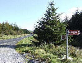
Trail crossing R462 road
|
|
| Length | 148 km (92 mi) |
| Location | County Clare, Ireland |
| Designation | National Waymarked Trail |
| Trailheads | Newmarket-on-Fergus |
| Use | Hiking |
| Elevation gain/loss | +1,620 m (5,315 ft) |
| Difficulty | Moderate |
| Season | Any |
The Mid Clare Way is a cool long-distance walking path in County Clare, Ireland. It's like a big loop, 148 kilometers (about 92 miles) long, that starts and ends in a town called Newmarket-on-Fergus. Most people take about six days to walk the whole thing.
This trail is officially known as a National Waymarked Trail. This means it's a special path recognized by the National Trails Office in Ireland. It's looked after by local groups who help keep it in good shape. The Mid Clare Way took six years to create and was officially opened on May 31, 1999. A government official, Síle de Valera, helped open it.
Contents
What is the Mid Clare Way?
The Mid Clare Way is a circular route designed for hikers. It lets you explore the beautiful countryside around the town of Ennis. As you walk, you'll pass through several charming villages. These include Quin, Spancil Hill, Doon, Ruan, Connolly, Lissycasey, and Clarecastle.
Connecting with Other Trails
This trail also connects with another famous path called the East Clare Way. They meet up in a place known as the townland of Gortnamearacaun. This connection means you could potentially walk even further if you wanted to explore more of County Clare's amazing trails!
Exploring the Mid Clare Way's Journey
The Mid Clare Way offers a unique way to see the heart of County Clare. It takes you through different landscapes, from quiet country roads to scenic paths. While a lot of the trail is on roads, it still gives you a great chance to experience the local area.
How Long Does it Take to Hike?
Most hikers complete the entire 148-kilometer loop in about six days. This allows for a good pace, giving you time to enjoy the scenery and visit the villages along the way. It's a moderate difficulty trail, meaning it's suitable for most people who enjoy walking.
 | Selma Burke |
 | Pauline Powell Burns |
 | Frederick J. Brown |
 | Robert Blackburn |

