
County Clare facts for kids
Quick facts for kids
County Clare
Contae an Chláir
|
||
|---|---|---|
|
||
| Nickname(s):
The Banner County
|
||
| Motto(s):
Irish: Dílis d'ár nOidreacht
"True to our heritage" |
||
 |
||
| Country | Ireland | |
| Province | Munster | |
| Region | Southern | |
| Established | 1565 | |
| County town | Ennis | |
| Area | ||
| • Total | 3,450 km2 (1,330 sq mi) | |
| Area rank | 7th | |
| Highest elevation
(Moylussa)
|
532 m (1,745 ft) | |
| Population
(2022)
|
127,938 | |
| • Rank | 19th | |
| Time zone | UTC±0 (WET) | |
| • Summer (DST) | UTC+1 (IST) | |
| Eircode routing keys |
H62, H91, V14, V15, V94, V95
|
|
| Telephone area codes | 061, 065 (primarily) | |

County Clare (Irish: Contae an Chláir) is a county in the Munster province of Ireland. It is located in the southern part of the country. The Atlantic Ocean borders County Clare to the west. Clare County Council is the local government here. In 2022, about 127,938 people lived in the county. The main town and largest settlement is Ennis.
Contents
Exploring County Clare's Geography
Clare is located north-west of the River Shannon. It covers an area of about 3,450 square kilometers. This makes Clare the seventh largest of Ireland's 32 traditional counties. It is the 19th largest in terms of how many people live there. County Clare shares borders with three other counties. To the south is County Limerick, to the east is County Tipperary, and to the north is County Galway. Clare is often called the Banner County.
Towns and Villages in Clare
County Clare has many towns and villages. Some of the well-known ones include:
- Ardnacrusha
- Ballynacally
- Ballyvaughan
- Barefield
- Boston
- Bridgetown
- Broadford
- Bunratty
- Carrigaholt
- Carron
- Clarecastle
- Clonlara
- Connolly
- Coolmeen
- Cooraclare
- Corofin
- Cranny
- Cratloe
- Cree (Creegh)
- Cross
- Crusheen
- Doolin
- Doonaha
- Doonbeg
- Ennis
- Ennistymon
- Fanore
- Feakle
- Inagh
- Inch
- Kilbaha
- Kilfenora
- Kilkee
- Kilkishen
- Kildysart
- Killaloe
- Killimer
- Kilmaley
- Kilmihil
- Kilmurry McMahon
- Kilnaboy
- Kilnamona
- Kilrush
- Labasheeda
- Lahinch
- Liscannor
- Lisdoonvarna
- Lissycasey
- Meelick
- Milltown Malbay
- Mountshannon
- Mullagh
- Newmarket-on-Fergus
- O'Brien's Bridge
- O'Callaghan's Mills
- Ogonnelloe
- Parteen
- Quilty
- Quin
- Ruan
- Scariff
- Shannon
- Sixmilebridge
- Toonagh
- Tuamgraney
- Tubber
- Tulla
- Whitegate
Natural Wonders of Clare
.jpg)
Many natural water bodies form Clare's borders. The River Shannon, Ireland's longest river, is to the south-east. The Shannon Estuary is to the south. Lough Derg, Ireland's third-largest lake, defines the north-east border. To the west is the vast Atlantic Ocean. Galway Bay is to the north. Loop Head is the westernmost point of land in the county.
County Clare is home to The Burren. This is a special karst area with rare plants and animals. The famous Cliffs of Moher are on the western edge of The Burren. They face the Atlantic Ocean. The highest point in County Clare is Moylussa, which is 532 meters tall. It is found in the Slieve Bernagh mountains.
Several islands are located off the coast of County Clare:
A Look at Clare's History

County Clare has the oldest proof of humans living in Ireland. A bear bone was found in the Alice and Gwendoline Cave. It had cut marks and dates back to about 10,500 BC. This discovery in 2017 showed that people were in Ireland much earlier than thought.
Later, during the Neolithic period, people built ancient dolmens. These are single-chamber tombs made of large upright stones. Clare has many of these tombs. The most famous is Poulnabrone dolmen in The Burren. It means "hole of sorrows." Bones found inside this tomb are from about 3800 BC.
Around 100 AD, a map of Ireland was made by Ptolemy. It showed a tribe called the Gangani living in the Clare area.

In the early Middle Ages, this area was part of the Kingdom of Connacht. Later, it became part of the Kingdom of Munster. It was then called Thomond, meaning North Munster. Brian Boru, a famous High King of Ireland, came from this area.
The name "Clare" might come from Thomas de Clare. He was involved in local conflicts in the 1200s. Another idea is that it comes from the town of Clare (now Clarecastle). Its Irish name, Clár, means "plank bridge." This refers to a bridge over the River Fergus.
How County Clare Got Its Name
Clare is known as the Banner County. There are a few ideas why. One is about the banners captured by Clare's Dragoons in a battle long ago. Another idea is linked to Daniel O'Connell. He won an election in 1828, which helped lead to more rights for Catholics. This event was seen as raising a "banner" for change.
People and Culture
The population of Clare was 127,419 in 2022. The main towns are Ennis (27,923 people) and Shannon (10,256 people).
Clare has a young population. About 22% are under 14 years old. Most people in Clare are Irish people. Many people around the world have family roots in Clare. They often visit to learn about their ancestors.
Most family names in Clare come from the ancient Dalcassian people. Common names include O'Brien, McMahon, and McNamara.
Religion in Clare

Most people in Clare are Christian. About 92% identified as Christian in the 2006 census. Clare has many old abbeys and priories. Some, like those on Scattery Island, date back to the sixth century. This was when Christianity first came to Ireland. Saint Senan, one of the Twelve Apostles of Ireland, was born near Kilrush.
Many other saints came from Clare, like Saint Flannan and Saint Molua. Today, the Catholic Church is the largest religion. About 88% of people in Clare are Catholic.

Most of Clare is part of the Catholic Diocese of Killaloe. The main church for this area is the St Peter and Paul Cathedral in Ennis. Some parts of north-western Clare belong to the Diocese of Galway, Kilmacduagh and Kilfenora.
The Church of Ireland is the largest religious minority. It has almost 2,000 members in Clare. The county is part of the Diocese of Limerick and Killaloe.
Fun Places to Visit
Here are some popular places to visit in County Clare:
- Cliffs of Moher
- Doolin
- Inis Cealtra (Holy Island) in Lough Derg
- Kilbaha
- Kilkee
- Loop Head
- Scattery Island
- Spanish Point
- The Burren
- Bunratty Castle
Irish Language in Clare
West Clare used to be part of the Gaeltacht. This is an area where the Irish language is spoken. In 1926, areas like Kilmihil, Kilrush, and Doolin were recognized for their Irish speakers. However, by 1956, fewer people spoke Irish. So, West Clare was removed from the official list.
The last native Irish speaker from Clare, Paddy Pháraic Mhíchíl Ó Sionáin, died in the early 1990s. Today, groups are working to bring the Irish language back to West Clare. They offer classes to help people learn and use the language again.
Music and Arts
County Clare has a rich history of traditional Irish music. It is home to famous groups like the Kilfenora Céilí Band and the Tulla Céilí Band. Many well-known musicians are from Clare, including Sharon Shannon and Martin Hayes.
Ennis is the birthplace of singer Maura O'Connell. The county also hosts many traditional music festivals. One of the most famous is the Willie Clancy Summer School. It happens every July in Milltown Malbay. This festival honors the great uilleann piper, Willie Clancy.
Musician Andy Irvine has written songs about County Clare. In "West Coast of Clare," he mentions Spanish Point and Milltown Malbay. In "My Heart's Tonight in Ireland," he talks about many towns and the music of Willie Clancy.
Milltown Malbay is also home to Oidhreacht an Chlair. This is a place where people can study Irish traditions, history, and literature.
Sports in Clare
The Clare hurling team has been very successful. They have won the Liam MacCarthy Cup in 1914, 1995, 1997, 2013, and 2024. They were also finalists in 2002. In football, Clare won the Munster Final in 1992.
The Gaelic Athletic Association (GAA) is very popular in County Clare. Michael Cusack, who founded the GAA, was born in Carron. Famous Irish rugby players from Clare include Keith Wood and Anthony Foley.
Getting Around Clare


Clare has major roads that connect it to other cities. The N18 links Limerick to Galway, passing through Ennis and near Shannon. Other important roads include the N67 along the coast and the N68 from Kilrush to Ennis.
Most public transport is by Bus Éireann buses. They run frequent routes through many towns in Clare. The Ennis railway station is the main train station. Trains from Ennis can take you to Dublin in about 3 hours. There used to be a larger railway network, the West Clare Railway, but most of it was removed.
Shannon Airport is in Clare. It is the third-busiest airport in Ireland. It handles flights to Great Britain, Europe, and the United States. Shannon was the first airport in Ireland to receive transatlantic flights. Ryanair and Aer Lingus are major airlines here.
There are also local ferry services. You can take a ferry from Killimer to Tarbert Island in Kerry. Another ferry goes from Doolin to the Aran Islands.
Famous People from Clare
- Gerald Barry, a composer
- Pat Breen, a politician
- Joe Carey, a politician
- Tony Killeen, a politician
- Timmy Dooley, a politician
- Síle De Valera, a politician
- Shane O'Donnell, a hurler
- Naomi Carroll, a camogie player
- Edna O'Brien, a writer
- Brendan O'Regan, a businessman
- Des Lynam, a sports broadcaster
Images for kids
-
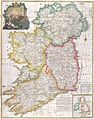
1794 map of Ireland, showing County Clare

See also
 In Spanish: Condado de Clare (Irlanda) para niños
