River Shannon facts for kids
Quick facts for kids River Shannon |
|
|---|---|
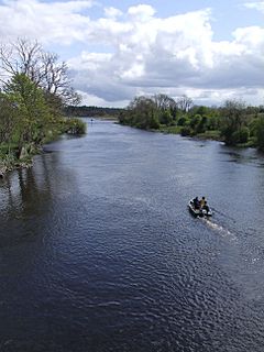
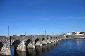
River Shannon from Drumsna bridge, County Leitrim
|
|
| Country | Ireland |
| Counties | Cavan, Leitrim, Longford, Roscommon, Westmeath, Offaly, Tipperary, Galway, Clare, Limerick, Kerry |
| Physical characteristics | |
| Main source | Shannon Pot Glangevlin, Cuilcagh Mountain, County Cavan 100 m 54°14′06″N 7°55′12″W / 54.235°N 7.92°W |
| River mouth | Shannon Estuary Limerick 52°39′25″N 8°39′36″W / 52.657°N 8.66°W |
| Length | 360.5 kilometres (224.0 mi) |
The River Shannon (called Abhainn na Sionainne in Irish) is the longest river in the British Isles. It is about 360.5 km (224 miles) long. The river drains a huge area of land called the Shannon River Basin. This basin covers about 16,865 km2 (6,512 sq mi), which is one-fifth of the entire island of Ireland.
The Shannon acts like a natural border. It separates the west of Ireland (mostly the Connacht province) from the east and south (like Leinster and most of Munster). County Clare is a special case. It is west of the river but is part of Munster. The river is a big obstacle to travel. There are fewer than 35 places to cross it between Limerick city in the south and Dowra village in the north.
The river gets its name from an old Celtic goddess named Sionna. People have known the Shannon as an important waterway for a very long time. It first appeared on maps made by the ancient geographer Ptolemy around 100-170 AD. The river generally flows south from the Shannon Pot in County Cavan. Then it turns west and flows into the Atlantic Ocean through the 102.1 km (63.4 mi) long Shannon Estuary. Limerick city is where the river's fresh water meets the sea water of the estuary. The Shannon has tides as far east as the Ardnacrusha dam.
Contents
Geography of the River Shannon
By tradition, the Shannon starts at the Shannon Pot. This is a small pool in Derrylahan on the side of Cuilcagh Mountain in County Cavan. From here, the young river looks like a small stream where trout live. Experts have found that the area feeding the Shannon Pot is about 12.8 km2 (4.9 sq mi). This area includes Garvah Lough and other underground water sources.
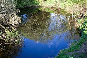
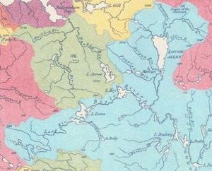
From the Shannon Pot, other smaller rivers join the Shannon. It then fills Lough Allen at its start. The river flows through or along the edges of 11 of Ireland's counties. Many rivers flow into it, such as the Boyle, Inny, Suck, Mulkear, and Brosna. Finally, it reaches the Shannon Estuary near Limerick.
The exact length of the Shannon has been measured differently over time. An official Irish source says it is 360.5 km (224.0 mi) long. This includes 258.1 km [160.4 mi] of fresh water and 102.1 km [63.4 mi] of tidal water. Some guides say it is 344 km (214 mi). The reason for different numbers is that it's hard to say where a river officially ends when it flows into a wide estuary.
The Shannon is the longest river in Ireland. People knew this even in the 12th century. The river is also Ireland's largest river by the amount of water it carries. It has an average flow rate of 208.1 m3/s (7,350 cu ft/s) near Limerick. This is twice as much as Ireland's second-largest river, the River Corrib. If you add the water from all the rivers flowing into the Shannon Estuary, the total flow at its mouth can reach 300 m3/s (11,000 cu ft/s).
The Shannon Callows are low-lying areas along the river. They are protected as a special natural area.
Many towns and villages are located along the river. Some of these include Limerick, Killaloe, Athlone, Carrick-on-Shannon, and Dowra.
History of the Shannon
The River Shannon started flowing in its current path after the last ice age ended.
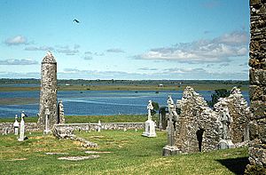
In the 10th century, Vikings settled near the river. They used the Shannon to travel inland and raid rich monasteries. In 937, Vikings from Limerick fought Vikings from Dublin on Lough Ree. The Dublin Vikings won that battle.
During the 17th century, the Shannon was very important in wars in Ireland. It formed a natural barrier between the east and west of the country. In the Irish Confederate Wars (1641–53), the Irish forces retreated behind the Shannon in 1650. They managed to hold out for two more years against the English Parliament's army. After his victory, Oliver Cromwell planned to move Irish landowners west of the Shannon. He famously said they would go to "Hell or Connacht." This meant they had to move across the river or face death. This freed up land in the east for English settlers.
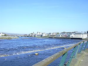
Later, in the Williamite War in Ireland (1689–91), the Jacobite forces also retreated behind the Shannon. This happened after they lost the Battle of the Boyne in 1690. Cities like Athlone and Limerick, which had bridges over the river, saw fierce battles and sieges.
Even in 1916, leaders of the Easter Rising planned to use the Shannon as a defensive line. However, their forces in the west were not strong enough to carry out this plan.
Folklore and Legends
According to Irish mythology, the river is named after a woman called Sionann. She was the granddaughter of Lir. Sionann went to Connla's Well to find wisdom, even though she was told not to. Some stories say she ate the Salmon of Knowledge there, becoming the wisest person on Earth. But then, the well overflowed, drowning Sionann and carrying her out to sea. People believe Sionann was the goddess of the river. This story shows how her divine power flowed into the water, giving life to the land.
The Shannon is also said to be home to a river monster named Cata. This monster first appeared in an old book called the Book of Lismore. It says that Saint Senán, a patron saint, defeated the monster at Inis Cathaigh. Cata is described as a huge monster with a horse's mane, glowing eyes, thick feet, iron nails, and a whale's tail. Another legend says that a monster called an Oilliphéist tried to escape Ireland when Saint Patrick arrived. As it fled, it carved out the path that became the River Shannon.
The Shannon has always been important for travel in Ireland. The river drops only 18 m (59 ft) over its first 250 km (160 mi). This means it has always been quite shallow in places, sometimes only 0.5 m (1 ft 8 in) deep.
Over the centuries, many efforts were made to improve navigation. In the 1700s, canals and locks were built to help boats pass difficult sections. For example, the first Jamestown Canal was built to cut out a bend in the river. The lower part of the Shannon, between Killaloe and Limerick, was harder to improve because the river drops 30 m (98 ft) in just 20 km (12 mi). It took many years and a lot of money to build a canal with six locks there.
By the 1820s, steamers started using the river. They carried many passengers and goods, which made trade grow a lot. However, by the mid-1800s, railways started to become popular. This caused the number of passengers and freight carried on the river to drop sharply.
In the 1920s, the new Irish Free State built the Shannon hydroelectric scheme. This project created the Ardnacrusha power station on the lower Shannon. A new canal was built for navigation, and a special double lock was added at the dam.
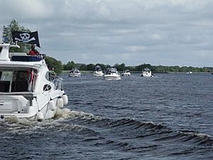
In recent times, the use of the Shannon for leisure activities has grown. People enjoy boating and other water sports. This has helped keep the river's bridges high enough for boats to pass.
Canals Connected to the Shannon
Many canals connect to the River Shannon. The Royal Canal and the Grand Canal link the Shannon to Dublin and the Irish Sea. The Shannon–Erne Waterway connects it to the River Erne and Lough Erne. Other towns like Ballinasloe and Boyle are also connected to the Shannon by canals and rivers.
Economy and the Shannon
Even though the Shannon is 360.5 km (224.0 mi) long, it only rises 76 m (249 ft) above sea level. This makes it easy to navigate, with only a few locks. The ESB has a hydroelectric power plant at Ardnacrusha that uses the river's water to make electricity.
In the 1980s, shipping in the Shannon estuary grew a lot. Over €2.5 billion was invested. A tanker terminal was built at Foynes, and an oil jetty was built at Shannon Airport. A large plant for extracting alumina was built at Aughinish. Big cargo ships bring raw materials from Africa to this plant. The refined alumina is then sent to Canada to be made into aluminum. A large coal-fired power plant was also opened at Moneypoint, which receives coal from huge ships.
Shannon Eel Management
There is a special program to help eels on the Shannon. It's called a "trap and transport" scheme. This program makes sure young eels can safely travel between Lough Derg and the Shannon estuary. This helps the eel population, which has been getting smaller.
Fishing on the Shannon
In the past, the Shannon estuary fishing industry was very big. It provided jobs for hundreds of people. In Limerick, fishermen used special boats called Gandelows to catch Salmon. However, in 1929, a dam was built at Ardnacrusha. This greatly affected salmon breeding. By the 1950s, salmon fishing had mostly stopped due to this and new fishing rules. Still, people enjoy recreational fishing on the river today.
Water for Dublin
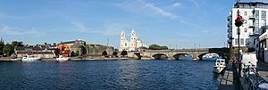
In 2011, Dublin City Council proposed a plan to supply water from Lough Derg to Dublin. The idea is to pump up to 350 million liters of water a day. In 2016, the Parteen Basin was chosen as the best place to take the water. The water would be pumped to a tank in County Tipperary and then flow by pipeline to Dublin.
|
See also
 In Spanish: Río Shannon para niños
 | Shirley Ann Jackson |
 | Garett Morgan |
 | J. Ernest Wilkins Jr. |
 | Elijah McCoy |


