County Longford facts for kids
Quick facts for kids
County Longford
Contae an Longfoirt
|
||
|---|---|---|
|
||
| Motto(s): | ||
 |
||
| Country | Ireland | |
| Province | Leinster | |
| Region | Eastern and Midland | |
| Established | 1570 | |
| County town | Longford | |
| Area | ||
| • Total | 1,091 km2 (421 sq mi) | |
| Area rank | 29th | |
| Highest elevation | 278 m (912 ft) | |
| Population
(2022)
|
||
| • Total | 46,634 | |
| • Rank | 31st | |
| • Density | 42.744/km2 (110.71/sq mi) | |
| Time zone | UTC±0 (WET) | |
| • Summer (DST) | UTC+1 (IST) | |
| Eircode routing keys |
N39 (primarily)
|
|
| Telephone area codes | 043 (primarily) | |
| Vehicle index mark code |
LD | |
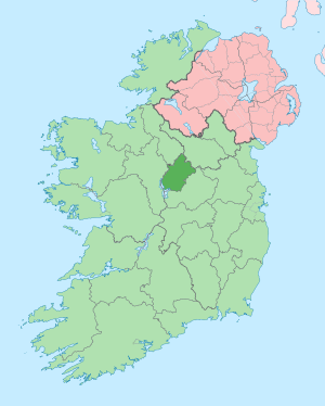
County Longford (Irish: Contae an Longfoirt) is a county in Ireland. It is located in the Leinster province. The county gets its name from the town of Longford.
Longford County Council is the local government for the area. In 2022, about 46,634 people lived here. The county is based on an old Irish territory called Annaly.
Contents
Exploring County Longford's Geography
Most of County Longford is in the area around the River Shannon. Lough Ree forms a big part of the county's western border. The northern part of the county sends its water towards the River Erne and Lough Gowna.
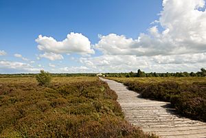
Longford's landscape is mostly low and flat. It has many lakes, bogs, and green fields. The highest point is Carn Clonhugh, also known as Cairn Hill. It is 278 meters high and is located in the north-west. A television transmitter on Cairn Hill broadcasts to much of central Ireland.
Longford is the third lowest county in Ireland by its highest point. Only Meath and Westmeath have lower high points. The northern part of the county is hilly. It is part of a "drumlin belt" that stretches across central Ireland. Drumlins are small, oval-shaped hills formed by glaciers.
The southern parts of the county are flat. They have large areas of raised bogland. The land here is good for grazing animals and growing crops. The River Shannon forms the border with Roscommon. The Rivers Inny and Tang create much of the border with Westmeath.
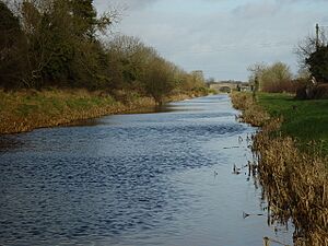
The Royal Canal goes through the south of the county. It ends at Cloondara, where it meets the Shannon. This canal was fixed up and reopened in 2010. Important lakes in Longford include Lough Kinale and Lough Gowna near the County Cavan border. There is also Lough Forbes on the Roscommon border. Lough Ree in the south is where Longford, Westmeath, and Roscommon meet.
County Longford's Subdivisions
County Longford is divided into six historical areas called baronies:
- Ardagh
- Granard
- Longford
- Moydow
- Rathcline
- Shrule or Abbeyshrule
Towns and Villages in Longford
- Abbeylara
- Abbeyshrule
- Ardagh
- Aughnacliffe
- Ballinamuck
- Ballymahon
- Ballinalee
- Cloondara
- Colehill
- Drumlish
- Edgeworthstown
- Granard
- Kenagh
- Killashee
- Killoe
- Lanesborough
- Legan
- Lisryan
- Longford
- Moydow
- Mullinalaghta
- Newtowncashel
- Newtownforbes
- Taghshinny
Longford Town is the biggest town in the county. It has a population of 10,008 people. Other large towns include Edgeworthstown (2,072 people), Ballymahon (1,877 people), Lanesborough (1,454 people), and Granard (816 people).
Smallest official land divisions in Ireland are called townlands. County Longford has 944 townlands.
A Look at Longford's History

The area that is now County Longford was once part of the Kingdom of Meath. From the 5th to the 12th centuries, it was known as the kingdom of Tethbae. Different local groups, like the Cairpre Gabra, ruled here.
Around the year 1070, new tribes took over Tethbae. These included the Ó Cuinns and Ó Fearghails. The area then became known as "Muintir Annaly". County Longford was also sometimes called Upper Conmaicne. This was to tell it apart from south Leitrim, which was Lower Conmaicne. Both areas were ruled by descendants of Conmac.
After the Norman invasion in the 12th century, Annaly was given to Hugh de Lacy, Lord of Meath. An English settlement was started in Granard. Monasteries were built by different religious groups. These include Cistercian monasteries at Abbeylara and Abbeyshrule. Augustinian monasteries were at Abbeyderg and Saints' Island.
You can still see old church ruins today. These are at Ardagh, Abbeylara, Abbeyderg, Abbeyshrule, and on islands in Lough Ree and Lough Gowna. These ruins show the county's long Christian past.
By the 14th century, English power in Ireland was getting weaker. Granard was attacked in 1315. The O'Farrells soon took back full control of the area. Annaly later became Longphoirt, which is now Longford. This name came from the O'Farrell's fortress.
County Longford was officially created in 1586. This happened during the time of Queen Elizabeth I. It was formed from the northern part of Westmeath. But England did not fully control it until after the Nine Years' War.
In 1608, King James I added County Longford to Leinster. Before this, it was considered part of Connacht. The county was divided into six baronies, and its borders were officially set. In 1620, English and Scottish landowners settled the county. Much of the O'Farrell lands were taken and given to new owners. This change was completed in the 1650s during the Cromwellian plantations.
The county was important during the Irish Rebellion of 1798. A French army, led by General Humbert, landed in Ireland. They were defeated near the village of Ballinamuck on September 8th by a British army. The British army was led by General Cornwallis. After the battle, the British punished the local people of the county.
A spirit of rebellion returned during the Irish War of Independence. The North Longford flying column, led by Seán Mac Eoin, was very active. They were one of the most important Irish groups during that war.
Learning in Longford
County Longford has many schools for students. These include national schools (primary schools) and secondary schools. Some of the secondary schools are Moyne Community School, St. Mels, and the Convent schools in Longford, Granard, Ballymahon, and Lanesborough.
Population and Economy
| Historical population | ||
|---|---|---|
| Year | Pop. | ±% |
| 1500 | 3,021 | — |
| 1510 | 2,054 | −32.0% |
| 1550 | 2,307 | +12.3% |
| 1580 | 2,089 | −9.4% |
| 1585 | 2,212 | +5.9% |
| 1600 | 2,054 | −7.1% |
| 1610 | 4,534 | +120.7% |
| 1653 | 5,150 | +13.6% |
| 1659 | 5,392 | +4.7% |
| 1672 | 10,784 | +100.0% |
| 1680 | 21,568 | +100.0% |
| 1690 | 33,136 | +53.6% |
| 1700 | 35,770 | +7.9% |
| 1710 | 33,105 | −7.5% |
| 1725 | 36,272 | +9.6% |
| 1735 | 37,668 | +3.8% |
| 1745 | 42,544 | +12.9% |
| 1755 | 41,335 | −2.8% |
| 1765 | 39,888 | −3.5% |
| 1771 | 38,771 | −2.8% |
| 1775 | 49,557 | +27.8% |
| 1781 | 55,088 | +11.2% |
| 1788 | 70,176 | +27.4% |
| 1790 | 75,352 | +7.4% |
| 1801 | 80,584 | +6.9% |
| 1811 | 94,168 | +16.9% |
| 1813 | 88,336 | −6.2% |
| 1816 | 80,205 | −9.2% |
| 1821 | 107,570 | +34.1% |
| 1831 | 112,558 | +4.6% |
| 1841 | 115,491 | +2.6% |
| 1851 | 82,348 | −28.7% |
| 1861 | 71,694 | −12.9% |
| 1871 | 64,501 | −10.0% |
| 1881 | 61,009 | −5.4% |
| 1891 | 52,647 | −13.7% |
| 1901 | 46,672 | −11.3% |
| 1911 | 43,820 | −6.1% |
| 1926 | 39,847 | −9.1% |
| 1936 | 37,847 | −5.0% |
| 1946 | 36,218 | −4.3% |
| 1951 | 34,553 | −4.6% |
| 1956 | 32,969 | −4.6% |
| 1961 | 30,643 | −7.1% |
| 1966 | 28,989 | −5.4% |
| 1971 | 28,250 | −2.5% |
| 1979 | 30,785 | +9.0% |
| 1981 | 31,140 | +1.2% |
| 1986 | 31,496 | +1.1% |
| 1991 | 30,296 | −3.8% |
| 1996 | 30,166 | −0.4% |
| 2002 | 31,068 | +3.0% |
| 2006 | 34,391 | +10.7% |
| 2011 | 38,970 | +13.3% |
| 2016 | 40,873 | +4.9% |
| 2022 | 46,634 | +14.1% |
County Longford covers an area of 1,091 square kilometers. With 46,634 people, it is the fourth smallest of Ireland's 32 counties by size. It is the second smallest in terms of population.
Longford borders Cavan to the northeast and Westmeath to the southeast. It also borders Roscommon to the southwest and Leitrim to the northwest.
The population of Longford grew by 10.6% between 2002 and 2006. This was faster than the average growth for Ireland (8.2%).
Farming is a very important part of life and the economy in County Longford. About 67.6% of the county's land is used for farming. There are also around 126,904 cattle in the county.
Famous People from Longford
- Willie Browne (1936–2004), an international football player for the Republic of Ireland.
- Padraic Colum (1881–1972), a well-known writer.
- Francis Ysidro Edgeworth (1845–1926), a philosopher, economist, and mathematician.
- Maria Edgeworth (1768–1849), a famous writer who lived at Edgeworthstown House.
- Albert Reynolds (1932–2014), a politician who used to be the Taoiseach (Prime Minister) of Ireland.
See also
 In Spanish: Condado de Longford para niños
 | Delilah Pierce |
 | Gordon Parks |
 | Augusta Savage |
 | Charles Ethan Porter |


