
Royal Canal facts for kids
The Royal Canal (Irish: An Chanáil Ríoga) is a long waterway in Ireland. It was first built to carry goods and people from Dublin to Longford. It's one of two canals that connect Dublin to the River Shannon. The Royal Canal was built to compete with the Grand Canal.
For many years, the canal was not used much and fell apart. But a lot of it has been fixed up! The main part of the canal, all the way to the River Shannon, was reopened on October 1, 2010. A small part that goes to Longford Town is still closed.
Quick facts for kids Royal CanalAn Chanáil Ríoga |
|
|---|---|

Royal Canal from D'Arcy's bridge, Co. Westmeath
|
|
| Specifications | |
| Length | 145 km (90 miles) |
| Maximum boat beam | 13 ft 3 in (4.04 m) (originally 13 ft 3 in or 4.04 m) (narrowest lock No.17) |
| Locks | 46 |
| Status | Open |
| Navigation authority | Waterways Ireland |
| History | |
| Construction began | 1790 |
| Date completed | 1817 |
| Date closed | 1961 |
| Date restored | 2010 |
| Geography | |
| Start point | Spencer Dock, Dublin (originally Broadstone) (Broadstone filled in) |
| End point | Cloondara (Cloondara connects to the River Shannon (at Termonbarry) via the River Camlin) |
| Branch(es) | Longford Town |
| Connects to | River Shannon |


Contents
History of the Royal Canal
Building the Canal

In 1755, two people named Thomas Williams and John Cooley looked for the best path for a canal. They wanted to connect Dublin to the Shannon River. They thought about using existing rivers and lakes.
But then, someone from the Grand Canal Company decided to build a new canal. This new canal would go from Dublin to Cloondara. This is in West County Longford.
Work on this huge project started in May 1790. It began at Cross Guns Bridge in Phibsborough, Dublin. It moved west towards Ashtown. A special plaque on Ranalagh Bridge remembers this start.
The canal finally reached the Shannon in 1817. This was 27 years after it began! Building the canal was very expensive. It cost over £1.4 million. The project had many problems. In 1794, the Royal Canal Company went broke.
A board member, the Duke of Leinster, wanted the canal to go through his town, Maynooth. This meant the builders had to change the plan. They had to dig a very deep section. This was between Blanchardstown and Clonsilla. This change also required building the Ryewater Aqueduct at Leixlip.
How the Canal Was Used
In 1796, a trip from Dublin to Kilcock cost 1 shilling and 1 penny. This was much cheaper than taking a stagecoach.
By the 1830s, the canal was very busy. It carried 80,000 tons of goods each year. It also carried 40,000 passengers.


In 1843, a famous mathematician named Sir William Rowan Hamilton was walking by the canal. He was with his wife. He suddenly figured out an important math idea called quaternions. He quickly carved his first thoughts onto a stone on the Broom Bridge. This bridge goes over the canal. Every year, people do a "Hamilton Walk" to remember this moment.
In 1845, the Midland Great Western Railway Company bought the canal. They thought about draining the canal. Then they could build a railway line in its place. But they decided to build the railway next to the canal instead. So, the railway and the canal run side by side. They go from Dublin all the way to Mullingar.
The Famine Walk
In May 1847, during the Great Famine, many people were struggling. Tenants from Major Denis Mahon's estate in County Roscommon had to leave their homes. They were known as the "Missing 1,490." They had a difficult choice. They could try to leave Ireland with help, stay and starve, or go to a workhouse.
Weak from hunger, these 1,490 people walked for many days. They followed the paths next to the Royal Canal to Dublin. From Dublin, they took boats to Liverpool. Then they traveled to Grosse Île in Quebec, Canada. These boats were cargo ships, not really meant for passengers. It's thought that many of them died before reaching Grosse Île. This was a very large group of people leaving at one time during the Famine. An annual walk along the canal remembers their journey.

Decline and Restoration
Over time, trains became more popular. This meant fewer people used the canal. By the 1880s, the amount of goods carried dropped a lot. Passenger travel almost stopped completely.
The canal was used more during World War II. Horses and barges returned to carry goods. In 1944, CIÉ took over the canal. But as cars and trucks became common, the canal was used less and less.
In 1974, volunteers formed the Royal Canal Amenity Group. They wanted to save the canal. By 1990, they had reopened 74 kilometers of the canal. This was from the 12th lock to Mullingar. In 2000, Waterways Ireland took over the canal. This group manages waterways in Ireland. On October 1, 2010, the entire canal was officially reopened.
Managing the Canal
Many groups have looked after the Royal Canal over the years. These include the Royal Canal Company and Waterways Ireland. Volunteers from the Royal Canal Amenity Group also helped a lot. They worked hard to fix and keep the canal open.
The Canal's Path
The Royal Canal goes through several towns. These include Maynooth, Kilcock, Enfield, Longwood, Mullingar, and Ballymahon. There is also a small branch that goes to Longford.
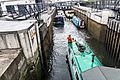
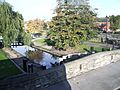
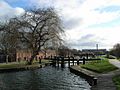
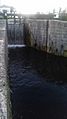
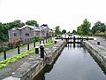
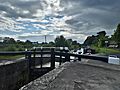
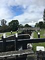
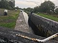
The main part of the canal is about 145 kilometers (90 miles) long. It has 46 locks. Locks are like water elevators that help boats move up or down hills. The canal gets its water from Lough Owel. This lake feeds water into the canal at Mullingar.
Connecting to Other Transport
The canal was first planned to end in Dublin at Broadstone. This area was very popular back then. But the canal was extended. Now, in Dublin, it connects to the River Liffey. It uses many docks and locks at Spencer Dock. A final lock controls access to the river and the sea.
The railway line from Dublin to Mullingar was built right next to the canal. The canal's winding path caused the railway to have many curves. This made trains go slower. The Midland Great Western Railway bought the canal. They wanted a route to the West of Ireland. Their first idea was to close the canal and build the railway on its bed.
The canal also crosses a major road junction. This is where the M50 meets the N3. It crosses over the roads using a special bridge called an aqueduct.
The Royal Canal Today
Today, Waterways Ireland is in charge of the canal. With help from the Royal Canal Amenity Group, the canal was fully reopened. This happened on October 2, 2010. It is now open from Dublin all the way to the Shannon River.
You can get onto the canal at several places. These include Leixlip, Maynooth, Enfield, Mullingar, and Ballynacargy. In 2006, a special marker was put up in Mullingar. It celebrated 200 years since the canal reached Mullingar in 1806.
Royal Canal Way and Greenway

The Royal Canal Way is a long walking path. It is about 144 kilometers (89 miles) long. It follows the path next to the canal. It goes from Ashtown, Dublin to Cloondara, County Longford. Most people walk it in about three days.
This path is part of Ireland's National Waymarked Trails. Waterways Ireland manages it. In 2015, Dublin City Council started extending the path. It will go from Ashtown to Sheriff Street Upper. The Royal Canal Way connects to the Westmeath Way. It will also be the start of the Dublin-Galway Greenway. This greenway is part of EuroVelo Route 2. This is a cycling path that goes from Moscow across Europe to Galway.
The Royal Canal Greenway is a special path for walking and cycling. It includes the Royal Canal Way between Maynooth and Cloondara. It also has a branch to Longford. It was officially opened in March 2021.
Canal Superstitions
Some old Royal Canal boatmen believed that the 13th lock was haunted. This lock is at Deey Bridge. It is between Leixlip and Maynooth. This spooky story inspired a poem by Arthur Griffith. It was called The Spooks of the Thirteenth Lock. This poem then gave a band its name, The Spook of the Thirteenth Lock.
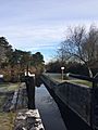
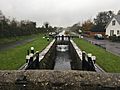
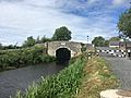
Images for kids
-
1st lock
-
2nd lock
-
4th lock
-
11th lock
-
12th lock
-
13th lock
-
22nd lock
-
44th lock
-
46th lock
-
Chambers bridge and lock
-
Digby bridge and lock
.jpg)


