
County Westmeath facts for kids
Quick facts for kids
County Westmeath
Contae na hIarmhí
|
||
|---|---|---|
|
||
| Nickname(s):
The Lake County
|
||
| Motto(s): | ||
 |
||
| Country | Ireland | |
| Province | Leinster | |
| Region | Eastern and Midland | |
| Established | 1542 | |
| County town | Mullingar | |
| Largest settlement | Athlone | |
| Area | ||
| • Total | 1,840 km2 (710 sq mi) | |
| Area rank | 21st | |
| Highest elevation | 258 m (846 ft) | |
| Population
(2022)
|
||
| • Total | 95,840 | |
| • Rank | 22nd | |
| • Density | 52.09/km2 (134.9/sq mi) | |
| Time zone | UTC±0 (WET) | |
| • Summer (DST) | UTC+1 (IST) | |
| Eircode routing keys |
N37, N91 (primarily)
|
|
| Telephone area codes | 044, 090 (primarily) | |
| ISO 3166 code | IE-WH | |
| Vehicle index mark code |
WH | |

County Westmeath (pronounced "west-MEED") is a county in Ireland. It's located in the Leinster province, which is in the eastern part of Ireland. The county is part of the Eastern and Midland Region.
Westmeath used to be part of a bigger area called the historic Kingdom of Meath. This kingdom was named Mide, meaning 'middle', because it was in the geographical centre of Ireland. Today, Westmeath County Council manages the county. The main town, also called the county town, is Mullingar. In 2022, about 95,840 people lived in County Westmeath.
Contents
History of Westmeath
After the Norman invasion of Ireland in 1172, a large area called the Lordship of Meath was created. This area was given to a powerful Norman lord named Hugh de Lacy.
Over time, this large lordship was divided. In 1543, the Irish Parliament decided to split it into two separate counties. The eastern part kept the name County Meath, and the western part became known as County Westmeath. This was done to help manage the area better.
Geography of Westmeath
Westmeath is the 20th largest county in Ireland by land area. It's also the 22nd largest in terms of how many people live there.
The Hill of Uisneach in Westmeath is sometimes thought of as the very centre of Ireland. However, the actual geographic centre is in the neighbouring county of Roscommon. The highest point in County Westmeath is the top of Mullaghmeen mountain. It's 258 metres high, making it the lowest "county top" in Ireland.
Economy and Jobs in Westmeath


In the past, towns like Mullingar, Moate, and Kinnegad grew because they were important market places. Athlone also grew because it was a military base and a key crossing point on the River Shannon for the main road between Dublin and Galway.
The Royal Canal helped Mullingar a lot by making it easier and cheaper to transport goods to Dublin, Britain, and Europe. Later, the arrival of the Midland Great Western Railway in the 1800s helped both Athlone and Mullingar grow even more.
Tourism and Water Activities
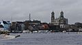
Tourism in Westmeath often focuses on its beautiful lakes. These include Lough Derravaragh, Lough Ennell, Lough Owel, Lough Lene, Lough Sheelin, and Lough Ree. The River Shannon, which is Ireland's most important waterway for tourism, has a modern harbour in Athlone.
Main Job Sectors
In 2017, the biggest job areas in Westmeath were:
| Sector | Percentage of total employment |
||
|---|---|---|---|
| Wholesale & retail trade | 15% | ||
| Health & social work | 13% | Education | 11% |
| Manufacturing industries | 9% | ||
| Agriculture | 8% | ||
| Real estate, renting & business activities | 7% | ||
| Hotels & restaurants | 7% |
Greenways for Cycling
Two big "Greenway" projects have been built to make cycling better. The section of the Dublin—Galway Greenway between Athlone and Mullingar opened in 2015. It follows an old railway line.
The Royal Canal Greenway takes visitors from the county border to Mullingar and then towards Longford. If you want to use the Dublin-Galway Greenway, you can switch from the Royal Canal route to the old railway path towards Athlone.
Industries and Farming
Industries in Westmeath mainly involve processing food and making consumer products. For example, whiskey is made in Kilbeggan, and tobacco is processed in Mullingar. The county is also well-known for its beef and dairy farming. Recently, a company called Alkermes, which makes medicines, opened a base in Athlone. Many people who live in the eastern part of Westmeath travel to work in the technology areas on the western side of Dublin.
Mullingar is famous for its high-quality beef and veal. Young cattle from west of the River Shannon are brought to the rich grasslands of Meath and Westmeath to grow bigger for market. These cattle also help keep the grasslands healthy, which supports wildlife around the Bog of Allen.
Westmeath is home to many horse stud farms. The flat lands of Westmeath have soil rich in calcium, which is very good for helping young horses' bones grow strong. Horses are usually born in spring so they can grow during the summer. A horse's pregnancy lasts about 335–340 days, and usually results in one foal. Horses are considered fully grown when they are about four years old.
Transport in Westmeath
Train Travel
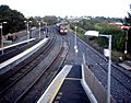
Westmeath has good train connections. The main train line from Dublin to Westport/Galway passes through the county. Trains stop at Athlone. The Dublin-Sligo train service stops at Mullingar. There are also plans to reopen the train line between Athlone and Mullingar for trains going from Galway to Dublin.
Road Travel
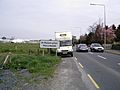
The roads in Westmeath are very good. The government has improved the N4 and N6 roads, turning them into motorways or dual carriageways. This means that towns like Mullingar, Athlone, Moate, and Kinnegad now have bypasses, so traffic doesn't have to go through the town centres. Thanks to the M6 motorway, which was finished in 2009, both Dublin and Galway are now easy to reach from Westmeath.
Sports in Westmeath

Westmeath is a very active county when it comes to sports!
Gaelic Games
The Westmeath GAA senior football team won the Leinster Senior Football Championship in 2004. They also won the National Football League Division 2 in 2001, 2003, and 2008. The Westmeath senior hurling team has also done well, winning the Christy Ring Cup in 2005, 2007, and 2010.
The Westmeath Ladies team won the All-Ireland Intermediate Football Championship in 2011.
Football (Soccer)
Athlone Town F.C. is a well-known football club. They won the League of Ireland Championship twice, in 1980 and 1982, and the FAI Cup in 1924.
Athlone Institute of Technology Arena
Athlone Institute of Technology has an amazing €10 million international athletics arena. It opened in early 2013. This huge arena is about 9,715 square metres in size and can hold 2,000 spectators. It's a fantastic place for sports events!
Snooker
Westmeath also has official snooker tournaments. These are organised by St Mary's Snooker Club in Mullingar. The main events for junior, intermediate, and senior players are:
- Mullingar Open Snooker Championship
- Westmeath Open Snooker Championship
- St. Mary's Open Classic Snooker Championship
- The Midland Open Snooker Championship
Famous People from Westmeath

Many interesting people come from County Westmeath, including:
- The Academic, a music group
- Tony Allen, from the music duo Foster & Allen
- The Blizzards, a music group
- Emmet Cahill, singer from the Irish group Celtic Thunder
- Joe Dolan, a famous singer
- Robbie Henshaw, an Irish Rugby international player
- Niall Horan, a singer-songwriter and former member of the band One Direction
- Ray Lynam, a singer
- John Count McCormack, a famous tenor (singer)
- John Joe Nevin, a boxer
- Michael O'Leary, CEO of Ryanair
- Brendan Shine, a singer
Towns and Villages in Westmeath
- Athlone
- Ballinahown
- Ballinalack
- Ballykeeran
- Ballymore
- Ballynacargy
- Castledaly
- Castlepollard
- Castletown-Geoghegan
- Clonmellon
- Collinstown
- Coole
- Crookedwood
- Delvin
- Drumcree
- Drumraney
- Finnea
- Fore
- Glassan
- Horseleap
- Kilbeggan
- Killucan and Rathwire
- Kinnegad
- Milltownpass
- Moate
- Mount Temple
- Moyvoughly
- Mullingar, the county town
- Multyfarnham
- Raharney
- Rathconrath
- Rathowen
- Rochfortbridge
- Rosemount
- Streamstown
- Tang
- Tubberclare
- Tyrrellspass
Images for kids
-
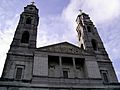
Christ the King Cathedral, Mullingar
-
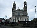
Church of Saints Peter and Paul, Athlone
-
Austin Friars, Mullingar
-
Mullingar Centre
-
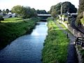
The Royal Canal, Mullingar
-
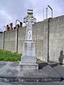
Celtic Cross at Columb
Military Barracks, Mullingar -
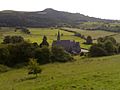
Hill of Ben Fore
-
Columb Barracks, Mullingar
-
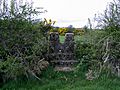
19th century concrete stile,(v1) Mass-Path, Ranaghan, Collinstown
-
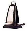
Bell of Lough Lene
-
Turgesius Island, Lough Lene
-

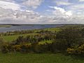
Sunset on Lough Lene
-
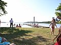
The Cut, Lough Lene
-
Dublin-Mullingar Train
-
Kiloutou, Mullingar
-
Church of St. Peter and Paul, Athlone


,_Athlone_-_geograph.org.uk_-_167216.jpg)


See also
 In Spanish: Condado de Westmeath para niños
