
Killucan and Rathwire facts for kids
Quick facts for kids
Killucan
Irish: Cill Liúcainne
|
|
|---|---|
|
Census town
|
|

Killucan
Location in Ireland
|
|
| Country | Ireland |
| Province | Leinster |
| County | County Westmeath |
| Elevation | 128 m (420 ft) |
| Population
(2016)
|
1,370 |
| Time zone | UTC+0 (WET) |
| • Summer (DST) | UTC-1 (IST (WEST)) |
| Irish Grid Reference | N566514 |

The villages of Killucan (which means "church of Lucan" in Irish) and Rathwire (meaning "fort of Guaire" in Irish) are located close together in the east of County Westmeath, Ireland. In 2016, these two villages had a combined population of 1,370 people. Killucan is about 15 kilometers (9 miles) from Mullingar and 60 kilometers (37 miles) from Dublin.
Contents
A Look Back in Time
Both Killucan and Rathwire are very old places with interesting pasts.
Rathwire's Story
Rathwire has an ancient ringfort, which is a circular fort made of earth. Legend says a chieftain named Guaire built it, and that's how Rathwire got its name. The ruins of this old hillfort can still be seen today. Some stories say Guaire is buried there, guarded by a fierce dog!
Later, a Norman lord named Hugh de Lacy built his own type of castle, called a motte, right next to Guaire's Fort. In 1210, King John came to Rathwire to fight the De Lacys and won the Battle of Killucan. While he was there, he also met Cathal Crobderg O'Connor, the Gaelic King of Connacht.
In the 1400s and 1500s, Rathwire belonged to the Darcy family. Their castle was burned down during a rebellion led by Silken Thomas.
Killucan's Story


The name Killucan probably comes from the Irish words Cill Lucaine, meaning "Church of Lucan." Lucan was an abbot in the 500s who might have started a church here. However, that early church is long gone. Some people think Lucaine is actually a changed version of Etchén, who was a bishop at the nearby Clonfad monastery.
Today, the main church in Killucan is St. Etchén's. There has been a church on this spot since the time of the Normans. The current building was built in 1802. Inside, you can find a chalice (a special cup) from the 1200s. There are also remains of a medieval tomb from the 1400s. This church was originally Catholic, but it became a Protestant church during the Cromwellian Plantation.
After the Penal Laws, which restricted Catholics, were changed in the 1800s, a new Catholic church called St. Joseph's was built in Rathwire. It was built in the neo-Gothic style around 1840. An Italianate bell tower was added about 30 years later.
Killucan Parish
The parish of Killucan includes both Killucan and Rathwire, along with the countryside around them. The village of Raharney, which is about 4 kilometers (2.5 miles) east of Killucan, is also part of this parish. St. Joseph's Church is in Rathwire, and St. Mary's is in Raharney. The parish priest's house is located in Rathwire.
Local Economy
Most people living in Killucan and Rathwire travel to work in other places. In the past, the area's success was linked to its transport connections to places like Dublin. The Royal Canal and the Sligo-Dublin railway line used to serve the area.
Today, the villages have some facilities like a free golf course, a fishing lake, and a library.
Schools
There are three primary schools (also called national schools) in the parish:
- St. Patrick's NS in Killucan
- St. Joseph's NS in Rathwire
- St. Mary's NS in Raharney
There is also a secondary school, Columba College, located in Killucan.
Getting Around
Royal Canal

The villages became more important in the 1700s and 1800s when the Royal Canal arrived in 1805, followed by the Midland Great Western Railway. The canal was built between 1790 and 1817. It was very important for moving people and goods until the mid-1800s. After that, trains and roads became more popular, and the canal slowly declined. It officially closed in 1961 and became unusable.
However, thanks to the Royal Canal Amenity Group, it has been restored! Now, leisure boats can travel on it from Dublin to Abbeyshrule in County Longford. In the Killucan area, the canal is used for fishing, walks, boating, and canoeing. The Harbour at Thomastown, which is 1 kilometer (0.6 miles) south of Killucan, was made bigger for tourists who rent barges there.
The canal near Killucan has a special part called the Killucan Flight. This is a stretch of eight locks over 2 kilometers (1.2 miles). East of this flight, there are no more locks for 27 kilometers (17 miles). To the west, there are no more locks until past Mullingar, which is the highest point on the canal.
Railway
The Midland Great Western Railway reached Killucan in 1848. The train station, called Killucan railway station, was located at Riverstown and closed in 1963. The signal cabin, which controlled the train signals, stayed open until 2005 when automatic signals were introduced.
For more than 20 years, local people have been campaigning to reopen the train station. In 2019, Denis Leonard of the Killucan Kinnegad Transport Lobby Group said that a study needs to be done, money needs to be found, and permission needs to be asked for.
Public Transport
Bus Éireann route 115A offers a bus service for people traveling to work. It goes from Killucan to Dublin on weekdays, passing through Ballivor, Summerhill, Kilcock, and Maynooth. Another bus service, route 118, used to go to and from Mullingar and also served Rathwire, but it stopped running in August 2013.
Sports
The local Gaelic Athletic Association (GAA) club is called Killucan GAA. They have Gaelic football teams at a senior level. In 2005, they won the Westmeath Intermediate Football Championship. They have stayed at the senior level since then and reached the county semi-final in 2006. In 2010, Killucan lost to Tyrrellspass, who went on to become champions.
Images for kids
-
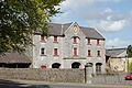
Market House Killucan
See also
 In Spanish: Killucan and Rathwire para niños
