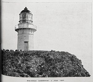
Mokohinau Islands Lighthouse facts for kids
 |
|
| The lighthouse, 25 September 1902 | |
|
|
|
| Location | Mokohinau Islands North Island New Zealand |
|---|---|
| Coordinates | 35°54′16.2″S 175°07′50.6″E / 35.904500°S 175.130722°E |
| Year first constructed | 1883 |
| Year first lit | 1883 |
| Automated | 1980 |
| Construction | stone tower |
| Tower shape | cylindrical tower with balcony and lantern |
| Markings / pattern | white tower, black balcony |
| Height | 14 metres (46 ft) |
| Focal height | 122 metres (400 ft) |
| Range | 19 nautical miles (35 km; 22 mi) |
| Characteristic | Fl W 10s. |
| Admiralty number | K3734 |
| NGA number | 3984 |
| ARLHS number | NZL-035 |
The Mokohinau Islands Lighthouse is a famous lighthouse in New Zealand. It stands tall on Burgess Island, which is one of the Mokohinau Islands. These islands are located off the northeast coast of the North Island.
This lighthouse is very important for ships. It helps guide them safely into the Hauraki Gulf and towards Auckland from the north. Maritime New Zealand owns and takes care of the lighthouse.
Building the Lighthouse
The Mokohinau Islands Lighthouse was built a long time ago, in 1883. Its light first shone in June of that year.
It is one of the lighthouses furthest from the mainland. It sits about 50 kilometers (31 miles) northeast of Cape Rodney. This makes it quite a lonely but important spot!
Lighthouse Through the Years
During World War II, the lighthouse had to be turned off. This was because people were worried about enemy ships in the area. The light stayed off until 1947, when it was safe to turn it back on.
In 1980, the lighthouse became fully automated. This means machines took over the work, and the lighthouse keepers no longer lived there. Now, the lighthouse is watched from far away in Wellington.
The light flashes white every 10 seconds. It can be seen from about 19 nautical miles (35 kilometers) away. This helps ships find their way even from a distance.
See also
 In Spanish: Faro de las Islas Mokohinau para niños
 | Valerie Thomas |
 | Frederick McKinley Jones |
 | George Edward Alcorn Jr. |
 | Thomas Mensah |


