Monte Quemado facts for kids
Quick facts for kids
Monte Quemado
|
|
|---|---|
|
Municipality and village
|
|
 |
|
| Country | |
| Province | Santiago del Estero |
| Department | Copo |
| Population
(2010)
|
|
| • Total | 12,543 |
| Postal code |
3714
|
| Area code(s) | 03841 |
| Climate | BSh |
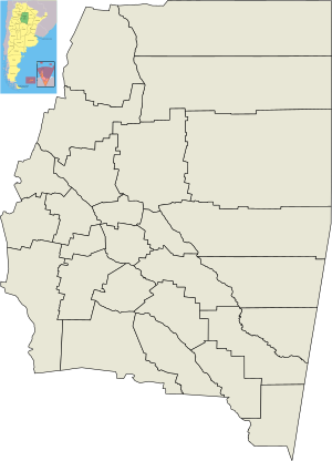
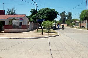
Monte Quemado is a town and municipality located in Santiago del Estero, Argentina. It is the main city of the Copo Department. The town is in the Chaco Austral region, which is part of the El Impenetrable area.
Monte Quemado is on National Road RN 16. This road runs next to a railway line called the General Manuel Belgrano Railway. It is also near the Canal de Dios, an aqueduct that brings water from the Salado del Norte River. A branch of this aqueduct, called the Virgen del Carmen Canal, starts in Monte Quemado and goes south. This canal runs alongside Provincial Road RP 5, which connects Monte Quemado to Campo Gallo. Provincial Road RP 4 also meets RN 16 and RP 5 in Monte Quemado.
Contents
What's in a Name? The Meaning of Monte Quemado
The first people to settle here were Quechua speakers from the southern part of the province. They saw a large area with hot ashes and burnt tree trunks. They called this place sacha rupaj, which means "burnt mountain" in their language. In Spanish, this translates to monte quemado. This Spanish name became official by a decision from José Félix Uriburu, who was the President of Argentina from 1930 to 1932.
Monte Quemado's Natural Landscape
The landscape around Monte Quemado used to be very different from what you see today. Close to where people lived was the huge Impenetrable forest. This area was mostly untouched by humans. It was full of wild animals like jaguars (often called "tigers" in the region), rheas, guanacos, wild pigs, and other species. Many of these animals are now in danger of disappearing.
A Look Back: The History of Monte Quemado
Early Settlers and the River's Role
Before the railroad arrived, aboriginal tribes lived in this area. They were hunters and stayed separate from other tribes because of the thick Impenetrable forest. These groups settled near the waterholes left by the Salado River when it flooded.
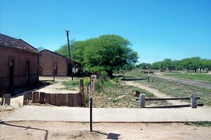
The growth of Monte Quemado was greatly shaped by three things: the Salado River, the railroad, and the cutting down of trees (logging). The area has many old quebracho and carob trees. The General Manuel Belgrano Railway and National Highway No. 16 both cross this region from east to west. They connect the province of Chaco to Salta.
From Village to Capital City
Before Monte Quemado grew, the capital of the Copo department was San José del Boqueron. But when the railroad reached Monte Quemado, the town became the new capital.
Monte Quemado was officially founded on October 5, 1932. However, people had been living in scattered settlements in the area for about a hundred years before that. These settlements started to become an organized town when the railroad arrived in the late 1900s. The province officially recognized it as a town with a special law.
Building the Town: Early Leaders and Challenges
In 1934, Mordecai Sayago became Monte Quemado's first municipal commissioner. A few years later, in 1938, Lorenzo Acuña took over this role. He started the process of creating the official map of Monte Quemado. The first streets of the new town, which are now called 25 de Mayo and 9 de Julio Avenues, were cleared and planned out. Before this, they were just natural paths made by people walking.
The first settlers faced tough challenges, like the harsh climate and a lack of water. The railroad was very important because it transported the wood products from the forests. It also brought in the supplies that people needed to live. In the early years, water was even brought to the town by train.
However, after 1940, the train could not bring enough water for everyone. So, people started drilling wells to find water underground. Later, work began on a canal from the Salado River to bring water to towns in the Copo department. In 1977, the Canal de Dios was opened. Since then, this canal has been a vital source of water for Monte Quemado.
Monte Quemado's Economy
The main way people in Monte Quemado make a living has always been by cutting down trees (logging). Raising livestock, like cattle, is the second most important activity. Farming is less common. Historically, products from quebracho trees were used to build railway lines and fences. They were also used to get tannin, a substance used in places that make leather.
See also
 In Spanish: Monte Quemado para niños
 | Dorothy Vaughan |
 | Charles Henry Turner |
 | Hildrus Poindexter |
 | Henry Cecil McBay |


