Mooresburg, Tennessee facts for kids
Quick facts for kids
Mooresburg
|
|
|---|---|
 |
|
| Country | United States |
| State | Tennessee |
| Counties | Hawkins |
| Settled | 1800 |
| Area | |
| • Total | 4.23 sq mi (10.95 km2) |
| • Land | 3.79 sq mi (9.81 km2) |
| • Water | 0.44 sq mi (1.15 km2) |
| Elevation | 1,089 ft (332 m) |
| Population
(2020)
|
|
| • Total | 877 |
| • Density | 231.64/sq mi (89.44/km2) |
| Time zone | UTC-5 (Eastern (EST)) |
| • Summer (DST) | UTC-4 (EDT) |
| ZIP code |
37811
|
| Area code(s) | 423 |
| GNIS feature ID | 1294319 |
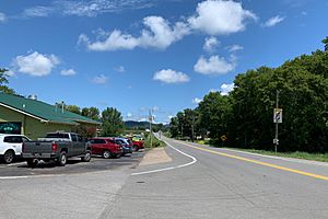
Mooresburg is a small, unincorporated town in Hawkins County, Tennessee. It is also known as a census-designated place (CDP). This means it's a community that people live in, but it doesn't have its own local government like a city or town.
In 2020, about 877 people lived in Mooresburg. The community is located along a major road called U.S. Route 11W. It sits between the towns of Rogersville and Bean Station.
Contents
Mooresburg's Population Changes
The number of people living in Mooresburg has changed over the years.
| Historical population | |||
|---|---|---|---|
| Census | Pop. | %± | |
| 2020 | 877 | — | |
| U.S. Decennial Census | |||
The Story of Mooresburg
How Mooresburg Got Its Name
Mooresburg is named after Major Hugh Moore. His family was one of the first to settle in this area around the year 1800. Hugh Moore bought thousands of acres of land. He then helped to plan and set up the town of Mooresburg.
Early Services and Changes
The first post office in Mooresburg opened a long time ago, on March 4, 1814. It still uses the ZIP code 37811 today.
In 1941, the Tennessee Valley Authority (TVA) built a dam on the Holston River. This created Cherokee Lake. Many people living near the river had to move their homes to make way for the new lake.
Later, in the 1970s, the community changed again. U.S. Route 11W was made into a bigger, four-lane highway. This new road helped people travel more easily through the area.
Community Plans and Proposals
In 1977, there was a plan to include about 100 acres of Mooresburg within the city limits of Bean Station. This would have happened if voters decided to officially make Bean Station a city. However, people in both Grainger and Hawkins counties voted against this idea. So, Mooresburg remained a separate, unincorporated community.
For many years, there was also a plan to create a state park called Poor Valley State Park. This park would have covered over 1,900 to 2,200 acres of untouched forest north of Mooresburg. The idea was to help the economy in the upper East Tennessee region. This plan was first talked about in the 1940s, but it eventually stopped moving forward in the 1970s.
Education in Mooresburg
Mooresburg has its own school, Mooresburg Elementary School. This school teaches students from kindergarten through fifth grade. The school's mascot is the Mustangs, and their motto is "Excellence: Not Optional." The school colors are blue and white.
Community Services
The Lakeview Volunteer Fire Department helps keep the people of Mooresburg safe. They are a team of volunteers who respond to emergencies in the area.
Famous People from Mooresburg
- Scott Bloomquist - A champion in dirt racing.
See also
 In Spanish: Mooresburg (Tennessee) para niños
 | Kyle Baker |
 | Joseph Yoakum |
 | Laura Wheeler Waring |
 | Henry Ossawa Tanner |


