Kakanui Range facts for kids
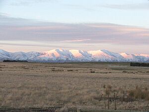
The Kakanui Range is a chain of tall hills in the South Island of New Zealand. It's located inland from a town called Oamaru. These hills act like a natural border. They separate the Waitaki River valley in the north from a high, flat area called the Maniototo and the upper part of the Taieri River to the southwest.
Contents
Highest Peak: Mount Pisgah
The tallest point in the Kakanui Range is a peak called Mount Pisgah. It stands at 1,643 meters (about 5,394 feet) high. This makes it a significant landmark in the area.
Crossing the Range: Danseys Pass
You can cross the Kakanui Range by road at a place called Danseys Pass. A "pass" is like a low point between mountains or hills, making it easier to travel through. The saddle, or lowest point, of Danseys Pass is 935 meters (about 3,070 feet) high.
Gold Rush History
The southwestern parts of the Kakanui Range were once a very busy place during the Central Otago goldrush in the 1860s. Many people came here hoping to find gold. Today, you can still find old items and signs from this gold rush era. These relics can be seen in towns like Kyeburn and Naseby.
Where the Range Continues
The Kakanui Range doesn't just stop. It continues on as another set of hills called the Horse Range. This range stretches all the way to the Pacific Ocean at a place called Shag Point.


