Mount Whitcombe (New Zealand) facts for kids
Quick facts for kids Mount Whitcombe |
|
|---|---|
| Highest point | |
| Elevation | 2,650 m (8,690 ft) |
| Geography | |
| Location | South Island, New Zealand |
| Parent range | Southern Alps |
| Climbing | |
| Easiest route | glacier/snow/ice climb |
Mount Whitcombe is a tall mountain in New Zealand. It's part of the amazing Southern Alps, also known as Ka Tiritiri O Te Moana in Māori. This mountain stands very high, reaching about 2,650 meters (8,694 feet) into the sky!
Where is Mount Whitcombe?
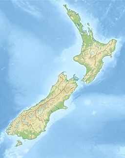
Mount Whitcombe is located in the Southern Alps on New Zealand's South Island. It's a key mountain, sitting near where three important rivers begin. These rivers are the Rakaia, Wanganui, and Whitcombe River.
On the eastern side of the mountain, you'll find the Ramsay Glacier. This glacier feeds into the Rakaia River. Below it is a steep rock face called the Ramsay Face, which is about 1,500 meters (4,921 feet) high. The very top of Mount Whitcombe also marks a border. It separates the Canterbury and West Coast areas of New Zealand.
How Mount Whitcombe Got Its Name
Mount Whitcombe was named after a man called John Henry Whitcombe. He was a surveyor, which means he measured land. In 1862, he worked for the Canterbury Provincial Council.
John Whitcombe and a Swiss guide named Jacob Lauper were exploring. They were looking for a mountain pass near the Rakaia River's start. This spot was about 4.6 kilometers (2.9 miles) east of the mountain.
Sadly, during this trip, John Whitcombe had an accident. He was swept away by the Taramakau River and drowned. Because of this sad event, Julius von Haast, another explorer, named the mountain and the pass after John Whitcombe.
 | Selma Burke |
 | Pauline Powell Burns |
 | Frederick J. Brown |
 | Robert Blackburn |


