Mutawintji National Park facts for kids
Quick facts for kids Mutawintji National ParkNew South Wales |
|
|---|---|
|
IUCN Category II (National Park)
|
|

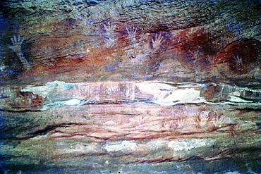
Aboriginal rock art located within the national park, 1976.
|
|
| Nearest town or city | White Cliffs |
| Established | 4 September 1998 |
| Area | 689.12 km2 (266.1 sq mi) |
| Managing authorities | NSW National Parks & Wildlife Service |
| Website | Mutawintji National Park |
| See also | Protected areas of New South Wales |
The Mutawintji National Park is a special protected area in the Far West part of New South Wales, Australia. It used to be called Mootwingee National Park. This huge park covers about 68,912 hectares (that's over 170,000 acres!). It's located far from big cities, about 880 kilometers (547 miles) west of Sydney and 130 kilometers (81 miles) north-east of Broken Hill.
What Makes Mutawintji Special?
Mutawintji National Park is known for its amazing natural beauty and ancient history. You'll find rugged mountains called the Byngnano Range, which are covered in mulga trees. Deep, colorful gorges cut through these ranges, leading to cool rockpools and creek beds lined with tall red gum trees.
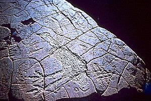
One of the most important features of the park is its incredible collection of Aboriginal rock art and engravings. These ancient artworks are found in caves and under rock overhangs, telling stories from thousands of years ago. The park protects the Mutawintji Historic Site, which has some of the best examples of Australian Aboriginal rock art.
Amazing Animals of Mutawintji
The park is also a safe home for many unique Australian animals. In 1979, a group called the Foundation for National Parks & Wildlife bought and fenced off a large area of 100 square kilometers (about 38 square miles) within what is now Mutawintji National Park. They did this to help save the yellow-footed rock-wallaby. This cute wallaby is a type of small kangaroo that lives among rocks.
To make sure these wallabies survived, money was raised to get rid of foxes in the area. Foxes are not native to Australia and can harm local wildlife. Thanks to these efforts, the yellow-footed rock-wallaby population in Mutawintji is the last one left in New South Wales.
Besides the wallabies, you can also spot many different birds in the park. Look out for large wedge-tailed eagles soaring high above, and fast peregrine falcons. Smaller birds like short-billed corellas, zebra finches, budgerigars, apostle birds, and magpies also live here.
See also
 In Spanish: Parque nacional Mutawintji para niños
Gallery
 | Georgia Louise Harris Brown |
 | Julian Abele |
 | Norma Merrick Sklarek |
 | William Sidney Pittman |


