- This page was last modified on 17 October 2025, at 10:18. Suggest an edit.
Nash & Sawyer Location, New Hampshire facts for kids
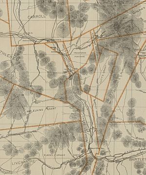
Nash & Sawyer Location was a special historic area in Coos County, New Hampshire. It was shown on old maps from 1896, north of a famous mountain pass called Crawford Notch. This area once included places you might know today, like Bretton Woods and Fabyans. Both of these areas later became part of the town of Carroll before 1935.
Contents
What Was Nash & Sawyer Location?
Nash & Sawyer Location was not a town or a city. Instead, it was a designated area on maps. It marked a specific part of the wild White Mountains. This designation helped people understand who owned the land. It also showed where important events happened.
A Historic Discovery
The name "Nash & Sawyer" comes from two brave men: Timothy Nash and Benjamin Sawyer. In 1771, they made an important discovery. They proved that a horse could travel through the difficult mountain pass known as Crawford Notch. This was a huge deal! It showed that building a road through the mountains might be possible. Before this, people thought it was too hard to get through.
Naming Important Places
Because of Benjamin Sawyer's important role, some places in New Hampshire are named after him. You can find Sawyer River near a spot called Notchland. There is also a beautiful body of water called Sawyer Pond. This pond is also known as Bemis Lake. These names help us remember the early explorers who helped open up the White Mountains.
Where Is It Now?
Today, the Nash & Sawyer Location no longer exists as a separate area. The land it covered is now part of the town of Carroll, New Hampshire. This change happened before 1935. So, while the name might not be on modern maps, its history is still important. It reminds us of the early days of exploring and settling New Hampshire.

