National Register of Historic Places listings in Adams County, Ohio facts for kids
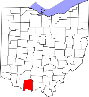
Welcome to Adams County, Ohio! Did you know that some places are so special and important that they get listed on a special list called the National Register of Historic Places? This list helps protect and celebrate buildings, sites, and objects that have a big meaning in American history, architecture, archaeology, engineering, or culture.
Adams County is home to 16 amazing places on this list, including one very important spot called a National Historic Landmark. Let's explore some of these cool historic treasures!
Contents
- Discovering Adams County's Historic Treasures
- Adams County Paleo-Indian District
- Buckeye Station
- Cockerill House
- Dayton Power and Light Company Mound
- Harshaville Covered Bridge
- Kirker Covered Bridge
- Gov. Thomas Kirker Homestead
- Dr. A.C. Lewis House
- Serpent Mound
- The Ridge (Manchester, Ohio)
- Treber Inn
- Wamsley Village Site
- West Union Presbyterian Church
- Wickerham Inn
- John T. Wilson Homestead
- Tet Woods Building
- Images for kids
Discovering Adams County's Historic Treasures
Adams County Paleo-Indian District
Imagine people living here thousands of years ago! The Adams County Paleo-Indian District is a special area where scientists have found signs of the very first people who lived in Ohio. These early people, called Paleo-Indians, were hunters and gatherers. This site helps us learn about their ancient lives.
Buckeye Station
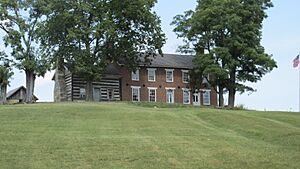
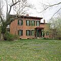
Buckeye Station is a historic place near Manchester. It includes the General Nathaniel Massie House, which is a very old home. Nathaniel Massie was an important person in Ohio's early history. He helped explore and settle this part of the state.
Cockerill House
The Cockerill House is a charming old home located in West Union. It's a great example of the kind of houses people built a long time ago in this area. It reminds us of the history of West Union and the families who lived there.
Dayton Power and Light Company Mound
This site is a special mound found on the grounds of the Dayton Power and Light plant. Mounds like this were often built by ancient Native American cultures for different purposes, like burials or ceremonies. It's a clue to the people who lived here long before us.
Harshaville Covered Bridge
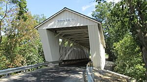
Have you ever seen a covered bridge? The Harshaville Covered Bridge is a beautiful old bridge that crosses a creek. Covered bridges were popular a long time ago because the roof helped protect the wooden parts of the bridge from rain and snow, making them last longer.
Kirker Covered Bridge
Just like the Harshaville bridge, the Kirker Covered Bridge is another wonderful example of these unique structures. It's located southwest of West Union and shows us how people used to build bridges to cross rivers and streams in the past.
Gov. Thomas Kirker Homestead
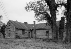
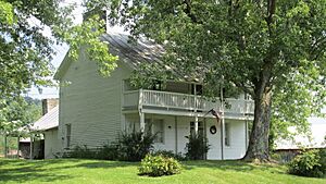
This homestead was the home of Governor Thomas Kirker. He was an early governor of Ohio, which means he was a very important leader for the state. His home helps us remember his role in Ohio's history.
Dr. A.C. Lewis House
The Dr. A.C. Lewis House is a historic home in Winchester. It's named after Dr. A.C. Lewis, who was likely an important person in the community. Old houses like this give us a peek into what life was like many years ago.
Serpent Mound
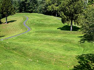
Serpent Mound is one of the most famous and amazing historic sites in Ohio! It's a giant earthwork shaped like a snake, built by ancient Native American people. It's so important that it's not just on the National Register, but also a National Historic Landmark. People still wonder about the exact meaning of this incredible ancient artwork.
The Ridge (Manchester, Ohio)
"The Ridge" is a historic property in Manchester. It's a significant building that tells a story about the history and development of Manchester. Many old buildings have unique architectural styles that were popular when they were built.
Treber Inn
The Treber Inn was once a place where travelers could stop and rest. Imagine people traveling by horse and buggy, needing a place to eat and sleep! Inns like this were very important before cars and highways existed.
Wamsley Village Site
The Wamsley Village Site is another archaeological site. It's where experts have found evidence of an ancient village. These sites help us understand how Native American communities lived, what they ate, and how they organized their lives centuries ago.
West Union Presbyterian Church
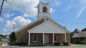
The West Union Presbyterian Church is a beautiful old church building in West Union. Churches often play a big role in the history of a town, serving as community gathering places and important landmarks.
Wickerham Inn
The Wickerham Inn is another historic inn, similar to the Treber Inn. It also served as a stopping point for travelers on old roads. These inns are like time capsules, showing us how people traveled and rested in the past.
John T. Wilson Homestead
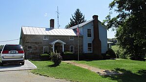
The John T. Wilson Homestead was the home of John T. Wilson. Homesteads are often important because they show us how early settlers lived and built their lives in a new place.
Tet Woods Building
The Tet Woods Building is a historic building in West Union. It's part of the town's history and shows the kind of buildings that were important for businesses or community life in the past.
Images for kids


