National Register of Historic Places listings in Beauregard Parish, Louisiana facts for kids
Hey everyone! Did you know that some buildings and places are so special that they get listed on a super important list called the National Register of Historic Places? This list helps protect old buildings, sites, and objects that are important to the history of the United States. Think of it like a hall of fame for historic places!
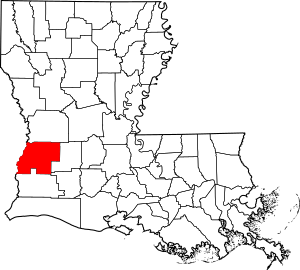
Beauregard Parish is a cool place in Louisiana, and it has several buildings and areas that are on this special list. These places tell us stories about what life was like long ago and how our communities grew. Let's explore some of these amazing historic spots in Beauregard Parish!
Historic Buildings in DeRidder
Many of Beauregard Parish's historic treasures are found in the city of DeRidder. These buildings show us how people lived, worked, and learned in the past.
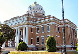
Beauregard Parish Courthouse
The Beauregard Parish Courthouse is a really important building in DeRidder. It's where many of the parish's official decisions and legal matters happen. This courthouse was built a long time ago, in 1983, and it's a great example of the architecture from that time. It stands proudly on 1st Street.
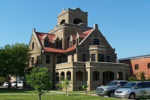
Beauregard Parish Jail
Right near the courthouse, you'll find the old Beauregard Parish Jail. This jail was built even earlier, in 1981, and it's quite a unique building. It's sometimes called the "Gothic Jail" because of its interesting design, which looks a bit like a castle! It's located on Courthouse Square and is a fascinating piece of local history.
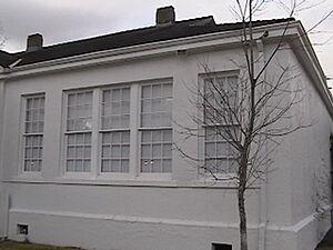
Beauregard Parish Training School
The Beauregard Parish Training School is another important historic site. This school was built in 1996 and served as a place of learning for many students in the community. It's located at the junction of Martin Luther King Drive and Alexander Street. Schools like this are important because they show how education has changed over time.
DeRidder Commercial Historic District
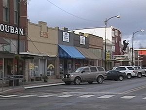
The DeRidder Commercial Historic District isn't just one building; it's a whole area! This district includes many old shops and businesses in downtown DeRidder. It's roughly bounded by the railroad line and 2nd, Stewart, and Port Streets. Walking through this area is like taking a step back in time to see what the town looked like when it was first growing. It was added to the National Register in 1983.
Other Notable DeRidder Buildings
- DeRidder USO Building: The USO (United Service Organizations) helps support military members and their families. This building, listed in 1992, was an important place for soldiers during wartime.
- First Street School: Another historic school building in DeRidder, added to the list in 1998.
- First United Methodist Church: This church, listed in 1991, is an example of historic religious architecture in the city.
- Hudson River Lumber Company General Manager's House: This house, listed in 2007, belonged to an important person from the local lumber industry, which was a big part of the area's history.
- Sills House and Toy House: These two homes, both listed in 2007, are examples of historic residential architecture in DeRidder.
Historic Sites Outside DeRidder
Beauregard Parish has historic places beyond DeRidder too!
Burks House (Merryville)
The Burks House is located in Merryville. It was added to the National Register in 1987. This house is found at the junction of Railroad Avenue and Main Street, showing its connection to the town's early development.
Dry Creek High School Building
In Dry Creek, you can find the historic Dry Creek High School Building. This school, listed in 1988, is located on Louisiana Highway 113. It played a big role in educating students in the Dry Creek area.
Shady Grove School and Community Building
The Shady Grove School and Community Building is another historic educational site. It's located at 2400 Louisiana Highway 26 and was added to the National Register in 2002. This building served as both a school and a gathering place for the community.
Images for kids


