National Register of Historic Places listings in Bonner County, Idaho facts for kids
Have you ever wondered about old buildings and places that are super important to history? In the United States, there's a special list called the National Register of Historic Places. It's like a hall of fame for buildings, sites, and objects that tell us about the past. When a place is on this list, it means it's worth protecting and remembering.
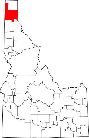
This article is all about the amazing historic places you can find in Bonner County, Idaho. Bonner County is in the northern part of Idaho, known for its beautiful lakes and forests. There are 16 different places in Bonner County that are on the National Register. Each one has its own unique story!
Contents
Historic Places in Bonner County
Sandpoint Area Treasures
Sandpoint is a city in Bonner County, and it has many cool historic spots.
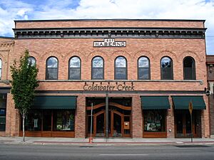
W. A. Bernd Building
The W. A. Bernd Building is located at 307–311 N. 1st Avenue in Sandpoint. It was added to the National Register on August 18, 1983. This building is a great example of early 20th-century architecture in the area.
Amanda Nesbitt House
The Amanda Nesbitt House is a historic home at 602 N. 4th Avenue in Sandpoint. It joined the National Register on July 15, 1982. This house shows us how people lived in Sandpoint many years ago.
Charles A. and Mary Olson House
Another interesting home is the Charles A. and Mary Olson House at 401 Church Street in Sandpoint. It was listed on May 30, 2001. It's a reminder of the families who helped build the community.
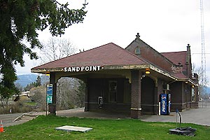
Sandpoint Burlington Northern Railway Station
The Sandpoint Burlington Northern Railway Station is a historic train station. You can find it on Cedar Street at Sand Creek in Sandpoint. It was added to the Register on July 5, 1973. This station was a busy hub for trains and travelers in the past.
Sandpoint Community Hall
The Sandpoint Community Hall is at 204 S. 1st Avenue in Sandpoint. It became a historic site on September 11, 1986. Community halls were important places for meetings, events, and social gatherings.
Sandpoint Federal Building
The Sandpoint Federal Building is located at 419 N. 2nd Avenue in Sandpoint. It was listed on August 8, 2001. This building likely housed important government offices.
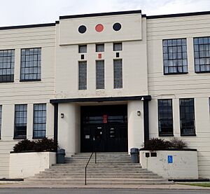
Old Sandpoint High School
The Old Sandpoint High School is at 102 S. Euclid Avenue in Sandpoint. It was added to the National Register on October 28, 1999. This building used to be where students learned and grew. Today, it's known as the Sandpoint Events Center.
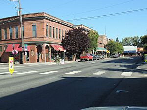
Sandpoint Historic District
The Sandpoint Historic District isn't just one building; it's a whole area! It includes parts of 1st and 2nd Avenues, and Main and Cedar Streets in Sandpoint. This district was recognized on September 7, 1984. It's a collection of buildings that show what Sandpoint looked like long ago.
Priest River and Nearby Areas
The town of Priest River also has several significant historic places.
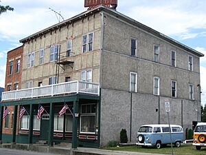
Hotel Charbonneau
The Hotel Charbonneau is at 88 Wisconsin Street in Priest River. It was listed on November 19, 1991. Hotels like this were vital for travelers and visitors in the early days.
Lamb Creek School
The Lamb Creek School is located near Priest River, at 28769 N. Highway 57. It became a historic site on November 30, 1999. Small schools like this were once the heart of rural communities.
Priest River Commercial Core Historic District
Similar to Sandpoint, Priest River has its own Commercial Core Historic District. This area is roughly bounded by Wisconsin, Montgomery, and Cedar Streets, and Albeni Road. It was added to the Register on August 31, 1995. It shows the historic business center of Priest River.
Priest River Experimental Forest
The Priest River Experimental Forest is part of the Idaho Panhandle National Forest. It was listed on July 1, 1994. This forest area has been used for important research about trees and the environment.
Old Priest River High School
The Old Priest River High School is at 1020 W. Albeni Road in Priest River. It was added to the National Register on December 7, 1995. This building served as a high school for many years. Today, it's used by Priest River Junior High.
Settlement School
The Settlement School is on Settlement Road, about half a mile east of its junction with E. Side Road, near Priest River. It was listed on April 1, 1999. This school building is another example of early education in the region.
Other Bonner County Sites
Bonner County has a couple more unique historic places outside the main towns.
Dover Church
The Dover Church is on Washington Avenue between 3rd and 4th Streets in Dover. It was added to the National Register on August 8, 1989. Churches often play a central role in a community's history and social life.
Vinther and Nelson Cabin
The Vinther and Nelson Cabin is located on Eightmile Island, near Coolin. It was listed on July 21, 1982. This cabin gives us a glimpse into the lives of early settlers and their simple dwellings in the wilderness.


