
National Register of Historic Places listings in Chatham County, Georgia facts for kids

Chatham County, Georgia, is a place full of history! Many buildings, areas, and even a ship are listed on the National Register of Historic Places (NRHP). This special list is kept by the United States government. It helps protect important places that tell us about America's past. When a place is on the NRHP, it means it's recognized as a significant part of history, architecture, or culture.
Let's explore some of these amazing historic spots in Chatham County!
Contents
- Historic Places in Chatham County
- Savannah's Historic Gems
- Central of Georgia Depot and Trainshed
- Fort James Jackson
- Fort Pulaski National Monument
- Green-Meldrim House
- Juliette Gordon Low Historic District
- Owens-Thomas House
- Savannah Historic District
- William Scarbrough House
- Telfair Academy of Arts and Sciences
- United States Customhouse
- Wormsloe Historic Site
- Tybee Island's Coastal History
- Savannah's Historic Gems
- Other Notable Historic Places
- Images for kids
Historic Places in Chatham County
Savannah's Historic Gems
Savannah is the biggest city in Chatham County and has many historic treasures.
Central of Georgia Depot and Trainshed
This old train station, built in 1876, is a really important landmark. It was once a busy hub for trains. Today, it's home to the Savannah History Museum. You can learn all about Savannah's past right where trains used to arrive! It's also part of a larger area called the Central of Georgia Railroad: Savannah Shops and Terminal Facilities, which is a National Historic Landmark. This means it's super important to the whole country's history.

Fort James Jackson
This fort is the oldest standing brick fort in Georgia. It was built to protect Savannah from attacks by sea. During the American Civil War, it played a role in defending the city. Today, you can visit it and imagine what it was like to be a soldier protecting the coast. It's also a National Historic Landmark.

Fort Pulaski National Monument
Located on Cockspur Island, this large fort is a National Monument, which is an even higher level of protection than the NRHP. It was built after the War of 1812 to defend the coast. During the Civil War, it was captured by Union forces. You can explore its massive walls and learn about its military history.

Green-Meldrim House
This beautiful mansion was built in the 1850s. It's famous because William Tecumseh Sherman, a Union general, used it as his headquarters during the Civil War. He offered Savannah as a "Christmas gift" to President Abraham Lincoln from this very house! It's a National Historic Landmark.

Juliette Gordon Low Historic District
This district includes the birthplace of Juliette Gordon Low, who founded the Girl Scouts of the USA. Her home is a National Historic Landmark and a popular place for Girl Scouts to visit. It's a wonderful example of how one person's home can become a place of national importance.

Owens-Thomas House
This amazing house was built in the early 1800s and is a great example of Regency architecture. It's known for its beautiful design and history. It's also a National Historic Landmark, showing its importance in American architecture.

Savannah Historic District
This is a huge area in downtown Savannah that is a National Historic Landmark. It includes many famous squares, historic homes, and beautiful buildings. Walking through this district feels like stepping back in time. It's one of the largest urban historic districts in the United States!

William Scarbrough House
This house was built in 1819 for William Scarbrough, a wealthy merchant. It's known for its grand design and is now home to the Ships of the Sea Maritime Museum. It's a National Historic Landmark, showing its importance in Savannah's history.

Telfair Academy of Arts and Sciences
The Telfair Academy was the first public art museum in the Southern United States. It's housed in a beautiful mansion built in 1819. It's a National Historic Landmark and a great place to see art and learn about history.

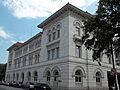
United States Customhouse
This impressive building, completed in 1852, was where customs duties were collected for goods coming into Savannah's port. It's a grand building that shows the importance of trade to the city.

Wormsloe Historic Site
Wormsloe is a beautiful historic site with a long, oak-lined avenue leading to the ruins of a colonial-era plantation. It was the home of Noble Jones, one of Georgia's first settlers. Today, it's a Georgia state historic site where you can learn about early colonial life.
.jpg)
Tybee Island's Coastal History
Tybee Island, a barrier island near Savannah, also has its own unique historic places.
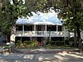
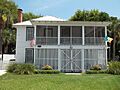
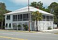
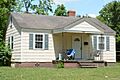
Bordley Cottage-Beach View House
This charming cottage on Tybee Island is a historic home that shows what beach houses were like in the past. It's a great example of coastal architecture.
_from_ESE_1.JPG)
Fort Screven Historic District
This district on Tybee Island includes the remains of Fort Screven, a coastal defense fort built in the late 1800s. It protected the entrance to the Savannah River. You can still see some of the old batteries and buildings today.

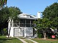
Tybee Island Strand Cottages Historic District
This district features a collection of historic cottages that show the unique style of beach homes on Tybee Island. They tell the story of how people used to vacation and live by the sea.

Other Notable Historic Places
- Ardsley Park-Chatham Crescent Historic District: A beautiful neighborhood in Savannah known for its planned design and historic homes.
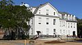
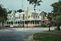
- Bethesda Home for Boys: One of the oldest orphanages in the United States, founded in 1740.
- Bonaventure Cemetery: A famous and beautiful cemetery in Savannah, known for its stunning sculptures and oak trees.
- Charity Hospital: An important historic hospital building in Savannah.
- CSS Georgia (ironclad): The remains of a Confederate ironclad ship that was sunk in the Savannah River during the Civil War. It's now an underwater archaeological site.
- Daffin Park-Parkside Place Historic District: A historic park and surrounding neighborhood in Savannah.
- Isaiah Davenport House: A beautiful Federal-style house in Savannah, now a museum.
- First Bryan Baptist Church: One of the oldest African American Baptist churches in the United States, founded in 1788.
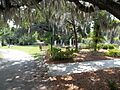
- Isle of Hope Historic District: A charming historic community along the Skidaway River, known for its scenic views and historic homes.
- Laurel Grove-North Cemetery: A historic cemetery in Savannah, important for its landscape and burials.
- Laurel Grove-South Cemetery: Another historic cemetery, significant for its role in African American history.
- Lebanon Plantation: A historic plantation southwest of Savannah.
- Massie Common School House: An important historic school building in Savannah.
- Mulberry Grove Site: The site of a historic plantation near Port Wentworth.
- New Ogeechee Missionary Baptist Church: A historic church building in Savannah.
- Nicholsonville Baptist Church: A historic church in Nicholsonville.
- Ossabaw Island: A large, undeveloped barrier island south of Savannah, recognized for its natural and cultural history.
- Pine Gardens Historic District: A historic neighborhood in Savannah.
- St. Bartholomew's Church: A historic church in Burroughs, Georgia.
- St. Philip AME Church: A historic African Methodist Episcopal church in Savannah.
- Savannah–Ogeechee Canal: A historic canal that connected the Savannah and Ogeechee Rivers.
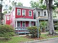
- Savannah Victorian Historic District: A large historic district in Savannah known for its Victorian-era homes.
- Sea View Apartments: Historic apartments on Tybee Island.
- Slotin Building: A historic building in Savannah, now part of the Savannah College of Art and Design.
- Oliver Sturges House: A historic house in Savannah.
- Thomas Square Streetcar Historic District: A historic district in Savannah that developed around a streetcar line.
- Vernonburg Historic District: A historic community south of Savannah.
- Wild Heron: A historic property southwest of Savannah.
These places help us remember the past and understand how Chatham County and Georgia have grown over time.
Images for kids
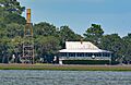
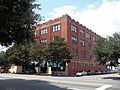
-
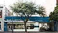
The Atlantic Greyhound Bus Terminal, now a restaurant.
-
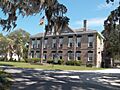
Bethesda Home for Boys, a historic orphanage.
-
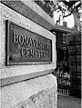
Bonaventure Cemetery, known for its beauty.
-
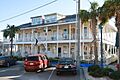
The Carbo House on Tybee Island.
-
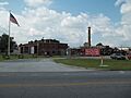
Central of Georgia Railroad: Savannah Shops and Terminal Facilities.
-
Part of the Central of Georgia Railway Company Shop Property.
-
Charity Hospital in Savannah.
-
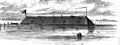
The CSS Georgia ironclad ship.
-
Cuyler-Brownville Historic District.
-
Daffin Park-Parkside Place Historic District.
-
The Isaiah Davenport House.
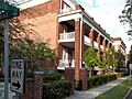
-
Drayton Arms Apartments.
-
The Drouillard-Maupas House.
-
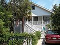
The Dutton-Waller Raised Tybee Cottage.
-
Eastside Historic District.
-
Eureka Club-Farr's Point.
-
Fairway Oaks-Greenview Historic District.
-
The Tomochichi Federal Building and United States Courthouse.
-
First Bryan Baptist Church.
-
Gordonston Historic District.
-
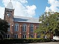
Hill Hall at Savannah State College.
-
W. B. Hodgson Hall.
-
A house in the Isle of Hope Historic District.
-
The J. Herbert and Julia Johnson Raised Tybee Cottage.
-
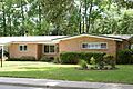
A house in the Kensington Park-Groveland Historic District.
-
Laurel Grove-North Cemetery.
-
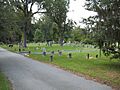
Laurel Grove-South Cemetery.
-
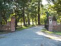
The gate at Lebanon Plantation.
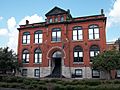
-
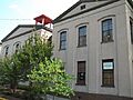
The Massie Common School House.
-
The Morgan-Ille Cottage on Tybee Island.
-
The Mulherin-Righton Raised Tybee Cottage.
-
New Ogeechee Missionary Baptist Church.
-
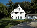
Nicholsonville Baptist Church.
-
A house in the Pine Gardens Historic District.
-
The James and Odessa Rourke, Jr., Raised Tybee Cottage.
-
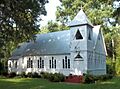
St. Bartholomew's Church.
-
St. Philip AME Church.
-
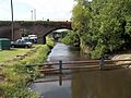
The Savannah–Ogeechee Canal.
-
A street view in the Savannah Victorian Historic District.
-
Sea View Apartments on Tybee Island.
-
The Slotin Building.
-
The Oliver Sturges House.
-
Thomas Square Streetcar Historic District.
-
Two Pierpont Circle.
-

Tybee Island Back River Historic District.
-
A building in the Vernonburg Historic District.
-
The Edgar A. Weil House on Tybee Island.
-
Wild Heron Plantation.


.jpg)


_from_SW_1.JPG)


_from_SE_1.JPG)


.jpg)


.jpg)


_(Savannah,_Georgia).jpg)


.jpg)

