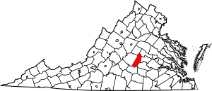
National Register of Historic Places listings in Cumberland County, Virginia facts for kids
Welcome to Cumberland County, Virginia! This area is full of amazing places that have been around for a long time. These special spots are listed on something called the National Register of Historic Places. Think of it like a national list of important buildings, parks, and other sites that tell us about America's past.
In Cumberland County, there are 17 different places on this list. They include old homes, churches, a courthouse, a school, and even a big bridge! Each one has a unique story and helps us understand what life was like many years ago. Let's explore some of these cool historic sites!
Exploring History in Cumberland County
Cumberland County is home to many places that are important to history. These sites are protected because they teach us about the past. They show us how people lived, worked, and built things a long time ago.
Historic Buildings and Homes
Many of the places on the National Register are old buildings. Some are grand houses, while others are important public buildings.
Grand Old Houses
- Ampthill is an old home located north of Cartersville. It was added to the list in 1972. Imagine the families who lived there over the centuries!
- Clifton is another historic house, found north of Hamilton. It joined the list in 1973. These old homes often have unique architecture and tell stories of early settlers.
- Morven is a historic house south of Cartersville. It became a registered place in 1990.
- Needham is located north of Farmville. This historic site was recognized in 1988.
- Oak Hill is a historic property in Cumberland. It was added to the list in 2005. Near Oak Hill, you can also find the Charles Irving Thornton Tombstone, which was listed in 1980. This tombstone is a reminder of someone important from the past.
- Trenton is another historic place in Cumberland, added in 2005. These old estates give us a peek into the past lives of people in the county.
Important Public Buildings
- The Cumberland County Courthouse is a very important building. It's located in Cumberland and was added to the list in 1994. Courthouses are where important legal decisions happen and records are kept.
- The Cumberland Court House Historic District includes the courthouse area. This whole district was recognized in 2007. It shows how the town center grew around this important building.
- Grace Church is an old church west of Cumberland, listed in 1980. Churches often serve as community centers and have long histories.
- Hamilton High School in Cartersville is also on the list, added in 2007. This school building tells us about education in the past.
Nature and Landmarks
Cumberland County also has natural areas and big structures that are historically significant.
Parks and Bridges
- Bear Creek Lake State Park is a beautiful natural area in Cumberland. It was added to the National Register in 2012. This park offers a chance to enjoy nature and learn about its history.
- The Cartersville Bridge crosses the James River in Cartersville. This important bridge was listed in 1972. Bridges are key for travel and trade.
- The High Bridge crosses the Appomattox River. It was added to the list in 2008. This bridge is very long and has a fascinating history, especially during the American Civil War. It even extends into Prince Edward County!
Mills and Historic Districts
- The Cartersville Historic District is a whole area in Cartersville that is historically important. It was recognized in 1993. This district includes many buildings that together show what the town was like in earlier times.
- Muddy Creek Mill is located south of Cartersville. This old mill was added to the list in 1974. Mills were once very important for grinding grain and other tasks.
These places help us remember and learn about the rich history of Cumberland County.
Images for kids


