National Register of Historic Places listings in Cumberland Island National Seashore facts for kids
Cumberland Island National Seashore is a beautiful place in Georgia, United States. It's not just famous for its wild horses and sandy beaches, but also for its rich history! Many important places on the island are protected because they tell us stories about the past. These special spots are listed on something called the National Register of Historic Places.
The National Register of Historic Places is like a special list kept by the United States government. It includes buildings, sites, and objects that are important in American history, architecture, archaeology, engineering, or culture. When a place is on this list, it means it's recognized as a valuable part of our country's heritage and should be preserved. On Cumberland Island, there are eight main places and areas that have earned a spot on this important list.
Contents
Discovering Cumberland Island's Historic Treasures
Cumberland Island is home to many fascinating historic sites. Each one has a unique story to tell about the people who lived here long ago, from Native Americans to wealthy families. Let's explore some of these special places.
Dungeness Historic District
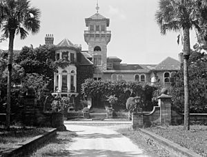
The Dungeness Historic District is one of the most famous areas on Cumberland Island. It's where the ruins of a grand mansion called Dungeness stand. This mansion was built by the Carnegie family, a very rich family, in the late 1800s. Before that, another large home stood here, built by Catharine Greene, the wife of Revolutionary War hero Nathanael Greene. The ruins you see today are a reminder of the island's past as a retreat for wealthy families. This district was added to the National Register on February 13, 1984.
Plum Orchard Historic District
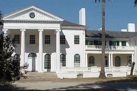
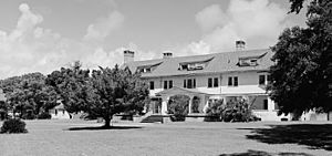
Another important area is the Plum Orchard Historic District. This district includes the beautiful Plum Orchard mansion, which was also built by the Carnegie family. Unlike Dungeness, Plum Orchard is still standing and is sometimes open for visitors to see what life was like for the wealthy families who lived on the island. It's a great example of the grand homes from that time period. This district joined the National Register on November 23, 1984.
Stafford Plantation Historic District
The Stafford Plantation Historic District tells a different part of Cumberland Island's story. This area was once a large plantation where enslaved people were forced to work. Today, you can find the ruins of the plantation house, a historic cemetery, and other structures that show what life was like during that difficult time. It's an important place for understanding the island's complex history. This district was added to the National Register on November 23, 1984.
High Point-Half Moon Bluff Historic District
The High Point-Half Moon Bluff Historic District is located on the northeastern part of Cumberland Island. This area has a long history, with evidence of human activity dating back thousands of years. It includes sites related to early Native American settlements and later historic uses. It was recognized on the National Register on December 22, 1978.
Duck House
The Duck House is a specific building on Cumberland Island that has its own unique history. It's a smaller structure compared to the grand mansions, but it's still considered important enough to be listed on the National Register. It was added on February 13, 1984.
Main Road
Even a road can be historic! The Main Road on Cumberland Island is listed on the National Register because it has been an important pathway for centuries. It connects different parts of the island and has been used by various groups of people throughout its history. It was listed on February 13, 1984.
Archeological Districts
Cumberland Island is also home to important archeological sites, which are places where scientists study the remains of past human life.
- The Rayfield Archeological District is one such area. It contains clues about the ancient people who lived on the island long before European settlers arrived. This district was added to the National Register on February 13, 1984.
- The Table Point Archeological District is another significant archeological site. Like Rayfield, it helps us understand the very early history of human presence on Cumberland Island. It was listed on November 23, 1984.
Associated Historic Site
There is also one other important historic site connected to Cumberland Island, though it's a private property.
Greyfield
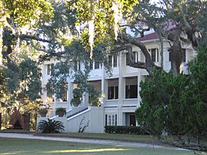
Greyfield is a historic mansion on Cumberland Island that operates as a private inn. It was built by Thomas Carnegie for his daughter, Margaret. Even though it's private, it's recognized for its historical importance and beautiful architecture. Greyfield was added to the National Register on July 24, 2003.
These historic places help us learn about the many different people who have lived on and shaped Cumberland Island over thousands of years. Protecting them ensures that their stories can continue to be told for future generations.


