National Register of Historic Places listings in Curry County, New Mexico facts for kids
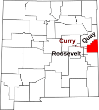
This is a list of the National Register of Historic Places listings in Curry County, New Mexico.
This is intended to be a complete list of the properties and districts on the National Register of Historic Places in Curry County, New Mexico, United States. Latitude and longitude coordinates are provided for many National Register properties and districts; these locations may be seen together in a map.
There are 12 properties listed on the National Register in the county. All of the places within the county on the National Register are also listed on the State Register of Cultural Properties.
| Bernalillo – Catron – Chaves – Cibola – Colfax – Curry – De Baca – Doña Ana – Eddy – Grant – Guadalupe – Harding – Hidalgo – Lea – Lincoln – Los Alamos – Luna – McKinley – Mora – Otero – Quay – Rio Arriba – Roosevelt – San Juan – San Miguel – Sandoval – Santa Fe – Sierra – Socorro – Taos – Torrance – Union – Valencia |
Current listings
| Name on the Register | Image | Date listed | Location | City or town | Description | |
|---|---|---|---|---|---|---|
| 1 | 1908 Clovis City Hall and Fire Station |
(#87001110) |
308 Pile St. 34°24′04″N 103°12′02″W / 34.401111°N 103.200556°W |
Clovis | ||
| 2 | Clovis Baptist Hospital |
(#82003322) |
515 Prince St. 34°24′12″N 103°11′44″W / 34.403333°N 103.195556°W |
Clovis | ||
| 3 | Clovis Central Fire Station |
(#87001111) |
320 Mitchell St. 34°24′05″N 103°12′23″W / 34.401389°N 103.206389°W |
Clovis | ||
| 4 | Curry County Courthouse |
(#87000881) |
700 block of Main St. 34°24′19″N 103°12′19″W / 34.405278°N 103.205278°W |
Clovis | ||
| 5 | First Methodist Church of Clovis |
(#87001112) |
622 Main St. 34°24′15″N 103°12′19″W / 34.404167°N 103.205278°W |
Clovis | ||
| 6 | Hillcrest Park Archway |
(#08000573) |
Intersection of East 10th and Sycamore St., approximately 2,757 feet (840 m) east of intersection of 10th and Prince Sts. 34°24′29″N 103°11′15″W / 34.408184°N 103.187544°W |
Clovis | part of the New Deal in New Mexico Multiple Property Submission | |
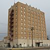
| 7 | Hotel Clovis |
(#84000571) |
210 Main St. 34°24′00″N 103°12′53″W / 34.4°N 103.214722°W |
Clovis | ||
| 8 | Lyceum Theater |
(#06001253) |
409 Main St. 34°24′14″N 103°12′19″W / 34.403889°N 103.205278°W |
Clovis | ||
| 9 | Old Clovis Post Office |
(#84000573) |
122 W. 4th St. 34°24′07″N 103°12′23″W / 34.4020°N 103.2063°W |
Clovis | ||
| 10 | Santa Fe Passenger Depot-Clovis |
(#95001451) |
221 W. 1st St. 34°23′52″N 103°12′26″W / 34.397778°N 103.207222°W |
Clovis | ||
| 11 | State Theater |
(#06001255) |
504 Main St. 34°24′18″N 103°12′20″W / 34.405°N 103.205556°W |
Clovis |

All content from Kiddle encyclopedia articles (including the article images and facts) can be freely used under Attribution-ShareAlike license, unless stated otherwise. Cite this article:
National Register of Historic Places listings in Curry County, New Mexico Facts for Kids. Kiddle Encyclopedia.


