
National Register of Historic Places listings in Flathead County, Montana facts for kids

Flathead County, Montana, is home to many amazing places that are listed on the National Register of Historic Places. This special list includes buildings, areas, and objects that are important to the history of the United States. When a place is on this list, it means it's recognized for its historical value and often gets special care to protect it.
In Flathead County, there are 147 such places! Three of these are even more special, called National Historic Landmarks. These landmarks are considered super important to the history of the entire country. Let's explore some of these cool historic spots!
Contents
Exploring Flathead County's Historic Places
Flathead County has a rich history, from early settlements to the development of Glacier National Park. Many of the historic places here tell stories of how people lived, worked, and explored this beautiful part of Montana.
Grand Old Buildings in Kalispell

Kalispell, a major city in Flathead County, has many historic buildings. These structures show how the city grew over time.
The Conrad Mansion: A Glimpse into the Past
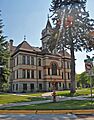
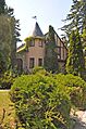
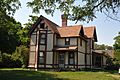
One of the most famous buildings is the Charles E. Conrad Mansion. It was built in 1895 for a businessman named Charles E. Conrad. The mansion is designed in a style called "Shingle style," which was popular back then. It's like stepping back in time to see how a wealthy family lived over a hundred years ago!
Kalispell's Main Street: A Walk Through Time
The Kalispell Main Street Historic District includes many old buildings. These buildings once housed businesses and shops. Walking down Main Street today is like taking a trip into the past. You can imagine what life was like when these buildings were first built.
Kalispell's City Water Department
The City Water Department building in Kalispell was built in 1927. It's an office building designed in the "Georgian Revival" style. This style often uses classic shapes and details. It shows how important city services were, even a long time ago.
Old Homes and Shops
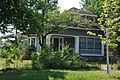
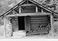
Many other houses and shops in Kalispell are also on the list. For example, the Ferguson House was built in 1897. It was home to a boilermaker who worked for the Great Northern Railway. Boyd's Shop started as a blacksmith shop in the 1910s. Later, it became a welding shop. These places show the daily lives and jobs of people from the past.
Historic Sites in Glacier National Park

Glacier National Park is not just famous for its stunning nature. It also has many historic buildings and areas. These places often helped park rangers and visitors in the early days of the park.
The Going-to-the-Sun Road
The Going-to-the-Sun Road is a very famous road in Glacier National Park. It's so important that it's listed as both a historic district and a National Historic Landmark! This road was a huge engineering project. It allows people to drive through some of the most beautiful parts of the park.
Historic Lodges and Chalets
Places like the Lake McDonald Lodge and Belton Chalets are also on the list. These were built to welcome early tourists to the park. The Lake McDonald Lodge is even a National Historic Landmark. Imagine staying in these grand old buildings after a day of exploring the park! The Granite Park Chalet is another historic lodge, located high up in the mountains.
Ranger Stations and Patrol Cabins
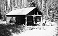
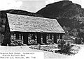
Many old ranger stations and patrol cabins are listed. These include the Belly River Ranger Station Historic District and the Bowman Lake Patrol Cabin. These small buildings were important for park rangers. They helped rangers patrol the vast wilderness and protect the park. Fire lookouts, like the Apgar Fire Lookout and Huckleberry Fire Lookout, were also vital for spotting wildfires.
Old Roads and Trails
Besides the Going-to-the-Sun Road, other old routes are historic. The Bowman Lake Road and the North Fork Road are examples. These roads helped people travel through the park. They also helped rangers get to remote areas. The Polebridge to Numa Ridge Phoneline is another interesting historic feature. It was an early communication line in the park.
Other Notable Historic Places

Flathead County has historic sites beyond Kalispell and Glacier National Park.
The Izaak Walton Inn
The Izaak Walton Inn is located in Essex, right next to the railroad. It was built to serve travelers on the Great Northern Railway. It's a unique hotel with a long history. It shows the importance of trains in connecting communities in Montana.
Historic Bridges
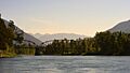
Bridges like the Flathead River Bridge near Columbia Falls are also listed. These bridges were important for transportation. They helped people and goods cross rivers. The Swan River Bridge in Bigfork is another example of a historic bridge.
Churches and Schools
Many old churches and schools are recognized for their history. The First Presbyterian Church of Whitefish and the Norwegian Evangelical Lutheran Church and Parsonage in Kalispell are examples. These buildings were central to community life. The Cornelius Hedges Elementary School and Russell School in Kalispell also tell stories of education in the past.
Farms and Homesteads
Some old farms and homesteads are also historic. The Porter Ranch Barn and the McCarthy-Pederson Farm Historic District show early farming life. Homesteads like the J.K. Miller Homestead in Glacier National Park tell the story of pioneers settling the land.
Images for kids
-
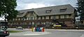
The W.L. Adair General Mercantile Historic District.
-
The Apgar Fire Lookout.
-
The Bader-Jaquette and Westwang Houses.
-
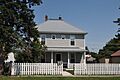
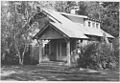
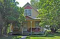
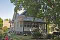
The Beaman House in Kalispell.
-
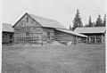
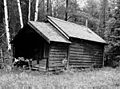
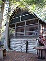
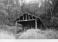
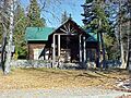
The barn at Belly River Ranger Station.
-
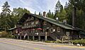
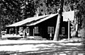
The Belton Chalets.
-
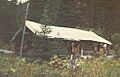
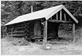
The Bowman Lake Patrol Cabin.
-
Bowman Lake Road.
-
The Brice Apartments in Kalispell.
-
The Bruyer Granary.
-
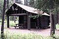
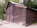
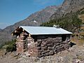
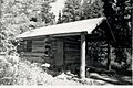
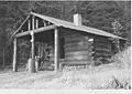
The Coal Creek Patrol Cabin.
-
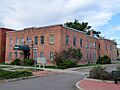
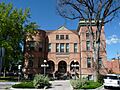
The Courthouse Historic District in Kalispell.
-
The A.J. Dean House.
-
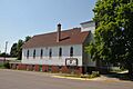
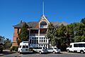
The Central School Museum in Kalispell, part of the East Side Historic District.
-
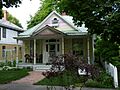
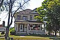
The Ferguson House.
-
The Fielding Snowshoe Patrol Cabin.
-
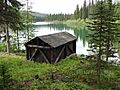
The Fish Creek Bay Boathouse.
-
The Fisher House.
-
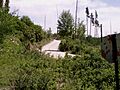
The Flathead River Bridge.
-
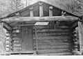
The Ford Creek Patrol Cabin.
-
The Edward Gay House.
-
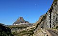
Another view of the Going-to-the-Sun Road.
-
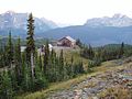
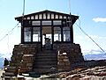
The Granite Park Chalet.
-
Side view of the Granite Park Chalet.
-
The Great Northern Railway Passenger and Freight Depot in Whitefish.
-
The Gregg-Moses House.
-
Greve's Tourist Cabins.
-
The Gunsight Pass Shelter.
-
The Harrison Lake Patrol Cabin.
-
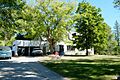
A residence in the Headquarters Historic District.
-
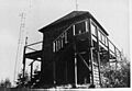
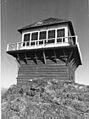
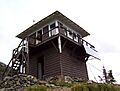
The Heaven's Peak Fire Lookout.
-
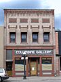
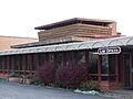
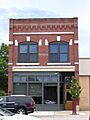
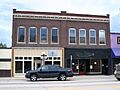
The Heller Building in Kalispell.
-
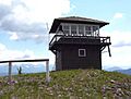
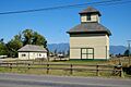
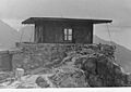
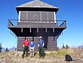
The Huckleberry Fire Lookout.
-
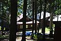
Kelly's Camp Historic District.
-
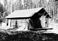
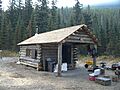
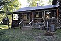
The Kintla Lake Ranger Station.
-
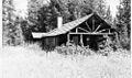
The Kishenehn Ranger Station.
-
The Lake McDonald Lodge Coffee Shop.
-
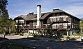
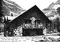
The Lake McDonald Lodge.
-
The former Lockridge Medical Clinic.
-
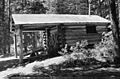
The Logan Creek Patrol Cabin.
-
The Logging Creek Ranger Station.
-
The Loneman Fire Lookout.
-
The Lower Logging Lake Boathouse.
-
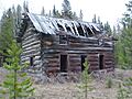
The Lower Nyack Snowshoe Cabin.
-
The Lower Park Creek Patrol Cabin.
-
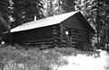
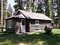
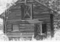
The McCarthy Homestead Cabin.
-
The J.K. Miller Homestead.
-
The Mount Brown Fire Lookout.
-
North Fork Road.
-
The Norwegian Evangelical Lutheran Church.
-
The Numa Ridge Fire Lookout.
-
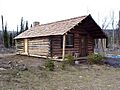
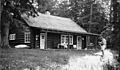
The barn at Nyack Ranger Station.
-
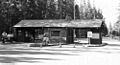
The O'Neil Lumber Company Office.
-
A residence at Polebridge Ranger Station.
-
The Polebridge to Numa Ridge Phoneline.
-
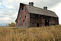
The Porter Ranch Barn.
-
The Quartz Lake Patrol Cabin.
-
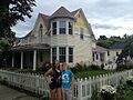
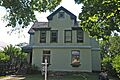
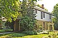
The Rogers House.
-
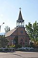
St. Richard's Church.
-
The Sauser-Mercord Building.
-
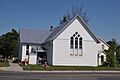
The Scandinavian Methodist Church.
-
The Scott-Forhan House.
-
The Skyland Camp-Bowman Lake Ranger Station.
-
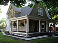
The Smith House.
-
The Snyder House.
-
A building in the Soldiers' Home Historic District.
-
The Sperry Chalet.
-
The Swiftcurrent Fire Lookout.
-
The Ray E. Taylor House.
-
The Thierwechter House.
-
The Upper Kintla Lake Patrol Cabin.
-
The Upper Lake McDonald Ranger Station.
-
The Upper Logging Lake Snowshoe Cabin.
-
The Upper Nyack Snowshoe Cabin.
-
The Upper Park Creek Patrol Cabin.
-
The Vance Lodge.
-
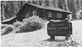
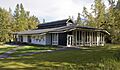
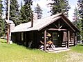
The Walton Ranger Station.
-
The West Entrance Station in Glacier National Park.
-
The Burton and Lulu Wheeler Cabin.


,_October_2011.jpg)


