National Register of Historic Places listings in Franklin County, Iowa facts for kids
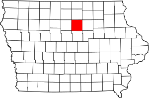
This page is about the cool and important places in Franklin County, Iowa that are listed on the National Register of Historic Places. Think of the National Register as a special list kept by the United States government. It helps protect buildings, sites, and objects that are important to history, architecture, archaeology, engineering, or culture. When a place is on this list, it means it's recognized as a valuable part of our past.
In Franklin County, Iowa, there are 12 different places that have earned a spot on this special list. These places include old buildings, parts of parks, and even a historic district. They tell stories about how people lived, worked, and built things in Franklin County a long time ago.
Historic Places in Franklin County
Here's a list of the places in Franklin County that are on the National Register of Historic Places. Each one has a unique story and helps us understand the history of the area.
| Name on the Register | Image | Date listed | Location | City or town | Description | |
|---|---|---|---|---|---|---|
| 1 | Beeds Lake State Park, Civilian Conservation Corps Area |
(#90001672) |
Junction of Iowa Highways 3 and 134 42°46′15″N 93°14′21″W / 42.770833°N 93.239167°W |
Hampton | This area of the park was built by the Civilian Conservation Corps (CCC) during the Great Depression. The CCC was a program that put young men to work on public projects. | |
| 2 | H.E. Boehmler House |
(#91001829) |
105 2nd St., SE. 42°44′26″N 93°12′18″W / 42.740556°N 93.205°W |
Hampton | A historic house located in Hampton, Iowa. | |
| 3 | Franklin County Courthouse |
(#76000772) |
Central Ave. and 1st St., NW. 42°44′29″N 93°12′32″W / 42.741389°N 93.208889°W |
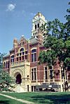
Hampton | This is the main building for the county government in Franklin County. Courthouses often have interesting architecture and history. | |
| 4 | Franklin County G. A. R. Soldiers' Memorial Hall |
(#91001828) |
3 Federal St., N. 42°44′29″N 93°12′25″W / 42.741389°N 93.206944°W |
Hampton | This hall was built to honor soldiers from the Grand Army of the Republic (G.A.R.), a group of Union veterans from the American Civil War. | |
| 5 | Franklin County Sheriff's Residence and Jail |
(#96000896) |
18 E. Central Ave. 42°44′31″N 93°12′23″W / 42.741944°N 93.206389°W |
Hampton | This building once served as both the home for the county sheriff and the county jail. | |
| 6 | Hampton Double Square Historic District |
(#03000834) |
Roughly bounded by 2nd Ave., 1st Ave., the alley west of 1st St., and the alley east of Federal 42°44′31″N 93°12′28″W / 42.741944°N 93.207778°W |
Hampton | A historic district means a whole area with many buildings that are important together. This district shows how Hampton was laid out and developed. | |
| 7 | Dr. O.B. Harriman House |
(#87000011) |
26 10th St., NW. 42°44′31″N 93°13′14″W / 42.741944°N 93.220556°W |
Hampton | The former home of Dr. O.B. Harriman, a notable person in Hampton's history. | |
| 8 | Maysville Schoolhouse |
(#81000237) |
South of Hampton 42°40′00″N 93°12′11″W / 42.666667°N 93.203056°W |
Hampton | An old schoolhouse that taught children in the Maysville area, south of Hampton. | |
| 9 | Reeve Electric Association Plant |
(#89002307) |
Rural Route 1 southwest of Hampton 42°41′14″N 93°13′58″W / 42.687222°N 93.232778°W |
Hampton | This plant was important for bringing electricity to rural areas, which was a big change for communities. | |
| 10 | Leander Reeve House |
(#79000896) |
Southeast of Hampton on Iowa Highway 134 42°40′36″N 93°09′49″W / 42.676667°N 93.163611°W |
Hampton | The historic home of Leander Reeve, a significant figure in the area's past. | |
| 11 | St. John's Danish Evangelical Lutheran Church Historic District |
(#15000726) |
1207 Indigo Ave. 42°43′10″N 93°20′24″W / 42.719506°N 93.339903°W |
Hampton | This church and its surrounding area are important for understanding the history of Danish immigrants in Iowa. | |
| 12 | Herman Wood Round Barn |
(#86001431) |
U.S. Route 65 42°33′28″N 93°15′02″W / 42.557778°N 93.250556°W |
Iowa Falls | Round barns are unique and were built for various reasons, sometimes to be more efficient or stronger against winds. This one is a great example. |


