National Register of Historic Places listings in Fulton County, Kentucky facts for kids
Hey everyone! Did you know that all across the United States, there are special places that are protected because they are important to history? These places are listed on something called the National Register of Historic Places. It's like a big list of treasures that tell us about the past.
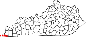
In Fulton County, Kentucky, there are 16 amazing spots that have made it onto this important list. These places include old buildings, special areas, and even ancient sites where people lived long, long ago. Let's explore some of these cool historic places together!
Contents
Cool Historic Places in Fulton County
The National Register of Historic Places helps make sure these important sites are looked after. It's a way to celebrate and remember the history of our country. Here are some of the special places in Fulton County:
Ancient Mound Sites
Long before modern towns were built, different groups of people lived in this area. They sometimes built large mounds of earth for various reasons, like burials or ceremonies. Fulton County has a few of these ancient sites:
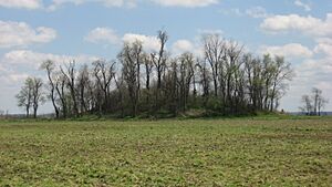
- Adams Site (15FU4): This is the biggest group of mounds in Fulton County. It's also known as "Fort Bayou de Chien" or the "Roberts Mounds." It was added to the list on March 15, 1984.
- Amburg Mounds Site (15FU15): This site has two mounds that were built during the Woodland period, which was a long time ago! It's located southwest of Hickman and was listed on December 31, 1985.
- Running Slough Site (15FU67): This site is found along Running Slough, near the Reelfoot National Wildlife Refuge. It became a historic place on December 5, 1985.
- Sassafras Ridge Site (15FU3): You can find this site west of Hickman. It was added to the list on November 23, 1984.
- White Site (15FU24): This site is located north of the Adams Site, near Moscow. It was recognized as a historic place on March 21, 1988.
Historic Districts and Buildings in Hickman
The town of Hickman has many areas and buildings that show its rich history:
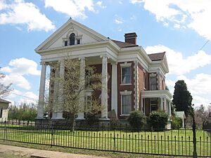
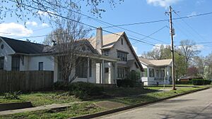
- Buchanan Street Historic District: This is a historic area in Hickman, roughly bordered by Wellington, Obion, Buchanan, and Union Streets. It was added to the list on August 3, 1990.
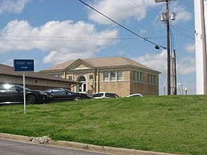
- Carnegie Library: This beautiful old library on Moscow Avenue was built with money from Andrew Carnegie, a famous businessman who helped build many libraries. It was listed on August 3, 1990.
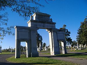
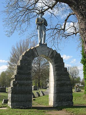
- Confederate Memorial Gateway in Hickman: This gateway is located in the Hickman City Cemetery. It was added to the list on July 17, 1997.
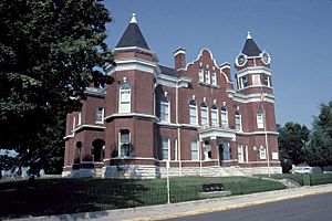
- Fulton County Courthouse: This important building is where many local government activities happen. It's located off Kentucky Route 94 and was listed on April 22, 1976.
- Old Hickman Historic District: This is another historic area in Hickman, including parts of Clinton, Exchange, Obion, Moulton, and Kentucky Streets. It was recognized on August 3, 1990.
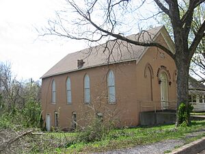
- Thomas Chapel C.M.E. Church: This church on Moscow Avenue is an important part of Hickman's history. It was added to the list on January 9, 1979.
Historic Districts and Buildings in Fulton
The city of Fulton also has its share of historic gems:
- Carr Historic District: This historic area in Fulton is roughly bounded by Carr, 4th, West State Line, and West Streets. It was listed on May 2, 2001.
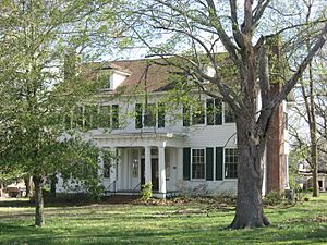
- Ben F. Carr Jr. House: This house at 203 2nd Street in Fulton is a historic home. It was added to the list on July 16, 1979.
- Confederate Memorial in Fulton: This memorial is found in Fairview Cemetery in Fulton. It was listed on July 17, 1997.
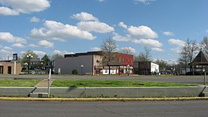
- Fulton Downtown Historic District: This historic area includes parts of Carr, Commercial, Lake, Main, and Walnut Streets in downtown Fulton. It was recognized on August 1, 2003.
- Jesse Whitesell House: This house is located west of Fulton on Kentucky Route 116. It was listed on August 29, 1977. Part of the property even extends into Obion County, Tennessee!
Places That Used to Be on the List
Sometimes, a historic place might be removed from the National Register. This can happen if the building is changed too much, or if it's unfortunately torn down.
- Vendome Opera House: This opera house, located at Main and Commercial Streets in Fulton, was once on the list. However, it was taken off in 1975 because it was demolished that year.
 | Victor J. Glover |
 | Yvonne Cagle |
 | Jeanette Epps |
 | Bernard A. Harris Jr. |


